
Founded 1864 | Incorporated March 16, 1864 Highest elevation 11,464 ft (3,494 m) Population 1,159 (2013) | |
 | ||
Country United States of America Time zone Pacific Standard Time (UTC-8) Area 1,924 km² (1,911 km² Land / 12.43 km² Water) Rivers Caples Creek, Clark Fork, Bloods Creek, Indian Creek Points of interest | ||
Alpine County, officially the County of Alpine, is a county in the U.S. state of California. As of the 2010 census, the population was 1,175. making it California's least populous county. The county seat is the Census Designated Place of Markleeville. There are no incorporated cities in the county.
Contents
- Map of Alpine County CA USA
- History
- Geography
- National protected areas
- 2010
- 2000
- Politics
- Posse Comitatus controversy
- Crime
- Major highways
- Public transportation
- Airport
- Census designated places
- Population ranking
- References
Map of Alpine County, CA, USA
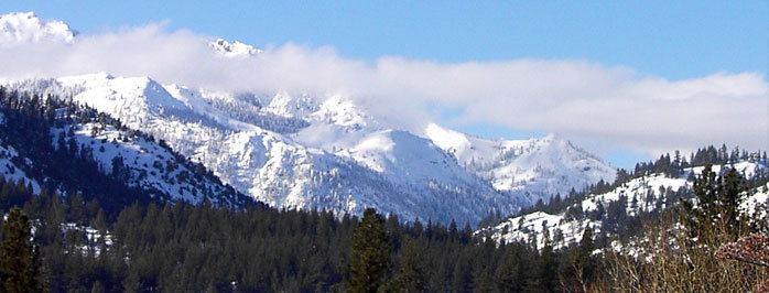
Alpine County is in the Sierra Nevada, between Lake Tahoe and Yosemite National Park.
History
Alpine County was created on March 16, 1864, during a silver boom in the wake of the nearby Comstock Lode discovery. It was named because of its resemblance to the Swiss Alps. The County was formed from parts of Amador, Calaveras, El Dorado, Mono and Tuolumne Counties. At its formation, the County had a population of about 11,000 with its County Seat at Silver Mountain City. By 1868, however, the local silver mines had proven unfruitful; and the population fell to about 1,200. The County Seat was moved to Markleeville in 1875.
After the silver rush, Alpine County's economy consisted almost entirely of farming, ranching, and logging. By the 1920s, the population had fallen to just 200 people. With the construction of the Bear Valley and Kirkwood ski resorts in the late 1960s, the population increased to the present level.
Geography
According to the U.S. Census Bureau, the county has an area of 743 square miles (1,920 km2), of which 738 square miles (1,910 km2) is land and 4.8 square miles (12 km2) (0.7%) is water. The federal government owns about 96% of Alpine County, the highest percentage in California.
National protected areas
2010
The 2010 United States Census reported that Alpine County had a population of 1,175. The racial makeup of Alpine County was 881 (75.0%) White, 0 (0.0%) African American, 240 (20.4%) Native American, 7 (0.6%) Asian, 0 (0.0%) Pacific Islander, 19 (1.6%) from other races, and 28 (2.4%) from two or more races. Hispanic or Latino of any race were 84 persons (7.1%).
2000
As of the census of 2000, there were 1,208 people, 483 households, and 295 families residing in the county. The population density was 2 people per square mile (1/km²). There were 1,514 housing units at an average density of 2 per square mile (1/km²). The racial makeup of the county was 73.7% White, 0.6% Black or African American, 18.9% Native American, 0.3% Asian, 0.1% Pacific Islander, 1.4% from other races, and 5.1% from two or more races. 7.8% of the population were Hispanic or Latino of any race. 12.1% were of German, 12.1% Irish, 9.3% English, 6.5% American and 5.7% Italian ancestry according to Census 2000. 95.0% spoke English, 3.1% Spanish and 2.0% Washo as their first language.
There were 483 households out of which 25.5% had children under the age of 18 living with them, 43.9% were married couples living together, 11.0% had a female householder with no husband present, and 38.9% were non-families. 27.7% of all households were made up of individuals and 5.4% had someone living alone who was 65 years of age or older. The average household size was 2.50 and the average family size was 2.96.
In the county, the population was spread out with 22.8% under the age of 18, 10.4% from 18 to 24, 27.5% from 25 to 44, 29.3% from 45 to 64, and 9.9% who were 65 years of age or older. The median age was 39 years. For every 100 females there were 110.8 males. For every 100 females age 18 and over, there were 117.2 males.
The median income for a household in the county was $41,875, and the median income for a family was $50,250. Males had a median income of $36,544 versus $25,800 for females. The per capita income for the county was $24,431. About 12.0% of families and 19.5% of the population were below the poverty line, including 27.4% of those under age 18 and 10.1% of those age 65 or over.
Politics
Alpine is historically a strongly Republican county in Presidential and congressional elections, and indeed was among the five most Republican counties in the entire nation in 1892, 1908, 1920 and 1928: Warren Harding and Herbert Hoover gained over ninety percent of the county’s vote.
Alpine County narrowly voted for George W. Bush in 2000, but went comfortably for John Kerry in 2004. Kerry became only the second Democrat to ever carry Alpine County after Franklin Delano Roosevelt in 1932 and 1936, when, except Riverside during the former election, Roosevelt carried every county in California. Barack Obama received an even wider margin of victory over John McCain in 2008.
In November 2008, Alpine was one of just three counties in California's interior in which voters rejected Proposition 8, the ballot initiative to amend the California Constitution to reject the legal extension of the title of marriage to same-sex couples. Alpine voters rejected Proposition 8 by 56.4 percent to 43.6 percent. The other interior counties in which Proposition 8 failed to receive a majority of votes were neighboring Mono County and Yolo County.
According to the California Secretary of State, as of January 2016, there are 696 registered voters in Alpine County. Of those, 257 (36.9%) are registered Democratic, 210 (30.2%) are registered Republican, 46 (6.6%) are registered with other political parties, and 183 (26.3%) declined to state a political party.
Alpine County is in California's 4th congressional district, represented by Republican Tom McClintock. In the State Assembly, the county is in the 5th Assembly District, represented by Republican Frank Bigelow. In the State Senate, the county is in the 1st Senate District, represented by Republican Ted Gaines.
Due to its low population density, Alpine County votes entirely by mail, one of two counties in California which do so. In the June 2014 primary elections, about 22% of registered voters went to the polls. In Alpine County, the number was almost 70%, the highest of any county in the state.
Posse Comitatus controversy
In the late 1970s, the Posse Comitatus organization attempted to take over Alpine County by settling there and fielding candidates in local elections. The Posse thought winning local elections in Alpine County was their best opportunity to take control of a single county. The group fielded a candidate for sheriff and registered fictitious voters using post office boxes and vacant lots as their addresses. Six people were prosecuted for voter fraud, the false registration thrown out, and the incumbent sheriff was re-elected.
Crime
The following table includes the number of incidents reported and the rate per 1,000 persons for each type of offense.
Major highways
Public transportation
There is limited, call ahead, public transportation provided by agreement with neighboring Douglas County, Nevada (There are a few trailhead shuttles, designed for hikers).
Airport
Alpine County Airport is a general aviation airport in the Eastern Sierra about 4 miles (6.4 km) from the town of Markleeville. The airport consists of a simple airstrip with an apron for small light aircraft to park. The airport has no buildings, no lights, and is very rarely used. The airport is popular with astronomers due to the clear, dark skies.
Census-designated places
Population ranking
The population ranking of the following table is based on the 2010 census of Alpine County.
† county seat