
Country United States State | Population 84,349 (2013) Area 8.155 sq mi | |
 | ||
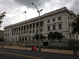
Points of interest Old Barracks Museum, New Jersey State House, New Jersey State Museum, William Trent House, Arm & Hammer Park Colleges and Universities The College of New Jersey, Thomas Edison State College, St Francis Medical Center-School of Radiologic Technology, Harris School of Business-Hamilton Campus | ||
Unemployment rate 9.7% (Feb 2015) Mayor Eric Jackson (term ends June 30, 2018) | ||
Map of Trenton, New Jersey
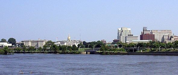
Trenton is the capital city of the U.S. state of New Jersey and the county seat of Mercer County. It was briefly the capital of the United States. The city's metropolitan area is grouped with the New York metropolitan area by the United States Census Bureau, but directly borders the Philadelphia metropolitan area and is part of the Federal Communications Commission's Philadelphia Designated Market Area. As of the 2010 United States Census, Trenton had a population of 84,913, making it the state's 10th-largest municipality. The Census Bureau estimated that the city's population was 84,034 in 2014.
Contents
- Map of Trenton New Jersey
- What is trenton new jersey like from the projects to fan favorite bonus footage
- History
- Geography
- Neighborhoods
- Climate
- 2010 Census
- 2000 Census
- Economy
- Urban Enterprise Zone
- Television market
- Arts and culture
- Sports
- Parks and recreation
- Historic sites
- Local government
- Mayor and Council
- Interim mayor 2014
- Mayors conviction and removal from office
- Federal state and county representation
- Politics
- Fire department
- Colleges and universities
- Public schools
- Charter schools
- Private schools
- Crime
- Riots of 1968
- New Jersey State Prison
- Roads and highways
- Public transportation
- Media
- Notable people
- References
Trenton dates back at least to June 3, 1719, when mention was made of a constable being appointed for Trenton, while the area was still part of Hunterdon County. Boundaries were recorded for Trenton Township as of March 2, 1720, a courthouse and jail were constructed in Trenton around 1720 and the Freeholders of Hunterdon County met annually in Trenton. Trenton became New Jersey's capital as of November 25, 1790, and the City of Trenton was formed within Trenton Township on November 13, 1792. Trenton Township was incorporated as one of New Jersey's initial group of 104 townships by an act of the New Jersey Legislature on February 21, 1798. On February 22, 1834, portions of Trenton Township were taken to form Ewing Township. The remaining portion of Trenton Township was absorbed by the City of Trenton on April 10, 1837. A series of annexations took place over a 50-year period, with the city absorbing South Trenton borough (April 14, 1851), portions of Nottingham Township (April 14, 1856), both the Borough of Chambersburg Township and Millham Township (both on March 30, 1888), as well as Wilbur Borough (February 28, 1898). Portions of Ewing Township and Hamilton Township were annexed to Trenton on March 23, 1900.

What is trenton new jersey like from the projects to fan favorite bonus footage
History
The first settlement which would become Trenton was established by Quakers in 1679, in the region then called the Falls of the Delaware, led by Mahlon Stacy from Handsworth, Sheffield, England. Quakers were being persecuted in England at this time and North America provided an opportunity to exercise their religious freedom.
By 1719, the town adopted the name "Trent-towne", after William Trent, one of its leading landholders who purchased much of the surrounding land from Stacy's family. This name later was shortened to "Trenton".
During the American Revolutionary War, the city was the site of the Battle of Trenton, George Washington's first military victory. On December 26, 1776, Washington and his army, after crossing the icy Delaware River to Trenton, defeated the Hessian troops garrisoned there. After the war, the Confederation Congress briefly met in Trenton in November and December 1784. While the city was preferred by New England and other northern states as a permanent capital for the new country, the southern states ultimately prevailed in their choice of a location south of the Mason–Dixon line.
Trenton became the state capital in 1790, but prior to that year the New Jersey Legislature often met here. The city was incorporated in 1792.
During the War of 1812, the United States Army's primary hospital was at a site on Broad Street.
Throughout the 19th century, Trenton grew steadily, as European immigrants came to work in its pottery and wire rope mills. In 1837, with the population now too large for government by council, a new mayoral government was adopted, with by-laws that remain in operation to this day.
Geography
According to the United States Census Bureau, the city had a total area of 8.155 square miles (21.122 km2), including 7.648 square miles (19.809 km2) of land and 0.507 square mile (1.313 km2) of water (6.21%).
Several bridges across the Delaware River — the Trenton–Morrisville Toll Bridge, Lower Trenton Bridge and Calhoun Street Bridge – connect Trenton to Morrisville, Pennsylvania, all of which are operated by the Delaware River Joint Toll Bridge Commission.
Trenton is located near the exact geographic center of the state, which is 5 miles (8.0 km) located southeast of Trenton. The city is sometimes included as part of North Jersey and as the southernmost city of the Tri-State Region, while others consider it a part of South Jersey and thus, the northernmost city of the Delaware Valley.
However, Mercer County constitutes its own metropolitan statistical area, formally known as the Trenton-Ewing MSA. Locals consider Trenton to be a part of an ambiguous area known as Central Jersey, and thus part of neither region. They are generally split as to whether they are within New York or Philadelphia's sphere of influence. While it is geographically closer to Philadelphia, many people who have recently moved to the area commute to New York City, and have moved there to escape the New York region's high housing costs.
Trenton is one of two state capitals that border another state – the other being Carson City, Nevada. It is also one of the seven state capitals located within the Piedmont Plateau.
Trenton borders Ewing Township, Hamilton Township and Lawrence Township in Mercer County; and Falls Township, Lower Makefield Township and Morrisville in Bucks County, Pennsylvania across the Delaware River.
Neighborhoods
The city of Trenton is home to numerous neighborhoods and sub-neighborhoods. The main neighborhoods are taken from the four cardinal directions (North, South, East, and West). Trenton was once home to large Italian, Hungarian, and Jewish communities, but since the 1950s, demographic shifts have changed the city into a relatively segregated urban enclave of middle and lower income African Americans. Italians are scattered throughout the city, but a distinct Italian community is centered in the Chambersburg neighborhood, in South Trenton. This community has been in decline since the 1970s, largely due to economic and social shifts to the suburbs surrounding the city. Today Chambersburg has a large Latino community. Many of the Latino immigrants are from Mexico, Guatemala and Nicaragua. There is also a significant and growing Asian community in the Chambersburg neighborhood primarily made up of Burmese and Bhutanese/Nepali refugees.
The North Ward, once a mecca for the city's middle class, is now one of the most economically distressed, torn apart by race riots following the assassination of Martin Luther King in 1968. Nonetheless, the area still retains many important architectural and historic sites. North Trenton still has a large Polish-American neighborhood that borders Lawrence Township, many of whom attend St Hedwig's Roman Catholic Church on Brunswick Ave. St. Hedwig's church was built in 1904 by Polish immigrants, many of whose families still attend the church. North Trenton is also home to the historic Shiloh Baptist Church—one of the largest houses of worship in Trenton and the oldest African American church in the city, founded in 1888. The church is currently pastored by Rev. Darrell L. Armstrong, who carried the Olympic torch in 2002 for the Winter Olympics in Salt Lake City. Also located just at the southern tip of North Trenton is the city's Battle Monument, also known as "Five Points". It is a 150 ft (46 m) structure that marks the spot where George Washington's Continental Army launched the Battle of Trenton during the American Revolutionary War. It faces downtown Trenton and is a symbol of the city's historic past.
South Ward is the most diverse neighborhood in Trenton and is home to many Latin American, Italian-American, and African American residents.
East Ward is the smallest neighborhood in Trenton and is home to the Trenton Transit Center and Trenton Central High School, as well as Trenton Central High School West. The Chambersburg neighborhood is within the East Ward, and was once noted in the region as a destination for its many Italian restaurants and pizzerias. With changing demographics, many of these businesses have either closed or relocated to suburban locations.
West Ward is the home of Trenton's more suburban neighborhoods.
Neighborhoods in the city include:
Climate
According to the Köppen climate classification, Trenton lies in the transition from a humid subtropical (Cfa) to a warmer humid continental climate (Dfa), favoring the former, with four seasons of approximately equal length and precipitation fairly evenly distributed through the year. Winters are cold and damp: the daily average temperature in January is 31.1 °F (−0.5 °C), and temperatures at or below 10 °F (−12 °C) occur on 3.9 nights annually, while there are 16–17 days where the temperature fails to rise above freezing. Summers are hot and humid, with a July daily average of 75.7 °F (24.3 °C); temperatures reaching or exceeding 90 °F (32 °C) occur on 15–16 days. Extremes in temperature have ranged from −14 °F (−26 °C) on February 9, 1934, up to 106 °F (41 °C) as recently as July 22, 2011. However, temperatures reaching 0 °F (−18 °C) or 100 °F (38 °C) are uncommon.
The average precipitation is 46.4 inches (1,180 mm) per year, which is fairly evenly distributed through the year. The driest month on average is February, with 2.31 in (59 mm) of precipitation on average, while the wettest month is July, with 4.95 in (126 mm) of rainfall on average. The all-time single-day rainfall record is 7.25 in (184.2 mm) on September 16, 1999, during the passage of Hurricane Floyd. The all-time monthly rainfall record is 14.55 in (369.6 mm) in August 1955, due to the passage of Hurricane Connie and Hurricane Diane. The wettest year on record was 1996, when 67.90 in (1,725 mm) of precipitation fell. On the flip side, the driest month on record was October 1963, when only 0.05 in (1.3 mm) of rain was recorded. The 28.79 in (731 mm) of precipitation recorded in 1957 were the lowest ever for the city.
Snowfall can vary even more year-to-year. The average snowfall is 23.4 inches (59.4 cm), but has ranged from as low as 2 in (5.1 cm) in the winter of 1918–19 to as high as 76.9 in (195.3 cm) in 1995–96, which included the greatest single-storm snowfall, the Blizzard of January 7–8, 1996, when 24.2 inches (61.5 cm) of snow fell.
2010 Census
As of the 2010 United States Census, there were 84,913 people, 28,578 households, and 17,747 families residing in the city. The population density was 11,101.9 per square mile (4,286.5/km2). There were 33,035 housing units at an average density of 4,319.2 per square mile (1,667.7/km2). The racial makeup of the city was 26.56% (22,549) White, 52.01% (44,160) Black or African American, 0.70% (598) Native American, 1.19% (1,013) Asian, 0.13% (110) Pacific Islander, 15.31% (13,003) from other races, and 4.10% (3,480) from two or more races. Hispanic or Latino of any race were 33.71% (28,621) of the population.
There were 28,578 households out of which 32.0% had children under the age of 18 living with them, 25.1% were married couples living together, 28.1% had a female householder with no husband present, and 37.9% were non-families. 30.8% of all households were made up of individuals, and 9.1% had someone living alone who was 65 years of age or older. The average household size was 2.79 and the average family size was 3.40.
In the city, the population was spread out with 25.1% under the age of 18, 11.0% from 18 to 24, 32.5% from 25 to 44, 22.6% from 45 to 64, and 8.8% who were 65 years of age or older. The median age was 32.6 years. For every 100 females there were 106.5 males. For every 100 females ages 18 and old there were 107.2 males.
The Census Bureau's 2006–2010 American Community Survey showed that (in 2010 inflation-adjusted dollars) median household income was $36,601 (with a margin of error of +/- $1,485) and the median family income was $41,491 (+/- $2,778). Males had a median income of $29,884 (+/- $1,715) versus $31,319 (+/- $2,398) for females. The per capita income for the city was $17,400 (+/- $571). About 22.4% of families and 24.5% of the population were below the poverty line, including 36.3% of those under age 18 and 17.5% of those age 65 or over.
2000 Census
As of the 2000 United States Census there were 85,403, people, 29,437 households, and 18,692 families residing in the city. The population density was 11,153.6 people per square mile (4,304.7/km²). There were 33,843 housing units at an average density of 4,419.9 per square mile (1,705.9/km²). The racial makeup of the city was 52.06% Black, 32.55% White, down from 88.6% in 1950, 0.35% Native American, 0.84% Asian, 0.23% Pacific Islander, 10.76% from other races, and 3.20% from two or more races. Hispanic or Latino of any race were 21.53% of the population.
There were 29,437 households, 32.4% of which had children under the age of 18 living with them. 29.0% were married couples living together, 27.1% had a female householder with no husband present, and 36.5% were non-families. 29.7% of all households were made up of individuals and 12.0% had someone living alone who was 65 years of age or older. The average household size was 2.75 and the average family size was 3.38.
In the city the age distribution of the population shows 27.7% under the age of 18, 10.1% from 18 to 24, 31.9% from 25 to 44, 18.9% from 45 to 64, and 11.4% who were 65 years of age or older. The median age was 32 years. For every 100 females there were 97.6 males. For every 100 females age 18 and over, there were 96.0 males.
The median income for a household in the city was $31,074, and the median income for a family was $36,681. Males had a median income of $29,721 versus $26,943 for females. The per capita income for the city was $14,621. About 17.6% of families and 21.1% of the population were below the poverty line, including 26.8% of those under age 18 and 19.5% of those age 65 or over.
Top 10 ethnicities reported during the 2000 Census by percentage were:
Economy
Trenton was a major manufacturing center in the late 19th and early 20th centuries. One relic of that era is the slogan "Trenton Makes, The World Takes", which is displayed on the Lower Free Bridge (just north of the Trenton–Morrisville Toll Bridge). The city adopted the slogan in 1917 to represent Trenton's then-leading role as a major manufacturing center for rubber, wire rope, ceramics and cigars.
Along with many other United States cities in the 1970s, Trenton fell on hard times when manufacturing and industrial jobs declined. Concurrently, state government agencies began leasing office space in the surrounding suburbs. State government leaders (particularly governors William Cahill and Brendan Byrne) attempted to revitalize the downtown area by making it the center of state government. Between 1982 and 1992, more than a dozen office buildings were constructed primarily by the state to house state offices. Today, Trenton's biggest employer is still the state of New Jersey. Each weekday, 20,000 state workers flood into the city from the surrounding suburbs.
Notable businesses of the thousands based in Trenton include Italian People's Bakery, a wholesale and retail bakery established in 1936.
Urban Enterprise Zone
Portions of Trenton are part of an Urban Enterprise Zone. In addition to other benefits to encourage employment within the Zone, shoppers can take advantage of a reduced 3½% sales tax rate at eligible merchants (versus the 7% rate charged statewide).
Television market
Trenton has long been part of the Philadelphia television market. However, following the 2000 United States Census, Trenton was shifted from the Philadelphia metropolitan statistical area to the New York metropolitan statistical area. With a similar shift by the New Haven, Connecticut, area to the New York area, they were the first two cases where metropolitan statistical areas differed from their defined Nielsen television markets.
Arts and culture
Sports
Because of Trenton's near-equal distance to both New York City and Philadelphia, and because most homes in Mercer County receive network broadcasts from both cities, locals are sharply divided in fan loyalty between both cities. It is common to find Philadelphia's Phillies, Eagles, 76ers, Union and Flyers fans cheering (and arguing) right alongside fans of New York's Yankees, Mets, Nets, Knicks, Rangers, Jets, Red Bulls and Giants or the New Jersey Devils.
Between 1948 and 1979, Trenton Speedway, located in adjacent Hamilton Township, hosted world class auto racing. Drivers such as Jim Clark, A. J. Foyt, Mario Andretti, Al Unser, Bobby Unser, Richard Petty and Bobby Allison raced on the one mile (1.6 km) asphalt oval and then re-configured 1½ mile race track. The speedway, which closed in 1980, was part of the larger New Jersey State Fairgrounds complex, which also closed in 1983. The former site of the speedway and fairgrounds is now the Grounds for Sculpture.
The Trenton Thunder, a Double-A minor league team affiliated with the New York Yankees that is owned by Joe Plumeri, plays at 6,341-seat Arm & Hammer Park, the stadium which Plumeri had previously named after his father in 1999.
The Trenton Freedom of the Professional Indoor Football League were founded in 2013 and played their games at the Sun National Bank Center. The Freedom ended operations in 2015, joining the short-lived Trenton Steel (in 2011) and Trenton Lightning (in 2001) as indoor football teams that had brief operating lives at the arena.
Parks and recreation
Historic sites
Local government
The City of Trenton is governed within the Faulkner Act, formally known as the Optional Municipal Charter Law, under the Faulkner Act (Mayor-Council) system of municipal government by a mayor and a seven-member city council. Three city council members are elected at-large, and four come from each of four wards. The mayor and council members are elected concurrently on a non-partisan basis to four-year terms of office as part of the May municipal election.
Mayor and Council
As of 2017, the Mayor of Trenton is Eric Jackson. Members of the City Council are Council President Zachary Chester (West Ward), Council Vice President Verlina Reynolds-Jackson (East Ward), Alex Bethea (At-Large), Marge Caldwell-Wilson (North Ward), Duncan Harrison Jr. (At-Large), Phyllis Holly-Ward (At-Large) and George Muschal (South Ward), all serving terms of office ending June 30, 2018.
Interim mayor 2014
From February 7 to July 1, 2014, the acting mayor was George Muschal who retroactively assumed the office on that date due to the felony conviction of Tony F. Mack, who had taken office on July 1, 2010. Muschal, who was council president, was selected by the city council to serve as the interim mayor to finish the term.
Mayor's conviction and removal from office
On February 7, 2014, Mack and his brother, Raphiel Mack, were convicted by a federal jury of bribery, fraud and extortion, based on the details of their participation in a scheme to take money in exchange for helping get approvals to develop a downtown parking garage as part of a sting operation by law enforcement. Days after the conviction, the office of the New Jersey Attorney General filed motions to have Mack removed from office, as state law requires the removal of elected officials after convictions for corruption. Initially, Mack fought the removal of him from the office but on February 26, a superior court judge ordered his removal and any actions taken by Mack between February 7 and the 26th could have be reversed by Muschal. Previously, Mack's housing director quit after it was learned he had a theft conviction. His chief of staff was arrested trying to buy heroin. His half-brother, whose authority he elevated at the city water plant, was arrested on charges of stealing. His law director resigned after arguing with Mack over complying with open-records laws and potential violations of laws prohibiting city contracts to big campaign donors.
Federal, state and county representation
Trenton is located in the 12th Congressional District and is part of New Jersey's 15th state legislative district. Prior to the 2010 Census, Trenton had been split between the 4th Congressional District and the 12th Congressional District, a change made by the New Jersey Redistricting Commission that took effect in January 2013, based on the results of the November 2012 general elections.
New Jersey's Twelfth Congressional District is represented by Bonnie Watson Coleman (D, Ewing Township). New Jersey is represented in the United States Senate by Democrats Cory Booker (Newark, term ends 2021) and Bob Menendez (Paramus, 2019).
For the 2016–2017 session (Senate, General Assembly), the 15th Legislative District of the New Jersey Legislature is represented in the State Senate by Shirley Turner (D, Lawrence Township, Mercer County) and in the General Assembly by Reed Gusciora (D, Trenton) and Elizabeth Maher Muoio (D, Pennington). The Governor of New Jersey is Chris Christie (R, Mendham Township). The Lieutenant Governor of New Jersey is Kim Guadagno (R, Monmouth Beach).
Mercer County is governed by a County Executive who oversees the day-to-day operations of the county and by a seven-member Board of Chosen Freeholders that acts in a legislative capacity, setting policy. All officials are chosen at-large in partisan elections, with the executive serving a four-year term of office while the freeholders serve three-year terms of office on a staggered basis, with either two or three seats up for election each year. As of 2014, the County Executive is Brian M. Hughes (D, term ends December 31, 2015; Princeton). Mercer County's Freeholders are Freeholder Chair Andrew Koontz (D, 2016; Princeton), Freeholder Vice Chair Samuel T. Frisby, Sr. (2015; Trenton), Ann M. Cannon (2015; East Windsor Township), Anthony P. Carabelli (2016; Trenton), John A. Cimino (2014, Hamilton Township), Pasquale "Pat" Colavita, Jr. (2015; Lawrence Township) and Lucylle R. S. Walter (2014; Ewing Township) Mercer County's constitutional officers are County Clerk Paula Sollami-Covello (D, 2015), Sheriff John A. Kemler (D, 2014) and Surrogate Diane Gerofsky (D, 2016).
Politics
As of March 23, 2011, there were a total of 37,407 registered voters in Trenton, of which 16,819 (45.0%) were registered as Democrats, 1,328 (3.6%) were registered as Republicans and 19,248 (51.5%) were registered as Unaffiliated. There were 12 voters registered to other parties.
In the 2012 presidential election, Democrat Barack Obama received 93.4% of the vote (23,125 cast), ahead of Republican Mitt Romney with 6.2% (1,528 votes), and other candidates with 0.4% (97 votes), among the 27,831 ballots cast by the city's 40,362 registered voters (3,081 ballots were spoiled), for a turnout of 69.0%. In the 2008 presidential election, Democrat Barack Obama received 89.9% of the vote here (23,577 cast), ahead of Republican John McCain with 8.2% (2,157 votes) and other candidates with 0.5% (141 votes), among the 26,229 ballots cast by the city's 41,005 registered voters, for a turnout of 64.0%. In the 2004 presidential election, Democrat John Kerry received 79.8% of the vote here (18,539 ballots cast), outpolling Republican George W. Bush with 16.3% (3,791 votes) and other candidates with 0.4% (146 votes), among the 23,228 ballots cast by the city's 39,139 registered voters, for a turnout percentage of 59.3.
In the 2013 gubernatorial election, Democrat Barbara Buono received 74.7% of the vote (9,179 cast), ahead of Republican Chris Christie with 24.7% (3,035 votes), and other candidates with 0.6% (77 votes), among the 11,884 ballots cast by the city's 38,452 registered voters (407 ballots were spoiled), for a turnout of 30.9%. In the 2009 gubernatorial election, Democrat Jon Corzine received 81.6% of the vote here (10,235 ballots cast), ahead of Republican Chris Christie with 12.4% (1,560 votes), Independent Chris Daggett with 2.4% (305 votes) and other candidates with 1.1% (135 votes), among the 12,537 ballots cast by the city's 38,345 registered voters, yielding a 32.7% turnout.
Fire department
The city of Trenton is protected on a full-time basis by the city of Trenton Fire and Emergency Services Department (TFD), which has been a paid department since 1892 after having been originally established in 1747 as a volunteer fire department. The TFD operates out of seven fire stations and operates a fire apparatus fleet of 7 engines, 3 ladders, and one rescue, along with one HAZMAT unit, a mobile command unit, one fireboat, and numerous other special, support and reserve units.
Colleges and universities
Trenton is the home of two post-secondary institutions—Thomas Edison State University serving adult students around the nation and worldwide and Mercer County Community College's James Kearney Campus.
The College of New Jersey, formerly named Trenton State College, was founded in Trenton in 1855 and is now located in nearby Ewing Township. Rider University was founded in Trenton in 1865 as The Trenton Business College. In 1959, Rider moved to its current location in nearby Lawrence Township.
Public schools
The Trenton Public Schools serve students in pre-kindergarten through twelfth grade. The district is one of 31 former Abbott districts statewide, which are now referred to as "SDA Districts" based on the requirement for the state to cover all costs for school building and renovation projects in these districts under the supervision of the New Jersey Schools Development Authority. The superintendent runs the district and the school board is appointed by the mayor. The school district has undergone a 'construction' renaissance throughout the district.
As of the 2014-15 school year, the district and its 22 schools had an enrollment of 13,881 students and 1,005.7 classroom teachers (on an FTE basis), for a student–teacher ratio of 13.8:1. Schools in the district (with 2014-15 enrollment data from the National Center for Education Statistics) are Stokes Early Childhood Center (197 students in PreK), Columbus Elementary School (334 students in grades K-5), Franklin Elementary School (372; K-5), Grant Elementary School (514; K-5), Gregory Elementary School (352; K-5), P.J. Hill Elementary School (360; K-5), Jefferson Elementary School (420; K-5), Dr. Martin Luther King Elementary School (624; K-5), Mott Elementary School (417; K-5), Parker Elementary School (537; K-5), Robbins Elementary School (412; K-4), Paul S. Robeson Elementary School (541; K-5), Washington Elementary School (280; K-4), Wilson Elementary School (414; K-5), Grace A. Dunn Middle School (956; 6-8), Hedgepeth-Williams Middle School (459; 6-8), Joyce Kilmer Middle School (453; 6-8), Luis Munoz Rivera Middle School (454; 6-8), Daylight/Twilight Alternative High School (9-12; 469), Trenton Central High School (1,561; 9-12) and Trenton Central High School West (688; 9-12).
Charter schools
Trenton is home to several charter schools, including Capital Preparatory Charter High School, Emily Fisher Charter School, Foundation Academy Charter School, International Charter School, Paul Robeson Charter School, and Village Charter School. The International Academy of Trenton, owned and monitored by the SABIS school network, became a charter school in 2014. On February 22, 2017, Trenton's mayor, Eric Jackson, visited the school when it opened its doors in to the former Trenton Times building on 500 Perry Street as a premier 21st century school. The school opened serving grades K-3 and will add an additional grade each year, ultimately serving students through 12th grade.
Private schools
Trenton Catholic Academy high school serves students in grades 9–12, while Trenton Catholic Academy grammar school serves students in Pre-K through 8th grade; both schools operate under the auspices of the Roman Catholic Diocese of Trenton.
Trenton is home to Al-Bayaan Academy, which opened for preschool students in September 2001 and added grades in subsequent years.
Trenton Community Music School is a not-for-profit community school of the arts. The school was founded by executive director Marcia Wood in 1997. The school operates at Blessed Sacrament Catholic Church (on Tuesdays) and the Copeland Center for the Performing Arts (on Saturdays).
Crime
In 2005, there were 31 homicides in Trenton, which at that time was the largest number in a single year in the city's history. The city was named the 4th "Most Dangerous" in 2005 out of 129 cities with a population of 75,000 to 99,999 ranked nationwide in the 12th annual Morgan Quitno survey. In the 2006 survey, Trenton was ranked as the 14th most dangerous city overall out of 371 cities included nationwide in the Morgan Quitno survey, and was again named as the fourth most dangerous municipality of 126 cities in the 75,000–99,999 population range. Homicides went down in 2006 to 20, but back up to 25 in 2007.
In September 2011, the city fired 108 police officers due to budget cuts; this constituted almost one-third of the Trenton Police Department and required 30 senior officers to be sent out on patrols in lieu of supervisory duties.
In 2013, the city set a new record with 37 homicides. In 2014, there were 23 murders through the end of July and the city's homicide rate was on track to break the record set the previous year until an 81-day period when there were no murders in Trenton; the city ended the year with 34 murders. The number of homicides declined to 17 in 2015.
Riots of 1968
The Trenton Riots of 1968 were a major civil disturbance that took place during the week following the assassination of civil rights leader Martin Luther King in Memphis on April 4. Race riots broke out nationwide following the murder of the civil rights activist. More than 200 Trenton businesses, mostly in Downtown, were ransacked and burned. More than 300 people, most of them young black men, were arrested on charges ranging from assault and arson to looting and violating the mayor's emergency curfew. In addition to 16 injured policemen, 15 firefighters were treated at city hospitals for smoke inhalation, burns, sprains and cuts suffered while fighting raging blazes or for injuries inflicted by rioters. Denizens of Trenton's urban core often pulled false alarms and would then throw bricks at firefighters responding to the alarm boxes. This experience, along with similar experiences in other major cities, effectively ended the use of open-cab fire engines. As an interim measure, the Trenton Fire Department fabricated temporary cab enclosures from steel deck plating until new equipment could be obtained. The losses incurred by downtown businesses were initially estimated by the city to be $7 million, but the total of insurance claims and settlements came to $2.5 million.
Trenton's Battle Monument neighborhood was hardest hit. Since the 1950s, North Trenton had witnessed a steady exodus of middle-class residents, and the riots spelled the end for North Trenton. By the 1970s, the region had become one of the most blighted and crime-ridden in the city, although gentrification in the area is revitalizing certain sections.
New Jersey State Prison
The New Jersey State Prison (formerly Trenton State Prison) has two maximum security units. It houses some of the state's most dangerous individuals, which included New Jersey's death row population until the state banned capital punishment in 2007.
The following is inscribed over the original entrance to the prison:
Labor, Silence, Penitence.
The Penitentiary House,
Erected By Legislative
Authority.
Richard Howell, Governor.
In The XXII Year Of
American Independence
MDCCXCVII
That Those Who Are Feared
For Their Crimes
May Learn To Fear The Laws
And Be Useful
Hic Labor, Hic Opus.
Roads and highways
As of May 2010, the city had a total of 168.80 miles (271.66 km) of roadways, of which 145.57 miles (234.27 km) were maintained by the municipality, 11.33 miles (18.23 km) by Mercer County and 10.92 miles (17.57 km) by the New Jersey Department of Transportation and 0.98 miles (1.58 km) by the Delaware River Joint Toll Bridge Commission.
City highways include the Trenton Freeway, which is part of U.S. Route 1, and the John Fitch Parkway, which is part of Route 29. Canal Boulevard, more commonly known as Route 129, connects US 1 and Route 29 in South Trenton. U.S. Route 206, Route 31, and Route 33 also pass through the city via regular city streets (Broad Street/Brunswick Avenue/Princeton Avenue, Pennington Avenue, and Greenwood Avenue, respectively).
Routes 29 and 129 connect the city to Interstate 195 which provides connections with Interstate 295 and the New Jersey Turnpike (also known as Interstate 95).
Public transportation
Public transportation within the city and to/from its nearby suburbs is provided in the form of local bus routes run by NJ Transit. SEPTA also provides bus service to adjacent Bucks County, Pennsylvania.
The Trenton Transit Center, located on the heavily traveled Northeast Corridor, serves as the northbound terminus for SEPTA's Trenton Line (local train service to Philadelphia) and southbound terminus for NJ Transit Rail's Northeast Corridor Line (local train service to New York Penn Station). The train station also serves as the northbound terminus for the River Line, a diesel light rail line that runs to Camden. Two additional River Line stops, Cass Street and Hamilton Avenue, are located within the city.
Long-distance transportation is provided by Amtrak train service along the Northeast Corridor.
The closest commercial airport is Trenton–Mercer Airport in Ewing Township, about 8 miles (13 km) from the center of Trenton, which has been served by Frontier Airlines offering service to and from points nationwide. In January 2015, Frontier cited low demand as the reason behind its decision to cut service to five cities in the Midwest, leaving 13 destinations available to passengers.
Other nearby major airports are Newark Liberty International Airport and Philadelphia International Airport, located 55.2 miles (88.8 km) and 43.4 miles (69.8 km) away, respectively, and reachable by direct New Jersey Transit or Amtrak rail link (to Newark) and by SEPTA Regional Rail (to Philadelphia).
NJ Transit Bus Operations provides bus service between Trenton and Philadelphia on the 409 route, with service to surrounding communities on the 600, 601, 602, 603, 604, 606, 607, 608, 609 and 611 routes.
Media
Trenton is served by two daily newspapers: The Times and The Trentonian, as well as a monthly advertising magazine: "The City" Trenton N.E.W.S.. Radio station WKXW is also licensed to Trenton. Defunct periodicals include the Trenton True American. A local television station, WPHY-CD TV-25, serves the entire Trenton area.'
Trenton is officially part of the Philadelphia television market but some local pay TV operators also carry stations serving the New York market. While it is its own radio market, many Philadelphia and New York stations are easily receivable.
Notable people
People who were born in, residents of, or otherwise closely associated with Trenton include: