
Country United States County Mercer Local time Friday 8:21 AM | Incorporated February 22, 1834 Area 40.4 km² Population 35,707 (2000) | |
 | ||
Area rank 174th of 565 in state8th of 12 in county Weather 2°C, Wind NE at 11 km/h, 86% Humidity Colleges and Universities The College of New Jersey, The Lab-Paul Mitchell Partner School, TCNJ School of Business | ||
Ewing Township is a township in Mercer County, New Jersey, United States. The township is within the New York metropolitan area as defined by the United States Census Bureau. It also directly borders the Philadelphia metropolitan area and is part of the Federal Communications Commission's Philadelphia Designated Market Area. As of the 2010 United States Census, the township's population was 35,790, reflecting an increase of 83 (+0.2%) from the 35,707 counted in the 2000 Census, which had increased by 1,522 (+4.5%) from the 34,185 counted in the 1990 Census.
Contents
- Map of Ewing Township NJ USA
- History
- Geography
- Census 2010
- Census 2000
- Economy
- Local government
- Federal state and county representation
- Politics
- Education
- Transportation
- Roads and highways
- Public transportation
- Points of interest
- Notable people
- References
Map of Ewing Township, NJ, USA
History
The earliest inhabitants of present-day Ewing Township in the historic era were Lenni Lenape Native Americans, who lived along the banks of the Delaware River. Their pre-colonial subsistence activities in the area included hunting, fishing, pottery-making, and simple farming. Europeans, mostly from the British Isles, began to colonize the area in the 17th and 18th centuries. One of the earliest European settlers was William Green, and his 1717 farmhouse still stands on the campus of The College of New Jersey.
The area that is now Ewing Township was part of Hopewell Township in what was a very large Burlington County at the beginning of the 18th century. In 1714 Hopewell was removed from Burlington County and added to Hunterdon County. By 1719, the area which was to become Ewing Township had been removed from Hopewell Township and added to the newly created Trenton Township. Portions of Trenton Township were incorporated as Ewing Township by an act of the New Jersey Legislature on February 22, 1834, posthumously honoring Charles Ewing for his work as Chief Justice of the New Jersey Supreme Court. The township became part of the newly created Mercer County on February 22, 1838. After incorporation, Ewing Township received additional territory taken from Lawrence Township and the city of Trenton in 1858. In 1894 the city of Trenton took back some of that territory, annexing more in 1900.
When Ewing Township was incorporated in the 19th century, it was primarily farmland with a handful of scattered hamlets, including Carleton (now known as Ewing), Cross Keys (now known as Ewingville), Birmingham (now known as West Trenton) and Greensburg (now known as Wilburtha). Since the beginning of the 20th century, the township has developed as a suburb of Trenton. The sections near the city border are distinctly urban, but most of the township is suburban residential development. The main commercial district extends along North Olden Avenue Extension (County Route 622), originally constructed to connect north Trenton residences with the now-closed General Motors Inland Fisher Guide Plant. Ewing Township today is the location of The College of New Jersey, the Community Blood Council of New Jersey, New Jersey State Police headquarters, the Jones Farm State Correction Institute, the Trenton Psychiatric Hospital, the New Jersey Department of Transportation headquarters, the Katzenbach School for the Deaf and Trenton-Mercer Airport.
From 1953 until 1997 Ewing was the home of Naval Air Warfare Center Trenton, encompassing 528 acres (214 ha) on Parkway Avenue. It was used as a jet engine test facility for the US Navy until its closure based on the recommendations of the 1993 Base Closure and Realignment Commission. Nearly 700 civilian positions were eliminated, most of which were relocated to other facilities in Maryland and Tennessee. The base's Marine operations were transferred to Fort Dix, which has since become Joint Base McGuire-Dix-Lakehurst. A charity to end homelessness acquired the base at no cost in October 2013 in a process involving the United States Department of Defense, the United States Department of Housing and Urban Development, Mercer County and Ewing Township.
The first location of an industrial robot used to replace human workers was at Ewing's Inland Fisher Guide Plant in 1961, a facility that operated in the township for 1938 to 1998, after which the plant was demolished and targeted for redevelopment.
Geography
According to the United States Census Bureau, the township has a total area of 15.599 square miles (40.400 km2), including 15.250 square miles (39.497 km2) of land and 0.349 square miles (0.903 km2) of water (2.23%).
The highest elevation in Ewing Township is 225 feet (69 m) AMSL just east of Interstate 95 and just west of Trenton-Mercer Airport, while the lowest point is just below 20 feet (6.1 m) AMSL along the Delaware River near the border with Trenton.
The largest body of water completely within the township is Lake Sylva, a man-made lake that was created in the 1920s when an earthen dam was constructed across the Shabakunk Creek. The 11-acre (4.5 ha) lake is located on the campus of The College of New Jersey. Water courses in Ewing include the Delaware River along its western boundary and the Shabakunk Creek in the eastern and central portions of the township.
Within the township are a number of distinct neighborhoods. These include Agasote, Altura, Arbor Walk, Braeburn Heights, Briarcrest, Briarwood, Cambridge Hall, Churchill Green, Delaware Rise, Ewing, Ewing Park, Ewingville, Fernwood, Ferry Road Manor, Fleetwood Village, Glendale, Green Curve Heights, Hampton Hills, Heath Manor, Hickory Hill Estates, Hillwood Lakes, Hillwood Manor, Mountainview, Parkway Village, Prospect Heights, Prospect Park, Scudders Falls, Shabakunk Hills, Sherbrooke Manor, Somerset, Spring Meadows, Spring Valley, Village on the Green, Weber Park, West Trenton, Whitewood Estates, Wilburtha and Wynnewood Manor. Some of these existed before suburbanization, while others came into existence with the suburban development of the township in the 20th century.
Census 2010
The 2010 United States Census counted 35,790 people, 13,171 households, and 7,982 families residing in the township. The population density was 2,346.9 per square mile (906.1/km2). The township contained 13,926 housing units at an average density of 913.2 per square mile (352.6/km2). The racial makeup of the township was 63.14% (22,598) White, 27.62% (9,885) Black or African American, 0.30% (109) Native American, 4.30% (1,538) Asian, 0.04% (15) Pacific Islander, 2.24% (803) from other races, and 2.35% (842) from two or more races. Hispanics or Latinos of any race were 7.62% (2,727) of the population.
Out of a total of 13,171 households, 22.3% had children under the age of 18 living with them, 43.0% were married couples living together, 13.2% had a female householder with no husband present, and 39.4% were non-families. 30.5% of all households were made up of individuals, and 11.5% had someone living alone who was 65 years of age or older. The average household size was 2.40 and the average family size was 2.97.
In the township, 16.3% of the population were under the age of 18, 20.0% from 18 to 24, 23.0% from 25 to 44, 25.9% from 45 to 64, and 14.7% who were 65 years of age or older. The median age was 37.2 years. For every 100 females the census counted 88.7 males, but for 100 females at least 18 years old, it was 85.9 males.
The Census Bureau's 2006-2010 American Community Survey showed that (in 2010 inflation-adjusted dollars) median household income was $69,716 (with a margin of error of +/- $2,668) and the median family income was $86,875 (+/- $4,312). Males had a median income of $56,308 (+/- $6,003) versus $52,313 (+/- $1,887) for females. The per capita income for the borough was $30,489 (+/- $1,527). About 4.7% of families and 10.0% of the population were below the poverty line, including 7.3% of those under age 18 and 6.4% of those age 65 or over.
Census 2000
As of the 2000 United States Census there were 35,707 people, 12,551 households, and 8,208 families residing in the township. The population density was 2,328.6 people per square mile (899.3/km2). There were 12,924 housing units at an average density of 842.8 per square mile (325.5/km2). The racial makeup of the township was 69.02% White, 24.82% African American, 0.15% Native American, 2.27% Asian, 0.06% Pacific Islander, 1.83% from other races, and 1.84% from two or more races. Hispanic or Latino of any race were 4.44% of the population.
There were 12,551 households out of which 25.3% had children under the age of 18 living with them, 49.7% were married couples living together, 12.2% had a female householder with no husband present, and 34.6% were non-families. 27.7% of all households were made up of individuals and 12.1% had someone living alone who was 65 years of age or older. The average household size was 2.45 and the average family size was 3.00.
In the township the population was spread out with 18.0% under the age of 18, 17.3% from 18 to 24, 26.8% from 25 to 44, 22.1% from 45 to 64, and 15.8% who were 65 years of age or older. The median age was 37 years. For every 100 females there were 93.0 males. For every 100 females age 18 and over, there were 90.0 males.
The median income for a household in the township was $57,274, and the median income for a family was $67,618. Males had a median income of $44,531 versus $35,844 for females. The per capita income for the township was $24,268. About 3.3% of families and 6.4% of the population were below the poverty line, including 5.4% of those under age 18 and 7.1% of those age 65 or over.
Economy
In mid–2013, Celator Pharmaceuticals established an office presence in Ewing.
Ewing's decommissioned Marine Reserve Center will be the headquarters of HomeFront, a charity dedicated to ending homelessness in the Mercer region, with construction starting summer 2014, including a shelter, job training and literacy programs, day care, computer rooms and a teaching kitchen.
Local government
Ewing Township is governed under the Faulkner Act, formally known as the Optional Municipal Charter Law, within Mayor-Council plan 2 form of New Jersey municipal government, as implemented as of January 1, 1995, based on the recommendations of a Charter Study Commission. The Governing Body of the township consists of five Council members and a Mayor, all of whom are elected by the voters of the community. The Mayor and Members of the Council are elected at-large to four-year terms of office, with either three seats up for election or two seats and the mayoral seat every other year.
As of 2016, the Mayor of Ewing Township is Democrat Bert H. Steinmann, whose term of office ends December 31, 2018. Members of the Ewing Township Council are Council President David P. Schroth (D, 2016), Vice President Sarah Steward (D, 2018), Kevin Baxter (D, 2016), Jennifer L. Keyes-Maloney (D, 2016) and Kathy Culliton Wollert (D, 2018).
Federal, state and county representation
Ewing Township is located in the 12th Congressional District and is part of New Jersey's 15th state legislative district.
New Jersey's Twelfth Congressional District is represented by Bonnie Watson Coleman (D, Ewing Township). New Jersey is represented in the United States Senate by Cory Booker (D, Newark, term ends 2021) and Bob Menendez (D, Paramus, 2019).
For the 2016–2017 session (Senate, General Assembly), the 15th Legislative District of the New Jersey Legislature is represented in the State Senate by Shirley Turner (D, Lawrence Township, Mercer County) and in the General Assembly by Reed Gusciora (D, Trenton) and Elizabeth Maher Muoio (D, Pennington). The Governor of New Jersey is Chris Christie (R, Mendham Township). The Lieutenant Governor of New Jersey is Kim Guadagno (R, Monmouth Beach).
Mercer County is governed by a County Executive who oversees the day-to-day operations of the county and by a seven-member Board of Chosen Freeholders that acts in a legislative capacity, setting policy. All officials are chosen at-large in partisan elections, with the executive serving a four-year term of office while the freeholders serve three-year terms of office on a staggered basis, with either two or three seats up for election each year. As of 2014, the County Executive is Brian M. Hughes (D, term ends December 31, 2015; Princeton). Mercer County's Freeholders are Freeholder Chair Andrew Koontz (D, 2016; Princeton), Freeholder Vice Chair Samuel T. Frisby, Sr. (2015; Trenton), Ann M. Cannon (2015; East Windsor Township), Anthony P. Carabelli (2016; Trenton), John A. Cimino (2014, Hamilton Township), Pasquale "Pat" Colavita, Jr. (2015; Lawrence Township) and Lucylle R. S. Walter (2014; Ewing Township) Mercer County's constitutional officers are County Clerk Paula Sollami-Covello (D, 2015), Sheriff John A. Kemler (D, 2014) and Surrogate Diane Gerofsky (D, 2016).
The New Jersey Juvenile Justice Commission has its headquarters in the township.
Politics
As of March 23, 2011, there were a total of 21,714 registered voters in Ewing Township, of which 9,358 (43.1%) were registered as Democrats, 3,256 (15.0%) were registered as Republicans and 9,087 (41.8%) were registered as Unaffiliated. There were 13 voters registered to other parties.
In the 2012 presidential election, Democrat Barack Obama received 73.0% of the vote (11,910 cast), ahead of Republican Mitt Romney with 25.8% (4,218 votes), and other candidates with 1.2% (190 votes), among the 17,947 ballots cast by the township's 23,230 registered voters (1,629 ballots were spoiled), for a turnout of 77.3%. In the 2008 presidential election, Democrat Barack Obama received 70.0% of the vote (11,911 cast), ahead of Republican John McCain with 28.1% (4,787 votes) and other candidates with 1.2% (200 votes), among the 17,021 ballots cast by the township's 22,913 registered voters, for a turnout of 74.3%. In the 2004 presidential election, Democrat John Kerry received 62.0% of the vote (10,091 ballots cast), outpolling Republican George W. Bush with 34.7% (5,653 votes) and other candidates with 0.6% (135 votes), among the 16,284 ballots cast by the township's 22,019 registered voters, for a turnout percentage of 74.0.
In the 2013 gubernatorial election, Democrat Barbara Buono received 53.7% of the vote (5,279 cast), ahead of Republican Chris Christie with 44.7% (4,395 votes), and other candidates with 1.7% (163 votes), among the 10,070 ballots cast by the township's 22,876 registered voters (233 ballots were spoiled), for a turnout of 44.0%. In the 2009 gubernatorial election, Democrat Jon Corzine received 59.4% of the vote (6,529 ballots cast), ahead of Republican Chris Christie with 34.1% (3,751 votes), Independent Chris Daggett with 4.7% (520 votes) and other candidates with 0.7% (81 votes), among the 10,989 ballots cast by the township's 22,263 registered voters, yielding a 49.4% turnout.
Education
The Ewing Township Board of Education oversees the Ewing Public Schools. As of the 2011-12 school year, the district's five schools had an enrollment of 3,704 students and 302.7 classroom teachers (on an FTE basis), for a student–teacher ratio of 12.24:1. Schools in the district (with 2011-12 enrollment data from the National Center for Education Statistics) are three K-5 elementary schools — W. L. Antheil Elementary School (670 students; in grades PreK-5), Francis Lore Elementary School (516; K-5) and Parkway Elementary School (465; K-5) — Gilmore J. Fisher Middle School (929) for grades 6-8 and Ewing High School (1,124) for grades 9-12.
A court case filed in 1946 challenged a policy of the Ewing Public Schools under which the district provided bus transportation to students living in the districts who attended private parochial schools. In Everson v. Board of Education, the Supreme Court of the United States ruled for the first time that state and local government were subject to the Establishment Clause of the First Amendment to the United States Constitution, but that it had not been violated in this instance.
The Ewing Public Education Foundation, established in 1995, is an independent, not-for-profit citizen's organization whose mission is to mobilize community support, concern, commitment and resources to help improve the quality of education in Ewing Township. EPEF provides grants to Ewing Township Schools for innovative educational programs through fund-raising activities, and corporate and institutional sponsorship. The Foundation also seeks to match corporate and organizational donors with teachers to fund additional projects of mutual interest. These programs enhance the educational experience without the use of additional taxpayer dollars.
The Mercer County Vocational School District's Thomas J. Rubino Academy (formerly Mercer County Alternative High School) is one of Mercer County's only alternative schools, offering an alternative educational program for students who have struggled in the traditional school environment, featuring smaller classes, mentoring and counseling.
The Marie H. Katzenbach campus of the New Jersey School for the Deaf serves 175 hearing-impaired students on a campus covering 148 acres (60 ha) that was opened in West Trenton in 1926. The school was established in Ewing through the efforts of Marie Hilson Katzenbach and was renamed in her honor in 1965.
Incarnation-St. James Catholic School (formerly Incarnation School), constructed in 1955, is a Pre-K to 8th grade parish school administered by The Sisters, Servants of the Immaculate Heart of Mary and overseen by the Roman Catholic Diocese of Trenton. The school added a parish center in 2003, which includes a gym, locker rooms, offices, meeting rooms, boiler room, and a kitchenette to be used to the benefit of its students, faculty, and staff. In 2006, the Incarnation School and parish combined with the St. James School and parish.
The Villa Victoria Academy is a private Catholic school in Ewing Township, christened as a private academy in 1933, and operated by the Religious Teachers Filippini. This single-gender school offers an education to young women from pre-kindergarten to twelfth grade.
The College of New Jersey (formerly Trenton State College) is located on a campus covering 289 acres (117 ha) within the township.
Transportation
Ewing Township is traversed by multiple main roadways, as well as by a passenger rail line and is the location of an airport.
Roads and highways
As of May 2010, the township had a total of 149.74 miles (240.98 km) of roadways, of which 108.73 miles (174.98 km) were maintained by the municipality, 28.16 miles (45.32 km) by Mercer County, 12.65 miles (20.36 km) by the New Jersey Department of Transportation, which also has its headquarters in Ewing, and 0.20 miles (0.32 km) by the Delaware River Joint Toll Bridge Commission.
Interstate 95 (the Scudder Falls Freeway and Bridge) crosses the northwestern section of the township. It is a 55 to 65 miles per hour (89 to 105 km/h), 4-6 lane divided freeway facility. It was constructed as a 4-lane facility in the 1960s, and widened to 6 lanes in the 1990s, with the exception of the Scudder Falls Bridge over the Delaware River. It connects south with Philadelphia, Pennsylvania and connects north to U.S. 1, where this branch of Interstate 95 ends and becomes Interstate 295. From there, travelers use U.S. 1 or Interstate 195 and the New Jersey Turnpike to reach the next major destination northwards, New York City. The Ewing portion of Interstate 95 will eventually be redesignated as Interstate 295 when a direct interchange between Interstate 95 in Pennsylvania and the Pennsylvania Turnpike is completed, re-routing Interstate 95 onto the New Jersey Turnpike at Exit 6 (in Mansfield Township).
U.S. Route 206 (Princeton Avenue) skirts the southeastern section of the township. It is a 25 miles per hour (40 km/h), undivided four-lane facility. Although part of US 206, it is actually maintained by the Mercer County Department of Transportation as part of County Route 583, which is co-signed with US 206. US 206 also connects south to Trenton, and connects north to Princeton and Somerville.
Route 29 (Daniel Bray Highway and River Road) extends north-south along the western edge of the township, along the Delaware River. The southern section, Daniel Bray Highway, is a 55 mph (90 km/h), divided four-lane facility with at-grade intersections and traffic lights, and was constructed in the 1950s. The northern section, River Road, is a 45 mph (70 km/h), undivided two-lane facility whose construction as a state highway dates from the 1930s. NJ 29 connects southwards to Trenton, and northwards to Lambertville and Frenchtown. The entire section of Route 29 in Ewing is designated the Delaware River Scenic Byway, a National Scenic Byway. Route 175 serves as a frontage road along the divided portion of Route 29.
Route 31 (Pennington Road) extends north-south towards the eastern side of the township. It is a 35-45 mph (60–70 km/h), undivided four-lane facility whose construction as a state highway also dates to the 1930s. It once also carried a trolley line, but it has long since been removed. It was once proposed to be bypassed by a freeway, but this plan has since been cancelled. NJ 31 also connects south to Trenton, and connects north to Pennington, Flemington, and Clinton.
Public transportation
The West Trenton Station is at the terminus of SEPTA's West Trenton Line. This commuter rail facility mainly serves commuter traffic to and from Philadelphia. NJ Transit has proposed a new West Trenton Line of its own, that would stretch for 27 miles (43 km) from the West Trenton Station to a connection with the Raritan Valley Line at Bridgewater Township, and from there to Newark Penn Station in Newark.
Ewing Township is the site of the Trenton-Mercer Airport (TTN), which first opened in 1929 and is one of three commercial airports in the state. The airport has 100,000 takeoffs and landings annually, and is served by Frontier Airlines, which offers nonstop service to and from 10 different locations nationwide.
Ewing Township is also traversed by the Delaware and Raritan Canal near the Delaware River. Originally important to commerce and trade, the advent of railroads caused the canal's commercial demise. The strip of land along the canal is currently part of the Delaware and Raritan Canal State Park.
NJ Transit provides service between the township and Trenton on the 601, 602, 607, 608 and 609 routes.
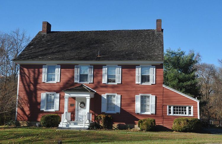
Points of interest
Notable people
People who were born in, residents of, or otherwise closely associated with Ewing Township include: