
 | ||
The Traverse Gap is an ancient river channel occupied by Lake Traverse, Big Stone Lake and the valley connecting them at Browns Valley, Minnesota. It is located on the border of the U.S. states of Minnesota and South Dakota. Traverse Gap has an unusual distinction for a valley: it is crossed by a continental divide, and in some floods water has flowed across that divide from one drainage basin to the other. Before the Anglo-American Convention of 1818 it marked the border between British territory in the north and U.S. – or earlier, French – territory in the south.
Contents
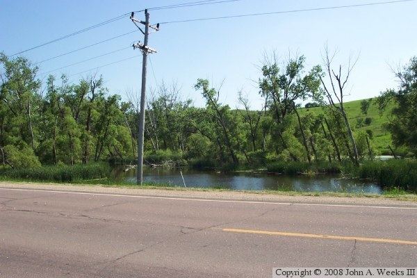
- Map of Ancient River Warren Channel Becker Township SD 56219 USA
- Geological history
- Topography and hydrology
- Geography
- Human settlement
- Natural Landmark designation
- References
Map of Ancient River Warren Channel, Becker Township, SD 56219, USA
Geological history
The Traverse Gap was cut at the end of the last ice age. The Laurentide Ice Sheet decayed and receded as the Wisconsonian glaciation drew to a close, and Glacial Lake Agassiz formed from its meltwaters. Outlets to the north were blocked by the glacier, and the outlet to the south was dammed by the Big Stone Moraine which had been left by the retreat of the ice sheet. Lake Agassiz filled until it overtopped the moraine about 11,700 years ago. The resulting enormous outflow of the lake carved a natural spillway through the moraine, through which cascaded Glacial River Warren. This great river not only created the gap, it also cut the valleys of the present-day Minnesota and Upper Mississippi Rivers. River Warren drained Agassiz in two or more intervals over the next 2300 years, separated by times when the ice sheet receded sufficiently to uncover other outlets for Lake Agassiz. About 9400 years ago, Agassiz found a permanent outlet to the north. With its former source now draining elsewhere, River Warren ceased to flow, and the spillway gorge became the Traverse Gap.
Topography and hydrology
Despite the low elevation and flat topography of its floor, the Traverse Gap marks southernmost point of the Northern Divide between the watersheds of the Arctic and the Atlantic Oceans. On the north, Lake Traverse is the source of the Bois des Sioux River, a source stream of the Red River of the North, which drains via Lake Winnipeg and the Nelson River to Hudson Bay in the Arctic Ocean. To the south, Big Stone Lake is the source of River Warren's remnant, the Minnesota River, tributary to the Mississippi, which drains to the Gulf of Mexico and the Atlantic. Big Stone Lake is now fed by the Little Minnesota River, the headwaters of which are in South Dakota. The Little Minnesota enters the gap from the west and meanders south through the old channel to Big Stone Lake. The Little Minnesota, part of the Mississippi watershed, is less than one mile (1.6 km) from Lake Traverse in the drainage basin of Hudson Bay.
The floor of Browns Valley is flat, which allows the waters of one basin to flood across the continental divide into the other basin in times of high water. The maximum elevation on the floor of the valley is 987 feet (300.8 m) above sea level. The Browns Valley Dike at the south end of Lake Traverse is at the same elevation; this structure was built to reduce the likelihood of flooding south across the continental divide. At 983.9 feet (299.9 m), that divide is lower than the level of the dike, and flooding at Lake Traverse has the potential to drain over the Big Stone Dike into the Minnesota River watershed. At the south end of the gap, the Big Stone Lake reservoir pool is maintained at 967 feet (294.7 m), and it has recently flooded to over 975 feet (297.2 m). The Little Minnesota River upstream and at a higher elevation near the divide has flooded to a level where it drained across that divide into Lake Traverse. While the natural state of the area has been altered by the dike and control structures on the two lakes, interbasin flooding did occur prior to construction of those improvements. The Traverse Gap therefore allows waters which would naturally flow to the Atlantic Ocean to flow to the Arctic instead, and in the past has allowed water from Lake Traverse to flow in the other direction to Big Stone Lake in the Atlantic basin.
Geography
The ancient channel at Browns Valley is a mile (1.6 km) wide and some 130 feet (40 m) deeper than the surrounding terrain through which it was carved. The distance from Lake Traverse to Big Stone Lake is about five miles (8 km). The ancient channel through the moraine includes not only the land between those modern lakes, but the lakes themselves.
The continental divide crosses the gap transversely at its northern end. The Minnesota-South Dakota border longitudinally bisects the old channel. Roberts County is on the South Dakota side. To the east is Traverse County, Minnesota and the community of Browns Valley near the continental divide. The southeast part of the gap is in Big Stone County, Minnesota.
Human settlement
The area has seen human presence for thousands of years. A Paleo-Indian skeleton now known as "Browns Valley Man" was unearthed in 1933, under circumstances which suggested death or interment after deposition of the gravel but before creation of significant topsoil. Found with tools of the Clovis and Folsom types, the human remains have been dated approximately 9,000 years b.p.
The Traverse Gap was used by Native Americans, who "from time immemorial . . . had place two weather-beaten buffalo skulls where travelers paused to smoke a pipe at the divide." The native trails were later used by fur traders who had posts at Lake Traverse and Big Stone Lake, and then by Red River ox carts on the earliest of the Red River Trails.
The rural part of the valley floor contains pastures, cropland, and marshes along the Little Minnesota River. The vale was named "Browns Valley" after one of its pioneer residents, which in turn gave its name to the incorporated community near its northern end. The valley floor is crossed by Minnesota State Highway 28, which becomes South Dakota Highway 10 at the south end of Lake Traverse.
Natural Landmark designation
Under the name of Ancient River Warren Channel, the Traverse Gap has been designated as a National Natural Landmark under the Historic Sites Act. It received this designation in April 1966 from the United States Secretary of the Interior, giving it recognition as an outstanding example of a geological feature of the United States' natural history. The designation describes it as "a channel cut by the Ancient River Warren during the Ice Age, containing the Hudson Bay-Gulf of Mexico divide, with a lake on each side as evidence of the irregularities in Ice Age sedimentation".