
Country US, Canada Bridges Black Hawk Bridge | Length 2,000 km (1,200 mi) | |
 | ||
Basin size 490,000 km (190,000 sq mi) Discharge Average rate:5,796 m/s (204,700 cu ft/s) | ||
Eight days on the upper mississippi river
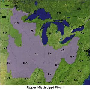
The Upper Mississippi River is the portion of the Mississippi River upstream of Cairo, Illinois, United States. From the headwaters at Lake Itasca, Minnesota, the river flows approximately 2000 kilometers (1250 mi) to Cairo, where it is joined by the Ohio River to form the Lower Mississippi River.
Contents
- Eight days on the upper mississippi river
- Headed up the upper mississippi river
- History
- Characteristics
- Ecology
- Navigation
- Expansion proposals for locks
- References
Headed up the upper mississippi river
History
In terms of geologic and hydrographic history, the Upper Mississippi is a portion of the now-extinct Glacial River Warren which carved the valley of the Minnesota River, permitting the immense Glacial Lake Agassiz to join the world's oceans at the Gulf of Mexico. The collapse of ice dams holding back Glacial Lake Duluth and Glacial Lake Grantsburg carved out the Dalles of the St. Croix River. "The Upper Mississippi River valley likely originated as an ice-marginal stream during what had been referred to as the “Nebraskan” glaciation. Current terminology would place this as Pre-Illinoian Stage.
The Driftless Area is a portion of North America left unglaciated at that ice age's height, hence not smoothed out or covered over by previous geological processes.
Inasmuch as the Wisconsin glaciation formed lobes that met (and blocked) where the Mississippi now flows, and given that huge amounts of glacial meltwater were flowing into the Driftless Area, and that there is no lakebed, it is assumed that there were instances of ice dams bursting. Considering the history of Glacial Lake Missoula, something like this is believed to have happened.
Characteristics
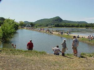
The Upper Mississippi from below St. Anthony Falls (Minneapolis, Minnesota) downstream to St. Paul, Minnesota is a gorge with high limestone bluffs carved by the waterfall. Upstream of the waterfall the land slopes gently to rivers edge. Downstream of downtown St. Paul the river enters its wide preglacial valley. The states of Minnesota, Wisconsin and Iowa, along with the federal government, have preserved certain areas of the land along this reach of the river.
There are three National Park Service sites along the Upper Mississippi River. The Mississippi National River and Recreation Area is the National Park Service site dedicated to protecting and interpreting the Mississippi River itself. The other two National Park Service sites along the river are: Effigy Mounds National Monument and the Jefferson National Expansion Memorial (the Gateway Arch in St. Louis).
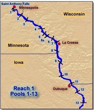
Unlike the Lower Mississippi, much of the upper river is a series of pools created by a system of 29 locks and dams. The structures were authorized by Congress in the 1930s, and most were completed by 1940. A primary reason for damming the river is to facilitate barge transportation. The dams regulate water levels for the Upper River and play a major part in regulating levels on the Lower Mississippi.
Ecology
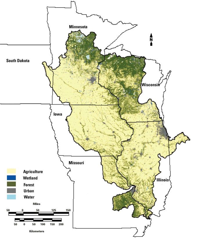
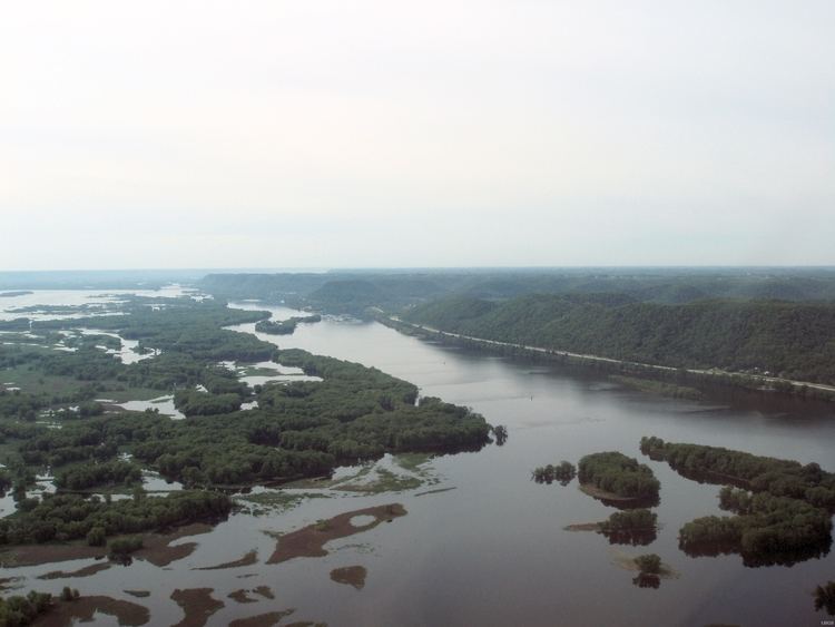
On the upper reaches near the Minnesota-Wisconsin border, the river's floodplain is between 1.5 and 5 kilometers (between 1 and 3 mi) wide. South of St. Louis, Missouri, the alluvial floodplain is approximately 80 kilometers (50 mi) wide. Major tributaries to the Upper Mississippi River include the Missouri, Illinois, Minnesota, St. Croix, Black, and Kaskaskia Rivers.
The Upper Mississippi provides habitat for more than 125 fish species and 30 species of freshwater mussels. Three national wildlife refuges along the river cover a total of 465 square kilometers (285,000 ac). The largest of them, the Upper Mississippi River National Wildlife and Fish Refuge, is over 420 kilometers (260 mi) long, reaching from the Alma, Wisconsin area down to Rock Island, Illinois. The refuge consists of blufflands, marshes, bottomland forest, islands, channels, backwater lakes and sloughs. It is part of the Mississippi Flyway.
Although the river is much cleaner than it was in recent decades, water quality is still a priority concern. Agricultural runoff, including sediment, excessive nutrients, (particularly nitrogen and phosphorus), and chemicals from agricultural and industrial sources continue to threaten Upper Mississippi River aquatic resources.In addition new threats continue to emerge such as personal care items including pharmaceuticals and endocrine-disrupting chemicals. The five states bordering the Upper Mississippi River are working together to address water quality issues.
There is general agreement that nutrients are contributing to the Gulf of Mexico dead zone and to eutrophication problems in Lake Pepin, a large natural riverine lake that is part of Pool 4 of the Upper Mississippi River. National and regional efforts are addressing these problems, but nutrient impairment problems are occurring elsewhere in the Upper Mississippi River as well, particularly in off-channel portions. Excessive nutrients contribute to thick floating mats of filamentous algae or duckweeds that have a pronounced negative impact on light penetration and may threaten the growth and persistence of submerged aquatic vegetation that is important for fish and aquatic life, including waterfowl. Efforts to control nutrients from point and non-point sources in the basin will provide additional benefits.
Navigation
Navigation locks allow towboats, barges, and other vessels to transit the dams. Approximately 1350 kilometers (850 mi), from the head of navigation in Mile 858, Minneapolis, Minnesota down to Cairo, has been made suitable for commercial navigation with a depth of 2.75 meters (9 ft). The agriculture and barge transportation industries have lobbied in the late 20th and early 21st centuries for a multibillion-dollar project to upgrade the aging lock and dam system. Some environmental groups and advocates of budgetary restraint argue that the project lacks economic justification.
Each lock & dam complex creates a pool upstream of it. There are 29 locks on the Upper Mississippi maintained by the U.S. Army Corps of Engineers—from Upper St. Anthony Falls upstream to Chain of Rocks downstream. The locks provide a collective 123 meters (404 ft) of lift. Note that there is a Lock 5 as well as a Lock 5A. Note also that there is no Lock 23.
Expansion proposals for locks
The Army Corps of Engineers has studied the expansion of some locks on the Upper Mississippi. The Corps is considering expanding locks 20, 21, 22, 24, and 25.