
County Bates ZIP code 64730 Elevation 285 m Local time Friday 2:30 AM | Time zone CST (UTC-6) GNIS feature ID 0766309 Area 92.95 km² Population 317 (2000) | |
 | ||
Weather 8°C, Wind NW at 13 km/h, 93% Humidity | ||
Summit Township is one of twenty-four townships in Bates County, Missouri, USA. As of the 2000 census, its population was 317.
Contents
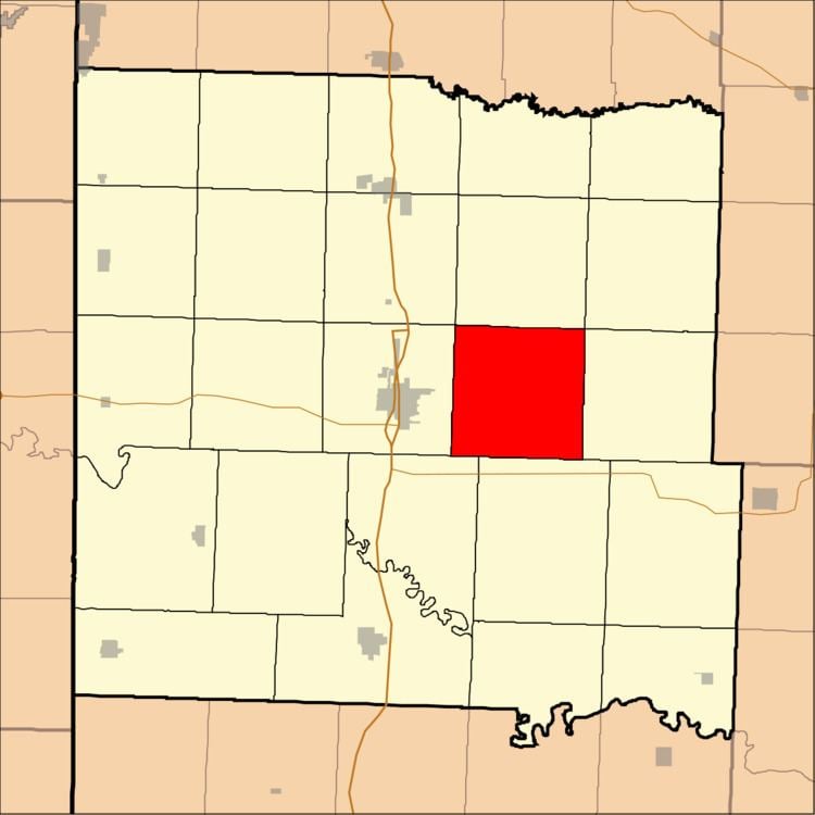
- Map of Summit Township MO 64730 USA
- Geography
- Adjacent townships
- Cemeteries
- School districts
- Political districts
- References
Map of Summit Township, MO 64730, USA
Summit Township was so named on account of the relatively elevated prairies within its borders.
Geography
According to the United States Census Bureau, Summit Township covers an area of 35.89 square miles (92.97 square kilometers); of this, 35.84 square miles (92.83 square kilometers, 99.85 percent) is land and 0.05 square miles (0.14 square kilometers, 0.15 percent) is water.
Adjacent townships
Cemeteries
The township contains these two cemeteries: Elizabeth Chapel and Glass.
School districts
Political districts
References
Summit Township, Bates County, Missouri Wikipedia(Text) CC BY-SA