
County Bates ZIP codes 64730, 64770 Elevation 275 m Local time Sunday 7:38 AM | Time zone CST (UTC-6) GNIS feature ID 0766290 Area 93.03 km² Population 247 (2000) | |
 | ||
Weather 13°C, Wind S at 26 km/h, 68% Humidity | ||
Deepwater Township is one of twenty-four townships in Bates County, Missouri, USA. As of the 2000 census, its population was 247.
Contents
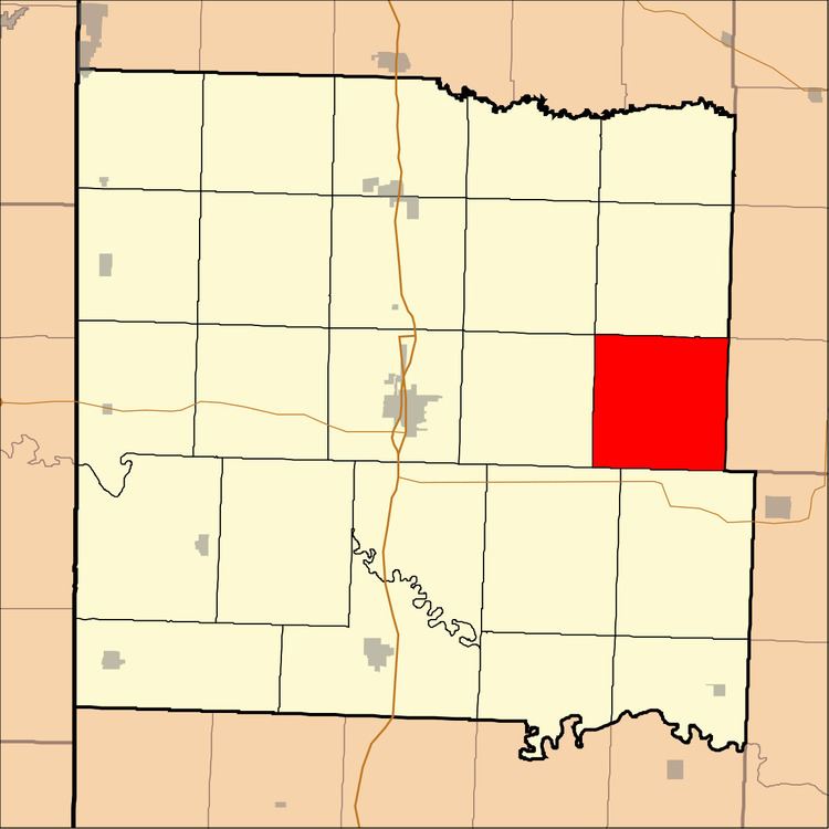
- Map of Deepwater Township MO USA
- Geography
- Unincorporated towns
- Adjacent townships
- Cemeteries
- School districts
- Political districts
- References
Map of Deepwater Township, MO, USA
Deepwater Township took its name from a nearby creek.
Geography
According to the United States Census Bureau, Deepwater Township covers an area of 35.92 square miles (93.03 square kilometers); of this, 35.91 square miles (93 square kilometers, 99.97 percent) is land and 0.01 square miles (0.03 square kilometers, 0.03 percent) is water.
Unincorporated towns
(This list is based on USGS data and may include former settlements.)
Adjacent townships
Cemeteries
The township contains these four cemeteries: Radford, Smith, Snodgrass Union and White.
School districts
Political districts
References
Deepwater Township, Bates County, Missouri Wikipedia(Text) CC BY-SA