Kalpana Kalpana (Editor)

Stirling (council area)

Updated on
Edit
Like
Comment
Share on FacebookTweet on TwitterShare on LinkedInShare on Reddit
Admin HQ
  
Stirling

ONS code
  
S12000030

Website
  
www.stirling.gov.uk

Area rank
  
Ranked 9th

ISO 3166 code
  
GB-STG

Stirling (council area)

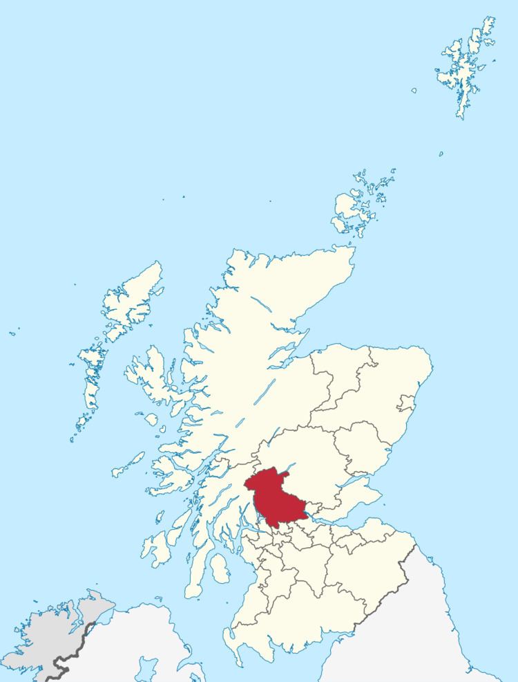
The Stirling council area (Scots: Stirlin, Scottish Gaelic: Sruighlea) is one of the 32 council areas of Scotland, and has a population of about 92,800 (2015 estimate). It was created under the Local Government etc (Scotland) Act 1994 with the boundaries of the Stirling district of the former Central local government region, and it covers most of the former county of Stirling (except Falkirk) and the south-western portion of the former county of Perth. Both counties were abolished for local government purposes under the Local Government (Scotland) Act 1973.

Contents

Map of Stirling, UK

The administrative centre of the area is the city of Stirling.

The area borders the council areas of Clackmannanshire (to the east), North Lanarkshire (to the south), Falkirk (to the south east), Perth and Kinross (to the north and north east), Argyll and Bute (to the north and north west), and both East and West Dunbartonshire to Stirling's southwest.

The majority of the population of the area is located in its southeast corner, in the city of Stirling and in the surrounding lowland communities: Bridge of Allan and Dunblane to the north, Bannockburn to the immediate south, and the three former coal mining communities of Cowie, Fallin, and Plean, known collectively as the "Eastern Villages".

The remaining 30 percent of the region's population is sparsely distributed across the rural, mainly highland, expanse in the north of the region. The southern half of this rural area comprises the flat western floodplain of the River Forth, bounded on the south by the Touch Hills and the Campsie Fells. North of the glen lie the Trossachs mountains, and the northern half of the region is generally mountainous in character.

The Council

As with all local authorities in Scotland, Stirling Council has a number of multi-member wards electing representatives under the single transferable vote system.

The wards and their councillors are:

  • Bannockburn (3 Councillors): Margaret Brisley (Lab), Alasdair MacPherson (SNP), Violet Weir (Lab)
  • Castle (3 Councillors): Johanna Boyd (Lab), John Hendry (Lab), Jim Thomson (SNP)
  • Dunblane & Bridge of Allan (4 Councillors): Callum Campbell (Con), Graham Houston (SNP), Mike Robbins (Lab), Mark Ruskell (Green)
  • Forth & Endrick (3 Councillors): Alistair Berrill (Con), Graham Lambie (SNP), Ian Muirhead (SNP)
  • Stirling East (3 Councillors): Danny Gibson (Lab), Corrie McChord (Lab), Gerry McLaughlan (SNP)
  • Stirling West (3 Councillors): Neil Benny (Con), Scott Farmer (SNP), Christine Simpson (Lab)
  • Trossachs and Teith (3 Councillors): Martin Earl (Con), Alycia Hayes (SNP), Fergus Wood (SNP)
  • Settlements

    As well as the city of Stirling itself, there are many towns, villages and hamlets spread across the council area:

    Towns

  • Bannockburn
  • Bridge of Allan
  • Callander
  • Doune
  • Dunblane
  • Villages

  • Aberfoyle
  • Arnprior
  • Balfron
  • Balmaha
  • Balquhidder
  • Blairlogie
  • Blanefield
  • Buchlyvie
  • Cambusbarron
  • Cambuskenneth
  • Cowie
  • Crianlarich
  • Croftamie
  • Deanston
  • Drymen
  • Fallin
  • Fintry
  • Gargunnock
  • Gartmore
  • Killearn
  • Killin
  • Kinlochard
  • Kippen
  • Lochearnhead
  • Plean
  • Port of Menteith
  • Strathblane
  • Strathyre
  • Thornhill
  • Throsk
  • Tyndrum
  • Hamlets

  • Ardchullarie More
  • Ardchyle
  • Ardeonaig
  • Ashfield
  • Auchlyne
  • Balfron Station
  • Boquhan
  • Buchanan Smithy
  • Carbeth
  • Clifton
  • Dalmary
  • Gartness
  • Kilmahog
  • Kinbuck
  • Milton
  • Mugdock
  • Ruskie
  • Places of interest

  • Carse of Lecropt
  • Culcreuch Castle
  • Inchmahome Priory (a ruined Augustinian priory on an island in the Lake of Menteith, used as a refuge in 1547 by Mary, Queen of Scots)
  • Breadalbane Folklore Centre
  • Cambuskenneth Abbey (formerly the seat of the Scottish Parliament)
  • Doune Castle
  • Falls of Dochart
  • Falls of Lochay
  • Glen Dochart
  • Glenfinlas
  • Lake of Menteith
  • Lecropt Kirk
  • Loch Achray
  • Loch Ard
  • Loch Earn
  • Loch Lomond and the Trossachs National Park
  • Loch Katrine (The source of most of the drinking water for the city of Glasgow)
  • Loch Rusky
  • Loch Venachar
  • Moirlannich Longhouse
  • Queen Elizabeth Forest Park (run by the Forestry Commission)
  • Scottish Institute of Sport (on the grounds of Stirling University)
  • Stirling Castle
  • The University of Stirling
  • The Trossachs
  • Wallace Monument
  • West Highland Way
  • References

    Stirling (council area) Wikipedia