
Population 139 Dialling code 01786 | OS grid reference NN784037 Sovereign state United Kingdom Postcode district FK15 | |
 | ||
Lieutenancy areas | ||
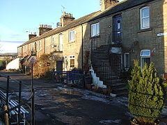
Ashfield (Scottish Gaelic: Achadh an Uinnsinn) is a hamlet in the Registration county of Perth and the local government district of Stirling, Scotland. It lies between the Allan Water and the Stirling-Perth Railway line. It is two miles north of Dunblane, and was designated a conservation village in 1976. It was originally built to house workers at a nearby silk dyeing mill. Prior to this a mill, Millash or Mill of Ash, existed, as did an extensive house or farm Ashfield has four residential streets (Ochillview, Alanview, The Steading and The Cottages) and also a square, named after the former prime minister William Gladstone, called Gladstone Square.
Map of Ashfield, Dunblane, UK
There are various annual activities based in the village hall such as a Blues festival, a Food festival and a Music festival.