
OS grid reference NN628079 Sovereign state United Kingdom Postcode district FK17 | Post town CALLANDER Local time Monday 7:36 PM | |
 | ||
Population 2,754 (2001 census)est. 3,130 (2006) Weather 6°C, Wind W at 10 km/h, 84% Humidity Points of interest Loch Lubnaig, Stùc a' Chroin, Hamilton Toy Collection | ||
Callander scotland
Callander (/ˈkæləndər/; Scottish Gaelic: Calasraid) is a small town in the council area of Stirling, Scotland, situated on the River Teith. The town is located in the historic county of Perthshire and is a popular tourist stop to and from the Highlands.
Contents
- Callander scotland
- Map of Callander UK
- Drive from doune to callander scotland
- History
- Annual events
- Trivia
- References
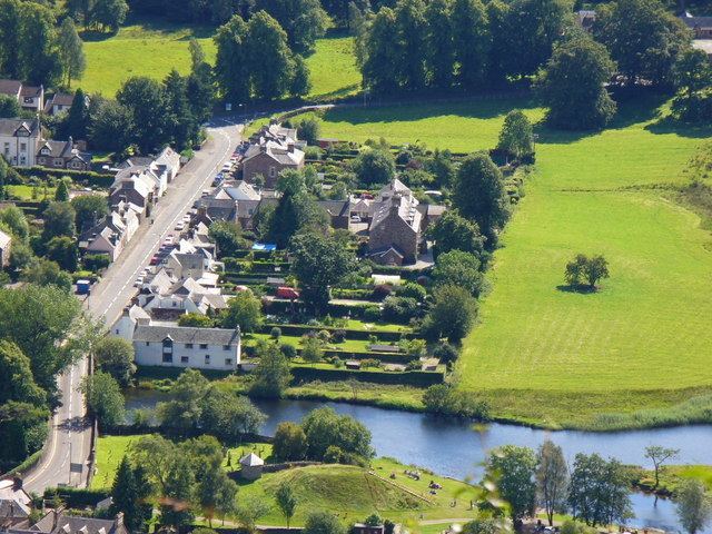
Map of Callander, UK
The town serves as the eastern gateway to the Loch Lomond and the Trossachs National Park, the first National Park in Scotland. Owing to its location it is often referred to as the "Gateway to the Highlands". The former St. Kessog's Church is now The Clanranald Trust for Scotland head office.
Dominating the town to the north are the Callander Crags, a visible part of the Highland Boundary Fault, rising to 343 m at the cairn. Ben Ledi (879 m) lies north-west of Callander. Local walks include Bracklinn Falls, The Meadows, Callander Crags and the Wood Walks. The town sits on the Trossachs Bird of Prey Trail. The River Teith is formed from the confluence of two smaller rivers, the Garbh Uisge (River Leny) and Eas Gobhain about half a mile west of the bridge at Callander.
McLaren High School founded in 1892 educates pupils aged 11 to 18 from a wide catchment area extending as far as Killin, Tyndrum and Inversnaid.
Callander achieved prominence during the 1960s as the fictional setting "Tannochbrae" in the BBC television series Dr. Finlay's Casebook.
Drive from doune to callander scotland
History
There is evidence of a neolithic site situated south of the river, which was excavated in 2001 finding evidence of a building and neolithic pottery. The Auchenlaich Cairn, a neolithic chambered cairn which at 322 m in length is the longest in Britain, is situated near Keltie Bridge just east of Callander.
Saint Kessog, a disciple of Columba of Iona, preached and taught in this area in the early sixth century. A small mound by the River Teith is named in pseudo-Gaelic as "Tom na Chessaig", meaning "the Hill of Kessog".
In 1645, during the campaigns of Montrose, a battle was fought at Callander between the Campbells of Argyll and the Atholl men. The Campbells were harassing the McGregors and the McNabs for their allegiance to Montrose. While besieging Castle Ample the news came of the advance of 700 Atholl men under Inchbrakie. A retreat was made southwards, but, as the Campbells were crossing a ford to the east of the village of Callander, they were overtaken and compelled to give battle. Inchbrakie, advancing part of his force to attack the defenders, quietly marched another detachment towards a ford higher up near the present bridge. A crossing was soon effected, and the Campbells, being unexpectedly attacked on the rear, broke and fled, leaving eighty of their men dead on the field.
As late as 1845 Scottish Gaelic was still spoken in Callander with two schools still teaching it.
Callander was served by rail from 1 July 1858 as the terminus of a branch line from Dunblane. A second Callander railway station was opened about 1⁄2 mile (800 m) to the west, behind the Dreadnought Hotel, on 1 June 1870 when the railway was extended to Killin en route to Oban, and closed on 5 November 1965. Sections of this former Callander and Oban Railway line, between Callander and Strathyre and between Balquhidder and Killin Junction, are now part of the National Cycle Network (route 7) and the Rob Roy Way. Track from the dismantled Callander and Oban Railway was used in the construction of the transit system for the 1968 Summer Olympics in Mexico City.