
Length 47 km | Source elevation 33 m Country United Kingdom | |
 | ||
Bridges | ||
The River Forth (Gaelic: Abhainn Dubh, meaning "black river", in the upper reach above Stirling, and Uisge For in the tidal reach below Stirling), 47 km (29 mi) long, is the major river draining the eastern part of the central belt of Scotland.
Contents
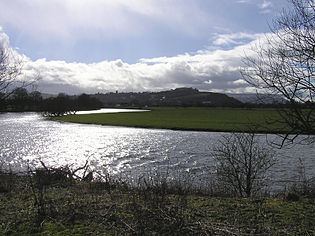
- Map of River Forth United Kingdom
- Settlements on the Forth
- Navigation on the Forth
- Bridges over the Forth
- References
Map of River Forth, United Kingdom
The Forth rises in Loch Ard in the Trossachs, a mountainous area some 30 km (19 mi) west of Stirling. It flows roughly eastward, through Aberfoyle, joining with the Duchray Water and Kelty Water, and out over the vast flat expanse of the Carse of Stirling including Flanders Moss. It is then joined by the River Teith (which itself drains Loch Venachar, Loch Lubnaig, Loch Achray, Loch Katrine, and Loch Voil) and the Allan Water, before meandering through the ancient city of Stirling. At Stirling the river widens and becomes tidal, and it is here that the last (seasonal) ford of the river exists. From Stirling, the Forth flows east over the Links of Stirling and past the towns of Cambus (where it is joined by the river Devon), Alloa, Fallin and Airth. Upon reaching Kincardine the river begins to widen into an estuary, the Firth of Forth.
Settlements on the Forth
The shores have many settlements, as well as the petrochemical complexes at Grangemouth, the commercial docks at Leith, oilrig construction yards at Methil, the ship-breaking facility at Inverkeithing and the naval dockyard at Rosyth, with numerous other industrial areas including the Forth Bridgehead area, Burntisland, Kirkcaldy, Bo'ness and Leven.
Navigation on the Forth
In the sixteenth and seventeenth centuries Stirling harbour was a busy port, with goods coming into Scotland and being exported to Europe. Links with the Hansa towns were strong, and Stirling had a particularly close relationship with Veere (Campvere as it used to be known) in the Netherlands. After 1707 much of the trade shifted to the port of Glasgow, as trade with America became the new focus. During the First and Second World Wars, however, Stirling harbour thrived again as a gateway for supplies of tea to Scotland. Trade slowly returned after the wars but the few agricultural merchants based at Stirling found such shipping uncompetitive due to high shore dues levied by the harbour’s owners. Today Stirling harbour is no more.
Bridges over the Forth
Upstream of Stirling, the river is rather small and is crossed in numerous places (although prior to modern drainage works, the ground was often treacherously marshy near the riverbank). After its confluence with the Teith and Allan, the river is sufficiently wide that a significant bridge is required. A bridge has existed at Stirling since at least the 13th century, and until the opening of the road crossing at Kincardine in 1936, Stirling remained the easternmost road crossing. A swinging railway bridge between Alloa on the north shore and Throsk on the south opened in 1885 and was closed (and largely demolished) in 1970. Only the metal piers remain. The Clackmannanshire Bridge just upstream of the Kincardine Bridge opened on 19 November 2008. Much further downstream joining North Queensferry and South Queensferry is the famous Forth Bridge (a railway bridge) opened in 1890, and the Forth Road Bridge which opened in 1964. In 2011 construction began on the Queensferry Crossing, to the west of the Forth Road Bridge, with a planned opening date in 2017.