
Founded December 14, 1818 Website www.lcmo.us Population 53,860 (2013) Unemployment rate 5.7% (Apr 2015) | Area 1,658 km² | |
 | ||
Rivers Cuivre River, Big Creek, Bryants Creek, Bear Creek | ||
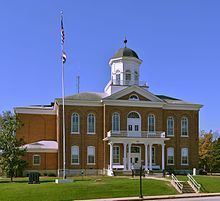
Lincoln County is a county in the eastern part of the U.S. state of Missouri. As of the 2010 census, the population was 52,566. Its county seat is Troy. The county was founded December 14, 1818, and named for Major General Benjamin Lincoln of the American Revolutionary War.
Contents
- Map of Lincoln County MO USA
- History
- Notable residents
- Geography
- Adjacent counties
- Major highways
- Demographics
- Public schools
- Private schools
- Local
- State
- Federal
- Missouri Presidential Preference Primary 2008
- References
Map of Lincoln County, MO, USA
Lincoln County is part of the St. Louis, MO-IL Metropolitan Statistical Area.
History
According to Goodspeed's History of Lincoln County, Missouri (1888), Lincoln County was named by Major Christopher Clark, the first permanent white settler, when he addressed the Territorial Legislature saying, "I was born, sir, in Link-Horn County, N.C., I lived for many years in Link-Horn County in old Kain-tuck. I wish to die in Link-Horn County, in Missouri; and I move, therefore, that the blank in the bill be filled with the name Link-Horn." The motion was carried unanimously and the clerk, not adopting the frontier parlance of the Major, wrote "Lincoln" in the blank space of the bill. Others say it was named for Major General Benjamin Lincoln who served in the Continental Army during the American Revolutionary War.
Notable residents
Geography
According to the U.S. Census Bureau, the county has a total area of 640 square miles (1,700 km2), of which 627 square miles (1,620 km2) is land and 14 square miles (36 km2) (2.2%) is water. The county's eastern border with Illinois is formed by the Mississippi River.
Adjacent counties
Major highways
Demographics
As of the census of 2000, there were 38,944 people, 13,851 households, and 10,554 families residing in the county. The population density was 62 people per square mile (24/km²). There were 15,511 housing units at an average density of 25 per square mile (10/km²). The racial makeup of the county was 96.13% White, 1.74% Black or African American, 0.37% Native American, 0.17% Asian, 0.03% Pacific Islander, 0.43% from other races, and 1.14% from two or more races. Approximately 1.14% of the population were Hispanic or Latino of any race. 37.7% were of German, 17.0% American, 10.9% Irish and 7.4% English ancestry.
There were 13,851 households out of which 40.00% had children under the age of 18 living with them, 61.50% were married couples living together, 10.10% had a female householder with no husband present, and 23.80% were non-families. 19.70% of all households were made up of individuals and 7.70% had someone living alone who was 65 years of age or older. The average household size was 2.77 and the average family size was 3.17.
In the county, the population was spread out with 30.00% under the age of 18, 8.10% from 18 to 24, 30.20% from 25 to 44, 21.00% from 45 to 64, and 10.80% who were 65 years of age or older. The median age was 34 years. For every 100 females there were 98.40 males. For every 100 females age 18 and over, there were 97.90 males.
The median income for a household in the county was $42,592, and the median income for a family was $47,747. Males had a median income of $35,564 versus $23,270 for females. The per capita income for the county was $17,149. About 6.20% of families and 8.30% of the population were below the poverty line, including 9.60% of those under age 18 and 9.00% of those age 65 or over.
Public schools
Private schools
Local
The Democratic Party mostly controls politics at the local level in Lincoln County. Democrats hold all but six of the elected positions in the county.
State
Lincoln County is divided into three legislative districts in the Missouri House of Representatives.
All of Lincoln County is a part of Missouri’s 10th District in the Missouri Senate and is currently represented by Jeanie Riddle (R-Fulton).
Federal
All of Lincoln County is included in Missouri’s 3rd Congressional District and is currently represented by Blaine Luetkemeyer (R-St. Elizabeth) in the U.S. House of Representatives.