
Archipelago Spratly Islands | ||
 | ||
Spratly islands china philippines incident 1995
Spratly Island (Chinese: 南威島; pinyin: Nánwēi dǎo; Vietnamese: đảo Trường Sa), also known as Storm Island, with an area of 15 hectares, is the fourth largest of the naturally occurring Spratly Islands in the South China Sea, and the largest of the Vietnamese-occupied/claimed Spratly islands.
Contents
- Spratly islands china philippines incident 1995
- Map of Spratly Island
- Spratly islands china philippines incident
- Location
- History in the 20th century
- Administration
- Geography
- Ecology
- Facilities
- References
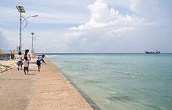
Map of Spratly Island
It is also claimed by PRC and Republic of China.
Spratly islands china philippines incident
Location
Spratly island lies west of Dangerous Ground in the western half of the Spratly Islands. It is neighboured by Ladd Reef to the west, the London Reefs to the east, and others.
History in the 20th century
In April 1930, France sent the dispatch boat (aviso), la Malicieuse, to the archipelago and raised the flag of France on a high mound on Spratly Island, also known as île de la Tempête. According to an official announcement by the French Ministry of Foreign Affairs, France occupied Spratly Island on April 13, 1930.
On 21 December 1933, the Governor of Cochinchina, Jean-Félix Krautheimer, signed Decree No. 4702-CP merging Spratly Island, Amboyna Cay, Itu Aba Island, Northeast Cay, Southwest Cay, Loaita Island, Thitu Island and other dependent islands with Ba Ria province (present-day Vietnam's Bà Rịa–Vũng Tàu Province).
During the occupation of the island by the Imperial Japanese Navy at the time of the Pacific War, the island was known by the Japanese as Nishitori jima (西鳥島, lit. "Western bird island").
After World War II, the Republic of China Navy sent a fleet of vessels to the South China Sea to take over the occupation of islands from Japan. In 1946, the Republic of China government announced the sovereignty of this island, set a milestone, and named it "Nanwei Island". (Nanwei is the name of the Chairman of Guangdong Province in China in 1946 - Chinese: 南威島).
During the early 1960s, the Republic of Vietnam Navy stopped off at the island several times. In 1963, three ships (HQ-404 Huong Giang, HQ-01 Chi Lang and HQ-09 Ki Hoa) visited and systematically rebuilt steles on a number of islands in the archipelago. On May 19, 1963, they built one on Spratly Island. However, the war on the mainland led to the absence of Vietnamese troops on the island until 1974 when the Republic of Vietnam (South Vietnam) set up a permanent garrison there after the Crescent Group of the Paracel Islands was lost to the PRC. On April 29, 1975, the Vietnam People's Army evicted the Republic of Vietnam troops and occupied the island.
Administration
Under the South Vietnamese regime, Spratly Island was placed under the administration of Phước Tuy Province. In 2007, the Vietnamese government upgraded the island's status to a commune-level town which is in charge of administrating all nearby Vietnamese-controlled features such as Amboyna Cay and Barque Canada Reef. On the island lies Trường Sa District's administrative center.
Geography
Spratly Island is shaped like an isosceles triangle. According to a document published by the Political Department of Vietnam's Navy Command, the island is 630 metres (2,070 ft) in length, up to 300 metres (980 ft) in width and has an area of 0.15 square kilometres (37 acres) while several foreign documents often use a slightly smaller number of 0.13 square kilometres (32 acres). It is 3.4 to 5 metres above sea level during low tide. The island has a variety of vegetation with a source of brackish water which can be utilized for bathing, washing and watering plants. The fringing reefs that lie at all three corners are up to 200 metres (660 ft) wide and uncovered at low tide.
With the typical meteorological characteristics of an archipelago, the Spratly Islands have a cool summer and a warm winter. The dry season, spanning from February to May, is characterized by a higher temperature from 4:30 AM to 19:00 PM. May to January is the time of the rainy season, when temperatures are lower during daytime, but thunderstorms more likely to occur.
Ecology
The island's plants are mostly Barringtonia asiatica, Ipomoea pes-caprae, Heliotropium foertherianum, and some kinds of bush and grass which grow poorly due to the harsh climate. Spratly Island is home to some birds and has guano deposits. Islanders try to cultivate banana, papaya, chili pepper and a variety of vegetables and herbs. There are also hundreds of dogs and lots of poultry such as chickens, ducks and geese.
Facilities
The island has a helicopter pad, a 600-metre (2,000-foot) landing strip that can accommodate small fixed-wing propeller aircraft (PZL M28 Skytruck, de Havilland Canada DHC-6 Twin Otter). Originally built in 1976-77 with a 660m runway, the current configurations were made in 2004. Aircraft are parked in small tarmac next to the runway. Homes surround the runway with both ends ending on a beachfront. A small two story building with a control tower on the roof is located by the tarmac.
A small jetty with two piers. Energy sources come from solar panels and wind turbines. Built in 1977, the meteorological station on Spratly Island has the station index number of 48920 assigned by the World Meteorological Organization. A clinic, a cultural house, a radio tower and a Buddhist pagoda also exist on the island. There is a 5.5 m-high obelisk at the southern tip. A primary school has been in operation since April 2013.
In 2016, photos and reports were published showing extensive land-reclamation and construction work at Spratly Island, with new harbours and extension of the runway to at least 1,000 metres (3,300 ft).