
Population 222 | ||
 | ||
Thitu Island (Tagalog: Pag-asa, literally "hope"; simplified Chinese: 中业岛; traditional Chinese: 中業島; pinyin: Zhōngyè Dǎo; Vietnamese: Đảo Thị Tứ; Pangasinan: Ilalo), having an area of 37.2 hectares (92 acres), is the second largest of the naturally occurring Spratly Islands and the largest of the Philippine-administered naturally occurring Spratly Islands. It lies about 480 kilometres (300 mi) west of Puerto Princesa City. Its neighbours are the North Danger Reef to the north, Subi Reef to the west, and the Loaita and Tizard Banks to the south.
Contents
Map of Thitu Island
Though administered as part of Kalayaan, Palawan, Philippines, it is also claimed by China, Taiwan and Vietnam.
History
Chinese fishermen historically called the island Tie Zhi (铁峙; 鐵峙; Min dialect pronounced IPA: [T’iɁTu]). It is sometimes incorrectly referred to as "Tiezhi Island" (铁峙岛; 鐵峙島; Tiezhi Dao); Tiezhi Reef (铁峙礁; 鐵寺礁) refers to another area 7.5 km northeast of this island. The modern Chinese name of the island was taken from one of the battleships named Chung-yeh (中業號; Zhongye Hao), sent by the Chinese government during the Republic of China era to regain control of the island in 1946.
From 1930 to 1933, the French colonial government in French Indochina sent naval troops to the Spratlys, including Thitu Island. On 21 December 1933, Gouverneur M. J. Krautheimer in Cochinchina (now Vietnam) decided to annex the Spratlys to Bà Rịa Province.
There are historical records of the island as having been inhabited at various times by Chinese and Vietnamese fishermen, and during the Second World War by French Indochina and Imperial Japanese troops. However, there were no large settlements on the island until 1956, when a Filipino lawyer-businessman-adventurer named Tomas Cloma decided to "claim" a part of the Spratly islands as his own, naming it the "Free Territory of Freedomland".
The Philippines formally established the Municipality of Kalayaan on Pag-asa island on 11 June 1978, by virtue of Presidential Decree 1596 series of 1978.
Topography
Pag-asa island is low-lying, with trees, shrubs and sand bars. It is surrounded by coral reefs populated with rusting wrecks visible above water.
Military
The island has been occupied by the Philippines since 1970. Being the second largest of the Spratly Islands, it is tightly protected by the Philippine forces. The island's beaches have unused concrete bunkers which were built in the 1970s, a few years after the Philippine military base was established. Two-thirds of the Philippine military stationed in Philippine-occupied islands (or, 40 out of 60 soldiers) are assigned to the island. It has a 1,300-metre (1,400 yd) unpaved airstrip called Rancudo Airfield, which serves both military and commercial air transportation needs. PAF regularly sends aircraft from Palawan to make reconnaissance missions in Philippine-controlled regions in the Spratly chain. The presence of an airstrip on the island makes such reconnaissance missions easier.
On July 7, 2009, the Philippine Navy renamed Naval Station Pag-Asa as Naval Station Emilio Liwanag (after retired WWII and Korean veteran, Navy Captain, Emilio Liwanag) as one of several bases, facilities, and stations renamed throughout the country.
In January 2014, the Chinese media reported the ambitions of China to reclaim the island as its own.
In June 2014, the Philippine government announced plans to repair the 1.3 km unpaved Rancudo airstrip using U.S. government aid.
Civilian
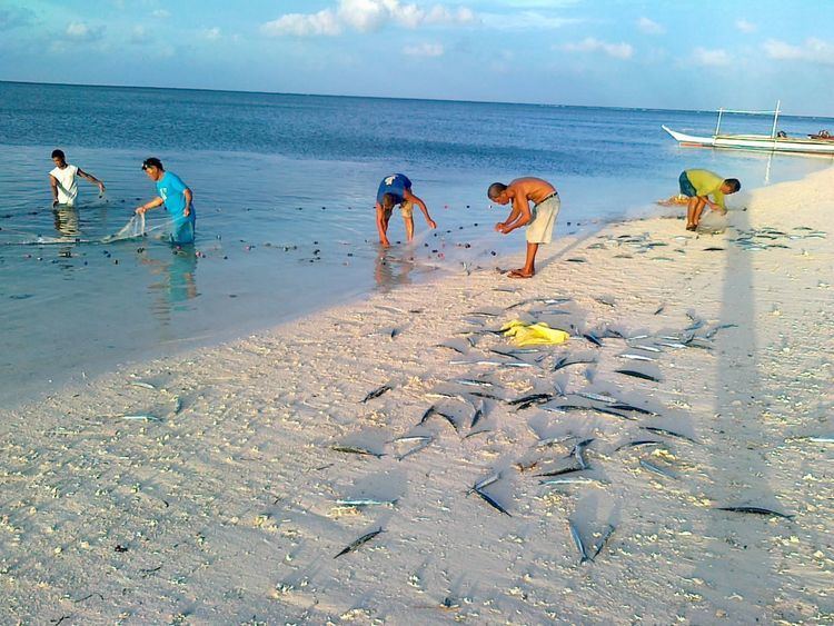
The island serves as a town proper to the municipality of Kalayaan. Only this island among all Philippine-occupied Spratly islands is currently inhabited by Filipino civilians. The civilian population of about 300, which includes children, was introduced in 2001. However, fewer than 200 civilian Filipinos are present in the island at a time. They live in a few dozen houses, linked with sandy paths.
It is the only Philippine-occupied island in the Spratlys to have a significant number of structures, including a municipal hall, multi-purpose hall, health center, school, water-filtration plant, engineering building, marina, communication tower, and military barracks. The residents raise pigs, goats, and chickens, and plant crops in an allotted space to supplement their supplies of goods provided by a naval vessel which visits once a month. By day, the residents get electricity from a power generator owned by the municipality. By night, they shift to stored solar power that comes from 1.5-volt solar panels installed on the island. The houses do not have running water – water is used from tanks in front of each house.
Future plans
There are numerous plans for the island. One of the plans, proposed by the Philippine Navy since 1999, is to create a long causeway that leads all the way to a deep-water region. The island is completely surrounded by its expansive shallow coral base, which caused the Philippine Navy's BRP Lanao del Norte (LT-504) to run aground during a failed attempt to dock near the island in 2004. The damaged ship remains at the site of the wreck. Additionally, the Philippine Navy has proposed a naval base be built on the island, specifically for the purposes of training the Philippine Navy's elite Special Warfare Group or Navy Seals.
In contrast, the municipality proposes that the island be developed for tourism. The island has a white sand coastline, is filled with trees, and is a sanctuary of several species of sea birds. Its wide coral base makes for good diving. Senator Angara filed a bill on 27 August 2016 that aims to promote the island as an ecotourism zone.