
Existed: 1926 – present Constructed 1926 | Length 674.3 km | |
 | ||
Counties Butte County, South Dakota | ||
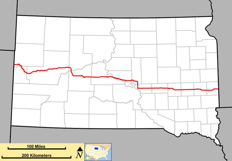
South Dakota Highway 34 (SD 34) is a state route that runs across the entire state of South Dakota, parallel to Interstate 90. It begins at the Wyoming border west of Belle Fourche, as a continuation of Wyoming Highway 24 (WYO 24). The eastern terminus is at the Minnesota border east of Egan, or southwest of Airlie, Minnesota, where it continues as Minnesota State Highway 30 (MN 30). It is just over 419 miles (674 km) in length.
Contents
Map of SD-34, South Dakota, USA
History
When first implemented in 1926, the western terminus was at South Dakota Highway 45 near Gann Valley. In the 1940s and early 1950s, a road was gradually built from Pierre to SD 45 via Fort Thompson, and SD 34 was extended west along it upon its completion. A further extension westward occurred in 1961, when SD 34 absorbed the alignment of South Dakota Highway 24.
In the late 1960s, a portion of SD 34 (along with U.S. Highway 14) was upgraded as part of the construction of Interstate 90. The segment between Whitewood and Sturgis (exits 23 and 30) remains signed with I-90 and U.S. 14.
A 10-mile (16 km) segment of SD 34 in Sanborn County has been upgraded to 4 lanes. This is part of a 4-lane route from Huron to Mitchell via South Dakota Highway 37.