
Existed: 1927 – present Length 318.6 km | Constructed 1927 | |
 | ||
Counties Charles Mix County, South Dakota | ||
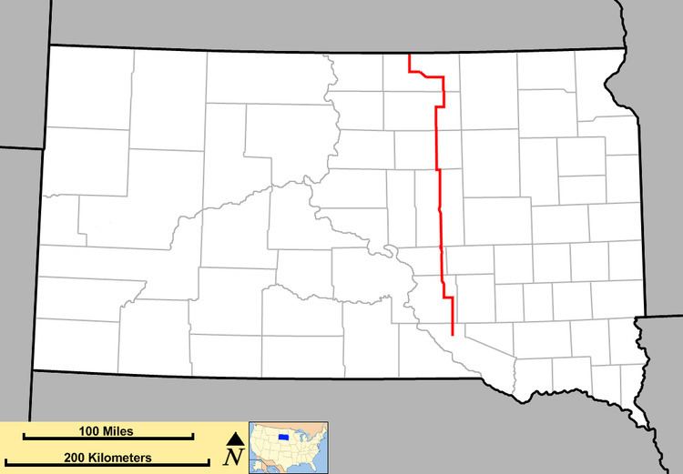
South Dakota Highway 45 is a state route that runs north to south across much of central South Dakota. The northern terminus is at the North Dakota border as a continuation of North Dakota Highway 3, and runs south to South Dakota Highway 44 at Platte. It is 198 miles (319 km) in length.
Contents
Map of SD-45, South Dakota, USA
History
South Dakota 45 was established around 1927. The northern end was at the intersection of South Dakota Highway 10 in Leola, and the southern end was at the intersection of present-day South Dakota Highway 50 and Charles Mix County Road 49.
By 1932, it was extended south along what was part of South Dakota Highway 47 to Wheeler. By 1936, SD 45 was truncated at Kimball (U.S. Highway 16), as U.S. Highway 281 supplanted the SD 45 designation to the south. In the early 1950s, when US 281 was relocated several miles east, SD 45 was extended back south to SD 50.
Around 1970, SD 50 had been realigned to intersect South Dakota Highway 44 west of Platte, and SD 45 was extended south along the old alignment to Platte, where it remains today.
The north end of the route has remained in its current configuration since 1936.