
Existed: 1926 – present Constructed 1926 | Length 389.5 km | |
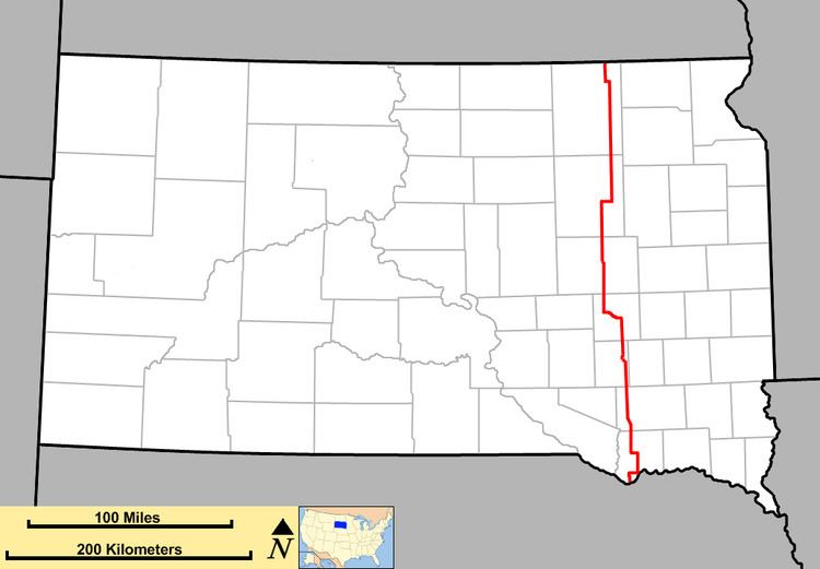 | ||
South Dakota Highway 37 (SD 37) is a state route that runs across eastern South Dakota. It begins at the Nebraska border northeast of Niobrara, Nebraska, as a continuation of Nebraska Highway 14. It runs to the North Dakota border north of Hecla, where it continues as North Dakota Highway 1. It is 242 miles (389 km) in length.
Contents
Map of SD-37, South Dakota, USA
History
South Dakota 37 was in place by 1926, and largely has used the same alignment since. The only significant exception was in northeast South Dakota, where SD 37 originally went westward from Groton to Bath, then north via Columbia to Houghton, where it continued to Hecla. This segment was rerouted to the current alignment by 1929.
On the south end, the road ended at the Missouri River at Running Water. A seasonal ferry was in place to carry traffic across the river. A direct connection via bridge did not open until 1998 when the Chief Standing Bear Memorial Bridge was completed.
In the early and mid-1930s, the segment between Huron and Tripp was co-numbered as U.S. Route 281. This concurrency was dropped by 1936, when US 281 was realigned further west.
The segment between Huron and Mitchell was upgraded to a 4-lane expressway, and was largely completed by 2004. A minor rerouting around the west end of Mitchell occurred, resulting in a 2-mile (3.2 km) concurrency with Interstate 90.
Legal definition
The route of SD 37 is defined in South Dakota Codified Laws § 31-4-158.