
Listing Ultra Easiest route rock/snow/ice climb First ascent 24 July 1962 | Length 80 km (50 mi) Elevation 7,742 m Prominence 2,160 m | |
 | ||
Location Siachen-Saltoro glacier First ascenders R.A. Bashir, A. Saito, Y. Takamura Similar Kanjut Sar, Batura Sar, K12, Gasherbrum III, Malubiting | ||
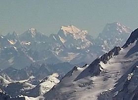
Saltoro Kangri is the highest peak of the Saltoro Mountains, better known as the Saltoro Range, which is a part of the Karakoram. It is the 31st highest mountain in the world, but it is in a very remote location deep in the Karakoram. It is located on the Actual Ground Position Line between Indian controlled territory in the Siachen region and Pakistani-controlled territory west of the Saltoro Range.
Contents
Map of Saltoro Kangri
Notable features
Saltoro Kangri rises dramatically above the valleys of the Kondus and Saltoro River of Baltistan to the west of the peak (draining eventually into the Indus River.) Due to danger from military operations, Saltoro Kangri is little visited. Areas just to the west are controlled by Pakistan, to the east by India.
Climbing history
The mountain was reconnoitered by the intrepid Workman couple in 1911-12.
The first attempt on the peak was in 1935 by a British expedition led by J. Waller, which reached c.24500' on the SE ridge.
A British university expedition led by Eric Shipton approached this peak through the Bilafond La via Pakistan with a Pakistani climbing permit. They reached the peak but did not attempt it. This expedition was inadvertently the first move in the deadly game of Siachen oropolitics that would lead to the Siachen conflict of 1984.
The first ascent of Saltoro Kangri was in 1962, by a joint Japanese-Pakistani expedition led by T. Shidei. This piggyback expedition put A. Saito, Y. Takamura and Pakistani climber R.A. Bashir on top on July 24, following the S.E. ridge route.
US maps of the area and many world atlases starting in the 1960s incorrectly showed the Line of Control between Pakistani and Indian territory running from the last defined point in the 1949 Karachi Agreement, NJ9842, east-northeast to the Karakoram Pass, thus putting the whole of Saltoro Kangri and the entire Siachen Glacier in Pakistan. However, the Simla Agreement defined the Line of Control no further than point NJ9842 other than with the phrase "thence north to the glaciers."
The Himalayan Index lists only one more ascent of the mountain, in 1981, and no other attempts.