
Listing Ultra Elevation 7,458 m Prominence 2,193 m | Easiest route glacier/snow/ice climb First ascent 23 August 1971 | |
 | ||
First ascenders H. Sturm, Hanns Schell, K. Pirker, Horst Schindlbacher Similar Kanjut Sar, Batura Sar, Gasherbrum III, Batura Muztagh, Saltoro Kangri | ||
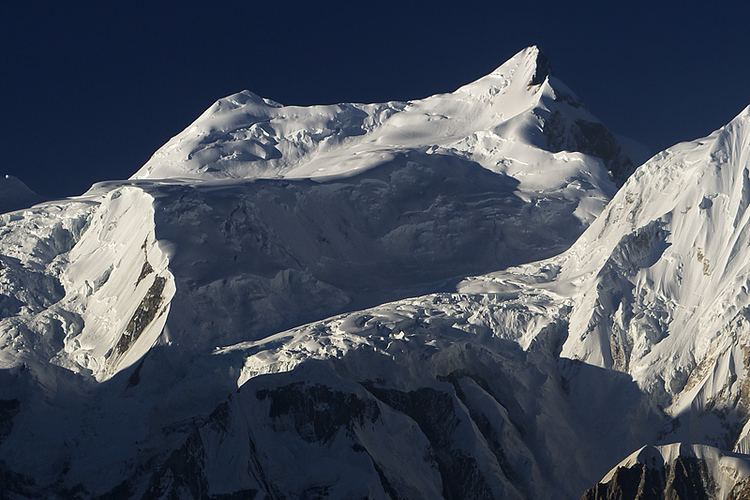
Malubiting (also known as Malubiting West) is the second highest peak in the Rakaposhi-Haramosh Mountains, a subrange of the Karakoram range of Pakistan.
Contents
Map of Malubiting
Location
Malubiting lies in the heart of the Rakaposhi-Haramosh Mountains, which rise above the north bank of the Indus River between its tributaries the Hunza River and the Shigar River. Malubiting lies about 40 km east-southeast of Rakaposhi, and about 50 km east of Gilgit, the most important town in the region. Malubiting rises steeply over the Phuparash River to the southwest, while on the east the large Chogo Lungma Glacier starts on its slopes.
Climbing history
Malubiting was unsuccessfully attempted in 1955, 1959, 1968, 1969 and 1970 and 1971 before the first ascent in 1971. In that year an Austrian team led by Horst Schindlbacher reached the summit via the Northeast Ridge, ascending the North Peak and skirting the Central Peak on the way.
According to the Himalayan Index, there has been only one additional ascent, by a Swiss-German team in 1997, via the original route. (There may however have been other ascents that did not make it into the Index.)