
 | ||
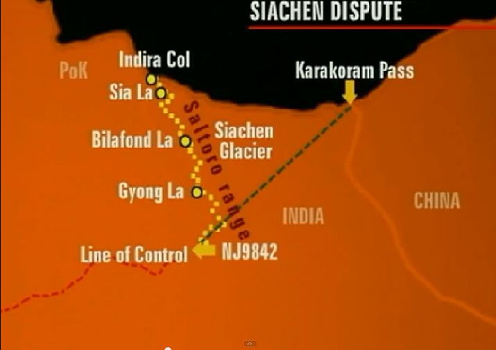
The Actual Ground Position Line (AGPL) is the line that divides current positions of Indian and Pakistani troops in the Siachen Glacier region. The line extends from the northernmost point of the LOC (Line of Control) to Indira Col. The AGPL is approximately 110 kilometres (68 mi) long.
Geographical location
This line runs across the edge of the Saltoro Ridge, which is a mountainous plateau with peaks which have heights in excess of 7,000 meters. The Indian soldiers hold on to the heights on the ridge, preventing the Pakistani soldiers from climbing up to the Saltoro Range heights. The current position of the AGPL follows the general line:
Indira Col - Sia La pass - Saltoro Kangri 1 - Bilafond La pass - K12 - Gyong La pass - NJ9842
References
Actual Ground Position Line Wikipedia(Text) CC BY-SA