
Founded October 16, 1787 Time zone Eastern: UTC-5/-4 Population 29,415 (2013) | Area 2,694 km² University Davis & Elkins College | |
 | ||
Named for Edmund Jennings Randolph Website randolphcountycommissionwv.org Rivers Shavers Fork, Cheat River, Dry Fork, Middle Fork River | ||
Randolph County is a county located in the U.S. state of West Virginia. As of the 2010 census, the population was 29,405. Its county seat is Elkins. The county was founded in 1787 and is named for Edmund Jennings Randolph.
Contents
- Map of Randolph County WV USA
- Geography
- Rivers
- Mountains
- Caves and caverns
- National Natural Landmarks
- Adjacent counties
- National protected area
- 2000 census
- 2010 census
- City
- Towns
- History
- Notable people
- References
Map of Randolph County, WV, USA
Randolph County comprises the Elkins, West Virginia, Micropolitan Statistical Area.
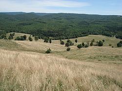
Geography
According to the U.S. Census Bureau, the county has a total area of 1,040 square miles (2,700 km2), of which 1,040 square miles (2,700 km2) is land and 0.3 square miles (0.78 km2) (0.03%) is water. It is the largest county in West Virginia by area.
Rivers
Mountains
Caves and caverns
National Natural Landmarks
Adjacent counties
National protected area
2000 census
As of the census of 2000, there were 28,262 people, 11,072 households, and 7,661 families residing in the county. The population density was 27 people per square mile (10/km²). There were 13,478 housing units at an average density of 13 per square mile (5/km²). The racial makeup of the county was 97.69% White, 1.07% Black or African American, 0.16% Native American, 0.38% Asian, 0.01% Pacific Islander, 0.16% from other races, and 0.53% from two or more races. 0.68% of the population were Hispanic or Latino of any race.
There were 11,072 households out of which 29.80% had children under the age of 18 living with them, 54.70% were married couples living together, 9.80% had a female householder with no husband present, and 30.80% were non-families. 26.30% of all households were made up of individuals and 11.90% had someone living alone who was 65 years of age or older. The average household size was 2.41 and the average family size was 2.89.
In the county, the population was spread out with 22.30% under the age of 18, 8.70% from 18 to 24, 28.50% from 25 to 44, 25.40% from 45 to 64, and 15.10% who were 65 years of age or older. The median age was 39 years. For every 100 females there were 101.30 males. For every 100 females age 18 and over, there were 99.70 males.
The median income for a household in the county was $27,299, and the median income for a family was $32,632. Males had a median income of $24,751 versus $17,819 for females. The per capita income for the county was $14,918. About 13.40% of families and 18.00% of the population were below the poverty line, including 24.30% of those under age 18 and 12.90% of those age 65 or over.
2010 census
As of the 2010 United States Census, there were 29,405 people, 11,695 households, and 7,753 families residing in the county. The population density was 28.3 inhabitants per square mile (10.9/km2). There were 14,189 housing units at an average density of 13.6 per square mile (5.3/km2). The racial makeup of the county was 97.3% white, 1.2% black or African American, 0.3% Asian, 0.2% American Indian, 0.1% from other races, and 0.8% from two or more races. Those of Hispanic or Latino origin made up 0.7% of the population. In terms of ancestry, 26.3% were German, 15.9% were Irish, 12.0% were English, 10.2% were American, and 5.4% were Italian.
Of the 11,695 households, 27.1% had children under the age of 18 living with them, 51.0% were married couples living together, 10.5% had a female householder with no husband present, 33.7% were non-families, and 28.4% of all households were made up of individuals. The average household size was 2.32 and the average family size was 2.81. The median age was 43.4 years.
The median income for a household in the county was $36,176 and the median income for a family was $47,071. Males had a median income of $34,903 versus $25,988 for females. The per capita income for the county was $18,472. About 12.7% of families and 17.1% of the population were below the poverty line, including 26.1% of those under age 18 and 11.4% of those age 65 or over.
City
Towns
History
Randolph County was part of Virginia until the American Civil War, in which the county was contested in the Western Virginia Campaign. The Battle of Rich Mountain was fought in the county, as was part of the Battle of Cheat Mountain.