
Founded 1860 | Area 1,440 km² Population 8,893 (2013) Congressional district 3rd | |
 | ||
Website www.webstercounty.wv.gov Rivers Gauley River, Williams River, Cranberry River, Elk River | ||
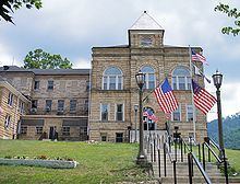
Webster County is a county in the U.S. state of West Virginia. As of the 2010 census, the population was 9,154. Its county seat is Webster Springs. The county was founded in 1860 and named for Daniel Webster.
Contents
- Map of Webster County WV USA
- Geography
- Major highways
- Adjacent counties
- National protected area
- 2000 census
- 2010 census
- Politics
- Towns
- Census designated places
- Notable residents
- References
Map of Webster County, WV, USA
Geography
According to the U.S. Census Bureau, the county has a total area of 556 square miles (1,440 km2), of which 553 square miles (1,430 km2) is land and 2.8 square miles (7.3 km2) (0.5%) is water.
Major highways
Adjacent counties
National protected area
2000 census
As of the census of 2000, there were 9,719 people, 4,010 households, and 2,815 families residing in the county. The population density was 18 people per square mile (7/km²). There were 5,273 housing units at an average density of 10 per square mile (4/km²). The racial makeup of the county was 99.18% White, 0.01% Black or African American, 0.07% Native American, 0.06% Asian, 0.01% Pacific Islander, 0.01% from other races, and 0.66% from two or more races. 0.37% of the population were Hispanic or Latino of any race.
There were 4,010 households out of which 29.80% had children under the age of 18 living with them, 55.40% were married couples living together, 10.60% had a female householder with no husband present, and 29.80% were non-families. 26.50% of all households were made up of individuals and 12.40% had someone living alone who was 65 years of age or older. The average household size was 2.41 and the average family size was 2.89.
In the county, the population was spread out with 23.00% under the age of 18, 8.00% from 18 to 24, 26.70% from 25 to 44, 27.10% from 45 to 64, and 15.20% who were 65 years of age or older. The median age was 40 years. For every 100 females there were 96.90 males. For every 100 females age 18 and over, there were 94.30 males.
The median income for a household in the county was $21,055, and the median income for a family was $25,049. Males had a median income of $25,362 versus $15,381 for females. The per capita income for the county was $12,284. About 26.60% of families and 31.80% of the population were below the poverty line, including 45.40% of those under age 18 and 21.00% of those age 65 or over.
2010 census
As of the 2010 United States Census, there were 9,154 people, 3,792 households, and 2,595 families residing in the county. The population density was 16.5 inhabitants per square mile (6.4/km2). There were 5,428 housing units at an average density of 9.8 per square mile (3.8/km2). The racial makeup of the county was 98.6% white, 0.2% black or African American, 0.1% Asian, 0.1% American Indian, 0.1% from other races, and 1.0% from two or more races. Those of Hispanic or Latino origin made up 0.5% of the population. In terms of ancestry, 19.8% were American, 15.7% were Irish, 12.6% were German, and 8.9% were English.
Of the 3,792 households, 30.1% had children under the age of 18 living with them, 51.8% were married couples living together, 11.2% had a female householder with no husband present, 31.6% were non-families, and 26.5% of all households were made up of individuals. The average household size was 2.40 and the average family size was 2.88. The median age was 44.1 years.
The median income for a household in the county was $28,025 and the median income for a family was $35,448. Males had a median income of $44,277 versus $19,292 for females. The per capita income for the county was $17,268. About 19.9% of families and 22.9% of the population were below the poverty line, including 26.4% of those under age 18 and 12.1% of those age 65 or over.
Politics
Since 1863, Webster County has voted Democratic in every presidential election with the exceptions of 1972, 2012, and 2016. In 1972, Richard Nixon carried the county by a mere 1.0% against George McGovern. However, in 2012 Mitt Romney carried the county handily with a 28% margin and in 2016 Donald Trump won by a margin of 58%.