
Country United States FIPS code 54-39628 Elevation 621 m Zip code 26273 Population 216 (2013) | Time zone Eastern (EST) (UTC-5) GNIS feature ID 1551537 Area 78 ha Local time Friday 7:19 AM Area code 304 | |
 | ||
Weather -9°C, Wind E at 0 km/h, 80% Humidity | ||
Huttonsville is a town in Randolph County, West Virginia, United States, along the Tygart Valley River. The population was 221 at the 2010 census.
Contents
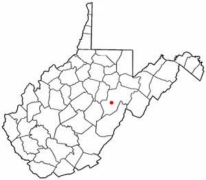
Map of Huttonsville, WV 26273, USA
History
Huttonsville was named for Jonathan Hutton, a pioneer settler.
Located at Huttonsville are the E. E. Hutton House and Tygarts Valley Church, listed on the National Register of Historic Places. Located near Huttonsville are the site of Cheat Summit Fort and Fort Marrow, also listed on the Register.
Geography
Huttonsville is located at 38°42′48″N 79°58′38″W (38.713266, -79.977329).
According to the United States Census Bureau, the town has a total area of 0.30 square miles (0.78 km2), all of it land.
Climate
The climate in this area has mild differences between highs and lows, and there is adequate rainfall year-round. According to the Köppen Climate Classification system, Huttonsville has a marine west coast climate, abbreviated "Cfb" on climate maps.
2010 census
As of the census of 2010, there were 221 people, 87 households, and 56 families residing in the town. The population density was 736.7 inhabitants per square mile (284.4/km2). There were 105 housing units at an average density of 350.0 per square mile (135.1/km2). The racial makeup of the town was 99.5% White and 0.5% from two or more races. Hispanic or Latino of any race were 2.3% of the population.
There were 87 households of which 33.3% had children under the age of 18 living with them, 40.2% were married couples living together, 13.8% had a female householder with no husband present, 10.3% had a male householder with no wife present, and 35.6% were non-families. 31.0% of all households were made up of individuals and 18.3% had someone living alone who was 65 years of age or older. The average household size was 2.54 and the average family size was 3.11.
The median age in the town was 32.4 years. 28.1% of residents were under the age of 18; 12.6% were between the ages of 18 and 24; 21.7% were from 25 to 44; 23% were from 45 to 64; and 14.5% were 65 years of age or older. The gender makeup of the town was 48.0% male and 52.0% female.
2000 census
As of the census of 2000, there were 217 people, 83 households, and 62 families residing in the town. The population density was 707.3 inhabitants per square mile (270.3/km²). There were 96 housing units at an average density of 312.9 per square mile (119.6/km²). The racial makeup of the town was 99.08% White and 0.92% Asian.
There were 83 households out of which 36.1% had children under the age of 18 living with them, 63.9% were married couples living together, 8.4% had a female householder with no husband present, and 24.1% were non-families. 22.9% of all households were made up of individuals and 13.3% had someone living alone who was 65 years of age or older. The average household size was 2.61 and the average family size was 3.06.
In the town, the population was spread out with 25.8% under the age of 18, 10.1% from 18 to 24, 30.9% from 25 to 44, 21.7% from 45 to 64, and 11.5% who were 65 years of age or older. The median age was 35 years. For every 100 females there were 88.7 males. For every 100 females age 18 and over, there were 91.7 males.
The median income for a household in the town was $22,321, and the median income for a family was $24,821. Males had a median income of $24,107 versus $12,321 for females. The per capita income for the town was $11,827. About 14.5% of families and 16.6% of the population were below the poverty line, including 28.4% of those under the age of eighteen and 7.1% of those sixty five or over.