
Area 1,808 km² Population 7,471 (2013) | Founded 1787 County seat Franklin | |
 | ||
Website www.pendletoncounty.wv.gov Rivers South Branch Potomac River, Kettle Creek, Brushy Fork | ||
Pendleton county west virginia
Pendleton County is a county located in the U.S. state of West Virginia. As of the 2010 census, the population was 7,695, making it the fifth-least populous county in West Virginia. Its county seat is Franklin. The county was created by the Virginia General Assembly in 1788 from parts of Augusta, Hardy, and Rockingham Counties and was named for Edmund Pendleton (1721–1803), a distinguished Virginia statesman and jurist. Pendleton County was strongly pro-Confederate during the American Civil War; however, there were pockets of Union support.
Contents
- Pendleton county west virginia
- Map of Pendleton County WV USA
- History
- Geography
- Major highways
- Adjacent counties
- National protected areas
- National Natural Landmarks
- Economy
- 2000 census
- 2010 census
- Towns
- Census designated place
- Historic Places
- References
Map of Pendleton County, WV, USA
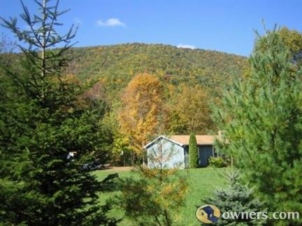
Spruce Knob, located in Pendleton County, is the highest point in the state and in the Alleghenies, its elevation being 4,863 feet. Parts of the Monongahela and George Washington National Forests are also located in Pendleton.
History
By the 1740s, the three main valleys of what became Pendleton County had been visited and named by white hunters and prospectors. One of the hunters, a single man named Abraham Burner, built himself a log cabin about a half mile downstream of the future site of Brandywine in 1745. He was the county's first white settler. A local historian recorded that:
The site ...[was] on the left bank of the river, and near the beginning of a long, eastward bend. From almost at his very door his huntsman's eye was at times gladdened by seeing perhaps fifty deer either drinking from the steam or plunging in their heads up to their ears in search of moss.
By 1747, immigrants were impinging on the (future) borders of Pendleton from two directions: the larger community was mostly Germans moving up the valley of the South Branch Potomac; the lesser consisted mainly of Scotch-Irish moving northwest from Staunton up into the headwaters of the James River. In an April 1758 surprise raid of Fort Seybert and nearby Fort Upper Tract occasioned by the French and Indian War (1754–63), most of the 60 white settlers sheltering there were massacred by Shawnee and Delaware warriors and the forts were burned.
Pendleton County was created by the Virginia General Assembly in 1788 from parts of Augusta, Hardy, and Rockingham Counties and was named for Edmund Pendleton, a distinguished Virginia statesman and jurist. Pendleton County was split between Northern and Southern sympathies during the American Civil War. The northern section of the county, including the enclave in the Smoke Hole community were staunchly Unionist. In June 1863, the county was included by the federal government in the new state of West Virginia against many of the inhabitants' wishes. In fall 1863, Union Brigadier General W.W. Averell swept up the South Branch valley and destroyed the Confederate saltpetre works above Franklin.
At Franklin, the Pendleton County seat, the South Branch of the Potomac River crested at 22.6 feet during the 1985 Election day floods. Flood stage in the shallow riverbed was only 7 feet. Most of the 47 people killed in this incident were in Pendleton and Grant counties, according to the National Weather Service.
Geography
According to the U.S. Census Bureau, the county has a total area of 698 square miles (1,810 km2), of which 696 square miles (1,800 km2) is land and 2.1 square miles (5.4 km2) (0.3%) is water. It is the fifth-largest county in West Virginia by area.
Major highways
Adjacent counties
National protected areas
National Natural Landmarks
Economy
Pendleton County's economy consists mainly of small to medium-sized farms and small businesses. Most of these are in Franklin, the county's only incorporated town. The North Fork Valley, on the western side of the county, has a number of businesses that cater to tourists who come for the area's outdoor recreation opportunities. These include motels, restaurants, and guide services. In recent years, maple syrup has emerged as a major growth industry in the county. Dry Fork Maple Works, the state's largest maple sugaring operation, is based in Pendleton County (though its sugaring operation occurs mainly in neighboring Randolph County).
The county is also home to a number of non-profits whose reaches extend well beyond the county lines. These include Almost Heaven Habitat for Humanity, Future Generations and Future Generations Graduate School, The Mountain Institute, and Mountain Springs Farm and Heritage Center.
The now closed Sugar Grove Station, a former naval base that once functioned as an electronic listening post for the National Security Agency, is located near the southeast corner of the Pendleton County.
2000 census
As of the census of 2000, there were 8,196 people, 3,350 households, and 2,355 families residing in the county. The population density was 12 people per square mile (5/km²). There were 5,102 housing units at an average density of 7 per square mile (3/km²). The racial makeup of the county was 96.34% White, 2.12% Black or African American, 0.27% Native American, 0.18% Asian, 0.04% Pacific Islander, 0.28% from other races, and 0.77% from two or more races. 0.89% of the population were Hispanic or Latino of any race.
There were 3,350 households out of which 28.00% had children under the age of 18 living with them, 57.40% were married couples living together, 8.10% had a female householder with no husband present, and 29.70% were non-families. 25.80% of all households were made up of individuals and 12.20% had someone living alone who was 65 years of age or older. The average household size was 2.40 and the average family size was 2.87.
In the county, the population was spread out with 21.80% under the age of 18, 7.30% from 18 to 24, 27.00% from 25 to 44, 26.10% from 45 to 64, and 17.80% who were 65 years of age or older. The median age was 41 years. For every 100 females there were 101.30 males. For every 100 females age 18 and over, there were 101.50 males.
The median income for a household in the county was $30,429, and the median income for a family was $34,860. Males had a median income of $25,342 versus $16,753 for females. The per capita income for the county was $15,805. About 8.00% of families and 11.40% of the population were below the poverty line, including 13.60% of those under age 18 and 12.50% of those age 65 or over.
2010 census
As of the 2010 United States Census, there were 7,695 people, 3,285 households, and 2,179 families residing in the county. The population density was 11.1 inhabitants per square mile (4.3/km2). There were 5,132 housing units at an average density of 7.4 per square mile (2.9/km2). The racial makeup of the county was 96.2% white, 1.9% black or African American, 0.3% Asian, 0.2% American Indian, 0.2% from other races, and 1.2% from two or more races. Those of Hispanic or Latino origin made up 0.9% of the population. In terms of ancestry, 30.1% were German, 8.1% were American, 7.3% were Irish, and 6.4% were English.
Of the 3,285 households, 24.8% had children under the age of 18 living with them, 54.6% were married couples living together, 7.1% had a female householder with no husband present, 33.7% were non-families, and 29.0% of all households were made up of individuals. The average household size was 2.28 and the average family size was 2.80. The median age was 47.3 years.
The median income for a household in the county was $33,323 and the median income for a family was $49,613. Males had a median income of $38,190 versus $23,243 for females. The per capita income for the county was $19,401. About 11.0% of families and 15.1% of the population were below the poverty line, including 17.3% of those under age 18 and 22.2% of those age 65 or over.
Towns
Census-designated place
Historic Places
The following sites are listed on the National Register of Historic Places.