
Founded November 1, 1814 Area 1,000 km² | Website www.perrycounty.in.gov Population 19,558 (2013) Unemployment rate 4.2% (Apr 2015) | |
 | ||
Rivers Stinking Fork, Oil Creek, Sigler Creek, Mill Creek Points of interest Hoosier National Forest, Winzerwald Winery, Two Lakes Loop Trail, Jacob Rickenbaugh House, Huffman Mill Covered | ||
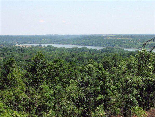
Perry County is a county located in the southwestern part of the U.S. state of Indiana. As of 2010, the population was 19,338. The county seat is Tell City. It is the hilliest county as well as one of the most forested counties of in Indiana as it features more than 60,000 acres (240 km2) of Hoosier National Forest. The Ohio River Scenic Byway along Indiana State Road 66 runs along the southern border of the county while Interstate 64 traverses the northern portion of the county. Connecting the two is Indiana State Road 37.
Contents
- Map of Perry County IN USA
- Climate and weather
- Government
- Geography
- Adjacent counties
- Major highways
- National protected area
- Roads and highways
- History
- Demographics
- Cities and towns
- Unincorporated communities
- Townships
- References
Map of Perry County, IN, USA
The county features three incorporated communities: Tell City (2009 population 7,473), Cannelton (2009 population 1,130) and Troy (2009 population 379). Each is located in Troy Township which is situated along the south western corner of the county.
Coordinated efforts with County officials led to the acquisition of an abandoned rail line that has since been reactivated as the County-owned Hoosier Southern Rail Road. Managed by the Perry County Port Authority, the 22-mile (35 km) short-line rail road connects the Perry County River Port with the Norfolk Southern Rail Road.
Climate and weather
In recent years, average temperatures in Tell City have ranged from a low of 24 °F (−4 °C) in January to a high of 88 °F (31 °C) in July, although a record low of −17 °F (−27 °C) was recorded in January 1985 and a record high of 106 °F (41 °C) was recorded in September 1954. Average monthly precipitation ranged from 2.98 inches (76 mm) in October to 5.22 inches (133 mm) in May.
Government
The county government is a constitutional body, and is granted specific powers by the Constitution of Indiana, and by the Indiana Code.
County Council: The county council is the fiscal body of the county government and controls all the spending and revenue collection in the county. Representatives are elected from county districts. The council members serve four-year terms. They are responsible for setting salaries, the annual budget, and special spending. The council also has limited authority to impose local taxes, in the form of an income and property tax that is subject to state level approval, excise taxes, and service taxes.
Board of Commissioners: The executive and legislative body of the county is made of a board of commissioners. The commissioners are elected county-wide, in staggered terms, and each serves a four-year term. One of the commissioners, typically the most senior, serves as president. The commissioners are charged with managing the day-to-day functions of the county government.
Court: The county maintains a small claims court that can handle some civil cases. The judge on the court is elected to a term of six years and must be a member of the Indiana Bar Association. The judge is assisted by a magistrate who is appointed by the judge. In some cases, court decisions can be appealed to the state level circuit court.
County Officials: The county has several other elected offices, including sheriff, coroner, auditor, treasurer, recorder, surveyor, and circuit court clerk Each of these elected officers serves a term of four years and oversees a different part of county government. Members elected to county government positions are required to declare party affiliations and to be residents of the county.
Perry County is part of Indiana's 9th congressional district and is represented in Congress by Republican Trey Hollingsworth.
Geography
According to the 2010 census, the county has a total area of 386.29 square miles (1,000.5 km2), of which 381.73 square miles (988.7 km2) (or 98.82%) is land and 4.56 square miles (11.8 km2) (or 1.18%) is water.
Adjacent counties
Breckinridge County, Kentucky (South) Hancock, County, Kentucky (Southwest)
Major highways
National protected area
Roads and highways
Interstate 64 cuts across the northern portion of the county. State Road 66, designated as the Ohio River Scenic Byway for most of its course in the county, is the most heavily traveled road by residents and visitors alike, adjacent to the three most populous towns in the county as well as most major tourist destinations. State Road 37 connects the county to Bloomington and Indianapolis. Other state roads in the county include State Road 62, which closely parallels I-64; State Road 145, which winds through the western parts of the county; State Road 166, which is little more than a road to and from the hamlet of Tobinsport; State Road 237, which connects Cannelton directly to State Road 37 (also the site of a bridge on the Ohio River); a short run of State Road 545 near Troy; and State Road 70 which connects State Road 37 with State Road 66.
History
Perry County was formed on November 1, 1814 (two years before the state of Indiana was admitted to the Union) from Warrick County. It was named for Commodore Oliver Hazard Perry who defeated the British squadron in the decisive Battle of Lake Erie in 1813. The Ohio River made Perry County a focal point and settlers were drawn here due to plentiful supplies of natural resources and the area's scenic beauty.
Demographics
As of the 2010 United States Census, there were 19,338 people, 7,476 households, and 5,020 families residing in the county. The population density was 50.7 inhabitants per square mile (19.6/km2). There were 8,495 housing units at an average density of 22.3 per square mile (8.6/km2). The racial makeup of the county was 96.0% white, 2.4% black or African American, 0.4% Asian, 0.2% American Indian, 0.3% from other races, and 0.8% from two or more races. Those of Hispanic or Latino origin made up 1.0% of the population. In terms of ancestry, 37.8% were German, 14.4% were Irish, 11.6% were American, and 8.7% were English.
Of the 7,476 households, 30.5% had children under the age of 18 living with them, 52.7% were married couples living together, 9.7% had a female householder with no husband present, 32.9% were non-families, and 28.7% of all households were made up of individuals. The average household size was 2.38 and the average family size was 2.91. The median age was 40.4 years.
The median income for a household in the county was $47,697 and the median income for a family was $55,497. Males had a median income of $42,017 versus $26,301 for females. The per capita income for the county was $20,806. About 6.7% of families and 10.4% of the population were below the poverty line, including 15.9% of those under age 18 and 6.8% of those age 65 or over.