
Existed: 1931 – present Constructed 1931 | Length 73.16 km | |
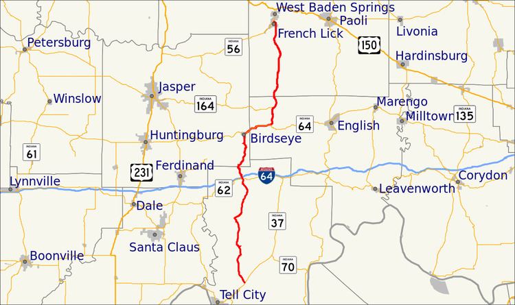 | ||
State Road 145 is a north–south road in the southwest portion of the U.S. State of Indiana.
Contents
Map of IN-145, Indiana, USA
Route description
State Road 145 begins at State Road 37 about 8 miles (13 km) to the northeast of Tell City, near the Perry County Municipal Airport. It runs north through the small towns of Bristow and Sassafras, and intersects Interstate 64 at exit 72 at Kitterman Corners. At Birdseye, it meets State Road 64 and is concurrent with that road for 4.35 miles (7.00 km) as it heads east to the Hoosier National Forest. It then strikes north again through the forest and across Patoka Lake, and terminates in French Lick at State Road 56.
References
Indiana State Road 145 Wikipedia(Text) CC BY-SA