
Length 24.58 km | ||
 | ||
Counties: Western SectionSpencerEastern SectionPerry | ||
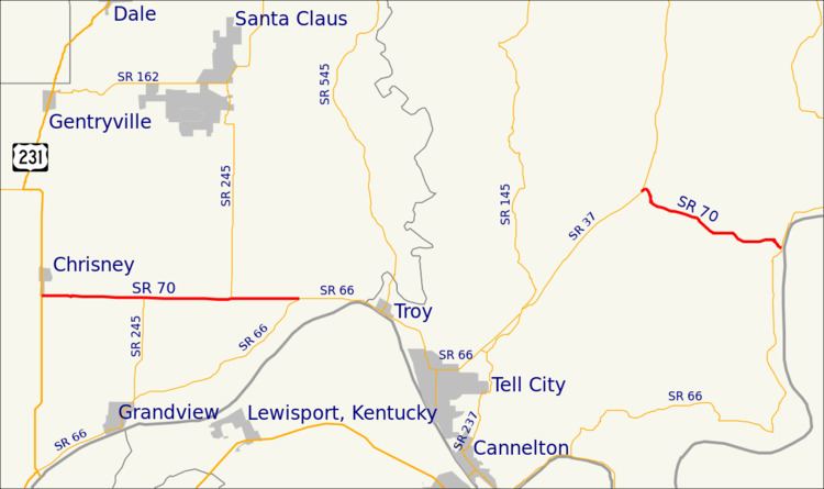
State Road 70 in the U.S. state of Indiana consists of two discontinuous east–west segments of two-lane rural roadway. State Road 70 passes through no cities or towns of significant size.
Contents
Map of IN-70, Indiana, USA
Western segment
The western segment is about 10 miles (16 km) long and is relatively straight; it runs entirely within the boundaries of Spencer County, from U.S. Route 231 at the west end through the unincorporated town of Newtonville to State Road 66 at the east end.
Eastern segment
The eastern segment about 6.2 miles (10.0 km) long and is a more winding road than the western segment; it runs entirely within Perry County, from State Road 37 at the west end to State Road 66 in the community of Derby, on the banks of the Ohio River, at the east end.
References
Indiana State Road 70 Wikipedia(Text) CC BY-SA