
Length 24.65 km | ||
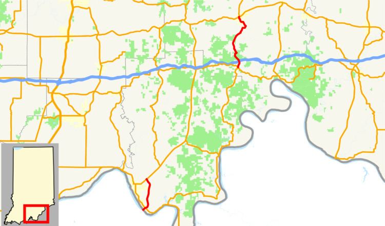 | ||
Indiana State Road 237 in the U.S. state of Indiana is a discontinuous route in Perry and Crawford counties.
Contents
Map of IN-237, Indiana, USA
Southern section
The Perry County segment of SR 237, which connects to SR 37 about 1-mile (1.6 km) northeast of Tell City, Indiana, provides access to Hawesville, Kentucky, via the Bob Cummings - Lincoln Trail Bridge in Cannelton. This segment of 237 is 5.6 miles (9.0 km) in length and replaced an older, winding and narrow segment in 2004.
Northern section
The Crawford County segment was created on November 21, 2007, when an 8.9-mile (14.3 km) segment of SR 37 from Interstate 64 at Sulphur to SR 64 at English was renumbered as SR 237. The redesignation is due to SR 37's designation being transferred to a new route (the Frank O'Bannon Highway) from I-64 to SR 64 and SR 145 between St. Croix and Eckerty.
Future
In addition, a proposed highway by-pass of Paoli, the seat of Orange County, may carry the SR 237 designation as well. This project is still in the planning stages and construction has yet to be scheduled.