
- elevation 722 ft (220 m) - elevation 518 ft (158 m) Basin area 39,627 km² | Length 444 km Discharge 308.1 m³/s | |
 | ||
Sources Marais des Cygnes River, Little Osage River | ||
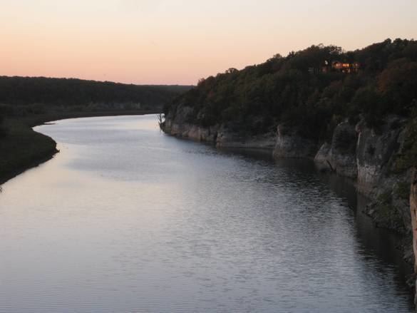
Bat cave drone view along osage river near st elizabeth missouri
The Osage River is a 276-mile-long (444 km) tributary of the Missouri River in central Missouri in the United States. The Osage River is the 8th largest river in Missouri. The river drains a mostly rural area of 15,300 square miles (40,000 km2). The watershed includes an area of east-central Kansas and a large portion of west-central and central Missouri where it drains northwest areas of the Ozark Plateau. The river flows generally easterly, then northeasterly for the final 80 miles (130 km) where it joins the Missouri River. It is impounded in two major locations. Most of the river has been converted into a chain of two reservoirs, the Harry S. Truman Reservoir and the Lake of the Ozarks.
Contents
- Bat cave drone view along osage river near st elizabeth missouri
- Map of Osage River Missouri USA
- Bait fishing shad with jackvanderpoolguide com osage river below truman lake missouri
- DescriptionEdit
- HistoryEdit
- References
Map of Osage River, Missouri, USA
Bait fishing shad with jackvanderpoolguide com osage river below truman lake missouri
DescriptionEdit
The Osage is formed in southwestern Missouri, approximately 14 miles (23 km) northeast of Nevada on the Bates-Vernon county line, by the confluence of the Marais des Cygnes and Little Osage rivers. (The Marais des Cygnes is sometimes counted as part of the river, placing its headwaters in eastern Kansas and bringing its total length to over 500 miles (800 km)). The combined stream flows east past the Schell-Osage Wildlife Area into St. Clair County, widening into a long meandering arm of the Harry S. Truman Reservoir, approximately 40 miles (64 km) long. The lake receives the South Grand River as a second arm of the reservoir from the northwest, as well as the Pomme de Terre River from the south. The two arms of the reservoir join near the Harry S. Truman Dam in central Benton County.
Downstream from the Truman Dam, the river becomes the serpentine Lake of the Ozarks, stretching eastward for nearly 92 miles (148 km) to Bagnell Dam in Camden County and southwestern Miller County. Constructed in 1931, it collects the Niangua River. Downstream from the dam, the Osage flows freely to the northeast in broad oxbow meanders through forested bluffs, joining the Missouri approximately 15 miles (24 km) east and downstream of Jefferson City.
HistoryEdit
The river is named for the Osage Nation, the indigenous people in area at the time of the arrival of the first European settlers. It presented significant navigation difficulties for early settlers because of its fluctuating water levels, as well as the presence of shallow pools and sand bars caused by its tight meandering course through the hills.
The Missouri Legislature attempted as early as 1839 to deepen the channel of the river. Early attempts failed because of lack of funding for the immense task. Commercial navigation on the river in the 19th century was confined mostly to smaller craft that could navigate the tight bends and shoals of the river. Improvements in the channel by the last two decades of the century led to greater commercial traffic. The construction of the Bagnell Dam, primarily for hydroelectricity, commenced in 1922 and was completed after nine years. It effectively ended commercial navigation on the river. The Truman Dam was authorized by the Flood Control Act of 1954 and completed in 1979.
The two dams on the river currently provide power for the St. Louis metropolitan area. The reservoirs are popular tourist destinations in the region.