
Website www.vernoncountymo.org Founded 1855 Unemployment rate 5.2% (Apr 2015) | Area 2,168 km² Population 20,949 (2013) | |
 | ||
Rivers Marmaton River, Osage River, McCarty Creek Colleges and Universities Cottey College, Nevada Regional Technical Center | ||
Vernon County is a county located in west central Missouri. As of the 2010 census, the population was 21,159. Its county seat is Nevada. The county was organized on February 27, 1855 and was named for Col. Miles Vernon (1786–1867), a state senator and veteran of the Battle of New Orleans.
Contents
- Map of Vernon County MO USA
- History
- Geography
- Adjacent counties
- Major highways
- Demographics
- Public schools
- Private schools
- Colleges and universities
- Local
- State
- Federal
- Missouri Presidential Preference Primary 2008
- Notable residents
- References
Map of Vernon County, MO, USA
History
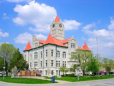
Vernon County suffered considerable damage during the American Civil War. The courthouse was burned by Union Army soldiers on May 23, 1863, along with the entire town of Nevada. The present courthouse dates to 1907. Vernon County was one of four Missouri counties that were completely depopulated by Union General Thomas Ewing's notorious General Order No. 11 (1863). Most of the inhabitants would not be allowed to return to their homes until after the Civil War ended in May 1865.
Geography
According to the U.S. Census Bureau, the county has a total area of 837 square miles (2,170 km2), of which 826 square miles (2,140 km2) is land and 10 square miles (26 km2) (1.2%) is water.
Adjacent counties
Major highways
Demographics
As of the census of 2000, there were 20,454 people, 7,966 households, and 5,432 families residing in the county. The population density was 24 people per square mile (9/km²). There were 8,872 housing units at an average density of 11 per square mile (4/km²). The racial makeup of the county was 96.99% White, 0.61% Black or African American, 0.79% Native American, 0.31% Asian, 0.03% Pacific Islander, 0.31% from other races, and 0.95% from two or more races. Approximately 0.84% of the population were Hispanic or Latino of any race.
There were 7,966 households out of which 32.20% had children under the age of 18 living with them, 55.30% were married couples living together, 9.60% had a female householder with no husband present, and 31.80% were non-families. 28.10% of all households were made up of individuals and 13.00% had someone living alone who was 65 years of age or older. The average household size was 2.44 and the average family size was 2.97.
In the county, the population was spread out with 26.60% under the age of 18, 9.20% from 18 to 24, 25.40% from 25 to 44, 22.50% from 45 to 64, and 16.30% who were 65 years of age or older. The median age was 37 years. For every 100 females there were 93.50 males. For every 100 females age 18 and over, there were 88.00 males.
The median income for a household in the county was $30,021, and the median income for a family was $37,714. Males had a median income of $28,182 versus $19,026 for females. The per capita income for the county was $15,047. About 10.10% of families and 14.90% of the population were below the poverty line, including 20.30% of those under age 18 and 13.30% of those age 65 or over.
Public schools
Private schools
Colleges and universities
Local
The Democratic Party predominantly controls politics at the local level in Vernon County. Democrats hold all but three of the elected positions in the county.
State
All of Vernon County is a part of Missouri’s 125th District in the Missouri House of Representatives and is represented by Barney Joe Fisher (R-Richards).
All of Vernon County is a part of Missouri’s 31st District in the Missouri Senate and is currently represented by David Pearce (R-Warrensburg).
Federal
All of Vernon County is included in Missouri’s 4th Congressional District and is currently represented by Vicky Hartzler (R-Harrisonville) in the U.S. House of Representatives.
Missouri Presidential Preference Primary (2008)
Notable residents
The Texas political figure Orville Bullington was born in Indian Springs in Vernon County before his family moved to Parker County, west of Fort Worth, Texas.