
Existed: 1934 – present Length 38.19 km | Constructed 1934 | |
 | ||
Counties | ||
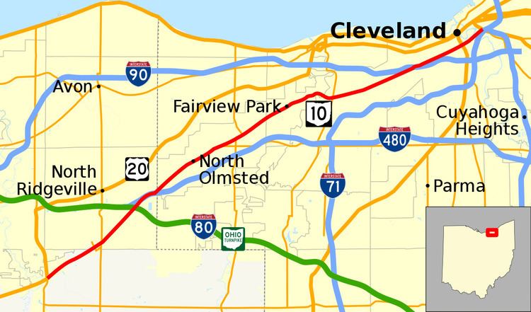
State Route 10 (SR 10) is a state highway located in and around Cleveland, Ohio. The current routing of SR 10 was certified in 1934. The route's western terminus is in Eaton Township in Lorain County at the junction of U.S. Route 20, State Route 57 and State Route 301, where US 20 and SR 301 continue westbound on the freeway. In North Ridgeville, route 10 merges with Interstate 480 at the interstate's western terminus in North Ridgeville, and continues with the interstate briefly eastward. Just east of this junction, the route also has an interchange with Interstate 80 and the Ohio Turnpike via a connecting or spur road. SR 10 then becomes a grade-level road in North Ridgeville before heading into Cuyahoga County, and is known as Lorain Road. It then continues through the western suburbs of Cleveland and through the western part of Cleveland, as Lorain Avenue, terminating shortly after it crosses the Cuyahoga River at Gateway at Broadway Avenue/Ontario Street (U.S. Route 422, State Route 8, State Route 14, State Route 43, and State Route 87).
Contents
Map of OH-10, Ohio, USA
History
The State Route 10 designation was originally used along what is now the US 30 corridor, then reassigned to part of current US 22, then reassigned again to what is now US 68.
Future
It is proposed that State Route 10 will be extended east to US 322 via the new Opportunity Corridor roadway that will connect Interstate 490 to University Circle.
Route 10C
State Route 10C is an unsigned portion of Lorain Road in North Ridgeville, Ohio between the Ohio Turnpike and I-480. It runs along a portion of former SR 10.