
Length 388.3 km Highway system U.S. Turnpike Roads | Constructed 1 October 1955 | |
 | ||
Existed: October 1, 1955 – present Componenthighways: I-80 from Indiana state line to near North Jackson I-90 from Indiana state line to near Elyria I-76 from near North Jackson to Pennsylvania state line East end: I-76 / Penna Turnpike at Pennsylvania state line | ||
Service plazas on the ohio turnpike
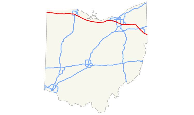
The Ohio Turnpike, officially the James W. Shocknessy Ohio Turnpike, is a 241.26-mile-long (388.27 km), limited-access toll highway in the U.S. state of Ohio, serving as a primary corridor to Chicago and Pittsburgh. The road runs east–west in the northern section of the state, with the western end at the Indiana–Ohio border near Bryan where it meets the Indiana Toll Road, and the eastern end at the Ohio–Pennsylvania border near Petersburg, where it meets the Pennsylvania Turnpike. The road is owned and maintained by the Ohio Turnpike and Infrastructure Commission (OTIC), headquartered in Berea.
Contents
- Service plazas on the ohio turnpike
- Map of Ohio Turnpike Ohio USA
- Route description
- History
- Services
- Speed limits
- Tolls
- References
Map of Ohio Turnpike, Ohio, USA
Built from 1949 to 1955, construction for the roadway was completed a year prior to the Interstate Highway System. The modern Ohio Turnpike is signed as three interstate numbers: I-76, I-80, and I-90.
Route description
The entire length of the Ohio Turnpike is 241.3 miles (388.3 km), from the western terminus in Northwest Township near Edon, where it meets the Indiana Toll Road at the Ohio–Indiana border, to the eastern terminus in Springfield Township near Petersburg where it meets the Pennsylvania Turnpike at the Ohio–Pennsylvania border. Most of the turnpike, 218.7 miles (352.0 km) between the Indiana border and an interchange with Interstate 76 (I-76) near Youngstown, is signed as part of I-80, while the eastern 22.6 miles (36.4 km), between the I-80/I-76 interchange and the Pennsylvania border, is signed as part of I-76. For 142.8 miles (229.8 km), between the Indiana border and Elyria, I-90 is cosigned with I-80 as part of the turnpike.
The Ohio Turnpike does not pass directly into any major city, but does provide access to the four major metro areas in northern Ohio through connected routes. Two auxiliary Interstate highways, I-271 near Cleveland and I-475 near Toledo, cross the turnpike, but do not have direct connections. In Northwest Ohio, the turnpike passes through the southern part of the Toledo metropolitan area, with direct access to Toledo through I-75 and I-280.
In Northeast Ohio, the turnpike passes through the southern suburbs of Greater Cleveland and the northern edge of the Akron metro area, with direct access to Cleveland via I-71, I-77, and I-480. Akron is connected to the turnpike via I-77 and State Route 8 (SR 8) in the north and I-76 on the east. The turnpike is located on the western and southern edges of the Mahoning Valley, with direct access to Youngstown through the remaining portion of I-80 east of the Turnpike, and I-680.
History
In 1947 a bill was introduced in the Ohio General Assembly authorizing a privately financed roadway. Originally consisting of a system of five highways, the turnpike was reduced to one when the other four were made redundant by the Federal Aid Highway Act of 1956. Construction for the road cost $326 million and was recorded the biggest project in state history, with 10,000 employees, more than 2,300 bulldozers, graders, loaders and other machines over a 38-month period.
On December 1, 1954, the first 22-mile (35 km) stretch (the portion lying east of SR 18) opened near the present-day exit 218 for I-76 and I-80. Several motorists attended a dedication ceremony, with over 1,000 people joining a caravan, following a snow plow and a patrol cruiser, to become the first to drive the turnpike. The remaining section from exit 218 west to Indiana opened on October 1, 1955. A connecting ramp near the Indiana state line closed on August 16, 1956, the day before the Indiana Toll Road was opened; this ramp had been used to allow traffic access to US 20 to cross into Indiana.
The turnpike was named after the first chairman of the commission, James W. Shocknessy, in 1976.
Originally, the turnpike offered 18 access points. Additional access points have since been provided, bringing the total number, including the Westgate and Eastgate toll barriers, to 31. Not included in this count is the unnumbered interchange at SR 49, which opened on December 29, 1992. There are no ramp tolls at this interchange; the Westgate toll barrier was, at the same time, moved from its previous location near the Indiana state line to its current location, which is east of SR 49.
In 1996, the turnpike began a project to add one lane in each direction from Toledo to Youngstown. The project, using financing from increased tolls, was originally projected to be finished in 2005, but is not expected to be completed until the end of the 2014 construction season.
In 1998, the Ohio Turnpike Commission began phasing in distance-based exit numbers; the sequential numbering system was retired in September 2002. In 2009, the Ohio Turnpike Commission began accepting E-ZPass for toll payment at all plazas, and added gates to toll lanes to prevent motorists from evading tolls.
Ken Blackwell, the defeated candidate in the 2006 Ohio governor's race, had announced a plan for privatizing the turnpike, similar to plans enacted in Illinois and Indiana. In 2010 and 2011, Governor John Kasich stated that he would consider a turnpike lease, but only during a prosperous economic period. In August 2011, Kasich stated his intention to create a task force to produce a leasing plan and also considered the option of reassigning the maintenance of the highway to the Ohio Department of Transportation (ODOT). Ultimately he decided against both, instead proposing to issue more debt under the renamed Ohio Turnpike and Infrastructure Commission, with cash tolls raised annually over a ten-year period to compensate.
Services
The Ohio Turnpike has had service plazas since its inception. Service plazas differ from typical freeway rest areas in that they offer amenities such as 24-hour food and fuel service; motorists do not have to pass through toll booths to re-fuel, use the restroom, or eat.
In 1998, The Ohio Turnpike Commission began modernizing its service plazas, first demolishing the original plazas and then reconstructing them from the ground up. In addition to modern restrooms, the new plazas offer several fast food choices, which vary between the plazas. They also include ATMs, gift shops, travel information counters, Wi-Fi internet access, and facilities for truck drivers, including shower facilities, lounge, and laundry areas. Sunoco fuel stations are provided at all service plazas along the Ohio Turnpike. The company signed a new contract to operate all 16 plazas on the Ohio Turnpike beginning in 2012. Facilities for overnight RV campers are provided at the service plazas located at mile markers 20, 76, 139, and 197.
Service plazas are located in pairs (one for each side of the turnpike) near mile markers 20, 76, 100, 139, 170, 197, and 237. The service plazas located at mile marker 49 were demolished in 2011 and there are no plans to rebuild.
The service plazas located in Lucas County west of Toledo at mile marker 49 were the least utilized. The Ohio Turnpike Commission eventually demolished them, and plans construction of new plazas between mile markers 20 and 49; the new facility will most likely be located in Fulton County and is expected to open after 2012. Due to the lack of a municipal water/sewer system, the service plazas located near mile marker 20 in Williams County were demolished in 2006, though they were eventually rebuilt and reopened on June 29, 2011. The plazas at mile 237 reopened in 2013.
Since the turnpike opened, the Ohio Turnpike Commission has contracted with the Ohio State Highway Patrol (OSHP) District 10 to provide law enforcement, as well as assistance to disabled or stranded motorists. The Patrol is the only law enforcement agency with jurisdiction on the turnpike. It monitors Citizen's Band channel 9 for distress calls.
Speed limits
The Ohio Turnpike opened on October 1, 1955, with a 65 mph (105 km/h) limit for cars and 55 mph (89 km/h) limit for trucks. The automobile speed limit was increased on September 30, 1963, in concert with other Ohio rural Interstates to 70 mph (110 km/h). Due to the National Maximum Speed Law, a 55 mph speed limit took effect in 1974 for all vehicles. The 55 mph limit remained until 1987 when the Ohio General Assembly adopted the federally permitted 65 mph maximum speed limit, but for automobiles only.
Governor Taft asked the Ohio Turnpike Commission to work with ODOT and the OSHP to formulate a plan to encourage truck traffic to use the turnpike instead of parallel highways, improving the safety of those other roadways. The three organizations created a plan with three points. The truck speed limit was increased from 55 to 65 mph (89 to 105 km/h) for consistency with the automobile limits. Enforcement of truck weight and speed limits on parallel highways was increased, and truck toll rates were lowered in a trial. The speed limit increase took effect on September 8, 2004.
The Ohio Turnpike has had uniform limits for all vehicles since 2004. On December 20, 2010, the Ohio Turnpike Commission voted to increase the speed limit of the Ohio Turnpike to 70 mph. Despite opposition from the Ohio Trucking Association, the increase was approved by the Commission by a vote of 4–1 and went into effect on April 1, 2011.
Tolls
Tolls are based upon the distance traveled, as well as the height and axle-count of vehicle driven. As of January 2014, the toll for a typical non-commercial passenger vehicle to travel the entire turnpike is $11.50 for E-ZPass holders and $17.00 for non E-ZPass holders.
The Ohio Turnpike Commission had been hesitant to deploy an electronic tolling system, citing an apparent lack of commuter travel as well as significant implementation expenses. In December 2006, the commission indicated their intention to move forward with the implementation of an E-ZPass-compatible system as a "customer convenience". The system was activated on October 1, 2009. In 2009, the turnpike became the first publicly owned toll facility in the U.S.—and the second overall—to allow users to pay tolls with a debit or credit card.
In April 2008, governor Ted Strickland and legislative leaders announced a planned stimulus package that would redistribute Turnpike tolls to road projects throughout the state. On May 23, the Ohio Senate Finance Committee voted to pass a new version of the package which would not involve tolls collected.