
Founded May 10, 1643 Population 1.553 million (2013) Unemployment rate 3.3% (Apr 2015) | Area 2,194 km² | |
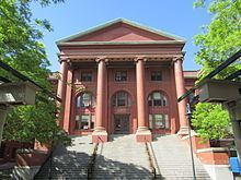 | ||
Colleges and Universities Harvard University, Massachusetts Institute of Technology, Middlesex Community College, Tufts University, University of Massach Destinations | ||
Middlesex County is a county in the Commonwealth of Massachusetts, in the United States. As of 2014, the estimated population was 1,570,315, making it the twenty-third most populous county in the United States, and the most populous county in both Massachusetts and New England. For administrative purposes the county held two regions, Middlesex-North with its county seat in Lowell, and Middlesex-South with its county seat in Cambridge.
Contents
- Map of Middlesex County MA USA
- History
- Law and government
- Geography
- Adjacent counties
- National protected areas
- Demographics
- Income
- Communities
- Culture
- References
Map of Middlesex County, MA, USA
Middlesex County is included in the Boston-Cambridge-Newton, MA-NH Metropolitan Statistical Area.
The county government was abolished in 1997, but the county boundaries continue to describe a state district for court jurisdictions and for other administrative purposes, such as an indicator for elections. Massachusetts counties also define locations for National Weather Service weather alerts (such as severe thunderstorm warnings).
In 2010, the center of population of Massachusetts was located in Middlesex County, in the town of Natick.
History
The county was created by the Massachusetts General Court on May 10, 1643, when it was ordered that "the whole plantation within this jurisdiction be divided into four sheires". Middlesex initially contained Charlestown, Cambridge, Watertown, Sudbury, Concord, Woburn, Medford, Wayland, and Reading. In the late 19th century and early 20th century, Boston annexed several adjacent cities and towns including Charlestown and Brighton from Middlesex County, resulting in an enlargement of Suffolk County. On April 19th, 1775, it became the site of the first armed conflict of the American Revolutionary War.
Law and government
On July 11, 1997, the Massachusetts State Legislature abolished Middlesex County as a governmental entity due primarily to the county's insolvency. Middlesex County continues to exist as a geographic boundary.
Immediately prior to its abolition, the government of Middlesex County consisted of three County Commissioners elected at-large to staggered four-year terms, a County Treasurer elected to a six-year term, a County Sheriff elected to a six-year term and two Registers of Deeds, one for the Northern District at Lowell and the other for the Southern District at Cambridge, both elected to six-year terms. Middlesex County owned and operated the Superior Courthouses in Cambridge and Lowell and the Middlesex County Hospital in Waltham. Besides the employees of the Sheriff's Department and the two Registries of Deeds, the county had a Maintenance Department, a Security Department, small administrative staffs in the Treasurer's and Commissioners' Offices, and the employees at the hospital. Budgets proposed by the County Commissioners were approved by a County Advisory Board that consisted of a single representative of each of the 54 cities and towns in the county. The votes of the individual members of the Advisory Board were weighted based on the overall valuation of property in their respective communities. The county derived its revenue primarily from document filing fees at the Registries of Deeds and from a Deeds Excise Tax, a transfer tax assessed on the sales price of real estate that was also collected by the Registries of Deeds.
The legislation abolishing Middlesex County retained the Sheriff and Registers of Deeds as independently elected officials and transferred for administrative purposes the Sheriff's Department to the state Department of Public Safety and the two Registry of Deeds offices to the Massachusetts Secretary of State's Office. Additionally, all county maintenance and security employees were absorbed into the corresponding staffs of the Massachusetts Trial Court. The legislation also transferred ownership of the two Superior Courthouses to the Commonwealth of Massachusetts. The hospital was closed. Finally, the office of County Commissioner was immediately abolished and the office of County Treasurer was abolished as of December 31, 2002.
Besides the Sheriff and the two Registers of Deeds, the Middlesex District Attorney, the Middlesex Register of Probate and the Middlesex Clerk of Courts (which were already part of state government before the abolition of Middlesex County government) are all elected countywide to six-year terms. In Middlesex County (as in the entire Commonwealth of Massachusetts) governmental functions such as property tax assessment and collection, public education, road repair and maintenance, and elections are all conducted at the city and town level and not by county government.
Records of land ownership in Middlesex County are maintained at the two Registries of Deeds. The first Middlesex County Registry of Deeds was created in 1649 in Cambridge. In 1855, the Massachusetts State Legislature created a Registry of Deeds for the Northern District of Middlesex County in Lowell. The Northern District consists the city of Lowell and the towns of Billerica, Carlisle, Chelmsford, Dracut, Dunstable, Tewksbury, Tyngsborough, Westford and Wilmington. The remaining 44 cities and towns of Middlesex County are in the Southern District which remained in Cambridge.
Even after the abolition of county government in Middlesex, communities are now granted the right to form their own regional compacts for sharing services.
Geography
According to the U.S. Census Bureau, the county has a total area of 847 square miles (2,190 km2), of which 818 square miles (2,120 km2) is land and 29 square miles (75 km2) (3.5%) is water. It is the third-largest county in Massachusetts by land area.
It is bounded southeast by the Charles River, and drained by the Merrimack, Nashua, and Concord rivers, and other streams.
The MetroWest region comprises much of the southern portion of the county.
Adjacent counties
National protected areas
Demographics
As of 2006, Middlesex County was tenth in the United States on the list of most millionaires per county.
As of the 2010 United States Census, there were 1,503,085 people, 580,688 households, and 366,656 families residing in the county. The population density was 1,837.9 inhabitants per square mile (709.6/km2). There were 612,004 housing units at an average density of 748.3 per square mile (288.9/km2). The racial makeup of the county was 80.0% white, 9.3% Asian, 4.7% black or African American, 0.2% American Indian, 3.3% from other races, and 2.5% from two or more races. Those of Hispanic or Latino origin made up 6.5% of the population. In terms of ancestry, 23.5% were Irish, 16.2% were Italian, 11.2% were English, 9.2% were French, and 7.1% were German.
Of the 580,688 households, 31.0% had children under the age of 18 living with them, 49.5% were married couples living together, 10.1% had a female householder with no husband present, 36.9% were non-families, and 27.8% of all households were made up of individuals. The average household size was 2.49 and the average family size was 3.10. The median age was 38.5 years.
The median income for a household in the county was $77,377 and the median income for a family was $97,382. Males had a median income of $64,722 versus $50,538 for females. The per capita income for the county was $40,139. About 5.1% of families and 7.6% of the population were below the poverty line, including 8.0% of those under age 18 and 8.0% of those age 65 or over.
79.6% spoke English, 4.3% Spanish, 2.7% Portuguese, 1.6% Italian, 1.6% Chinese including Mandarin and other Chinese dialects and 1.5% French as their first language. Middlesex County has the largest Irish-American population of any U.S. county with a plurality of Irish ancestry.
Income
The ranking of unincorporated communities that are included on the list are reflective if the census designated locations and villages were included as cities or towns. Data is from the 2007-2011 American Community Survey 5-Year Estimates.
Communities
Most municipalities in Middlesex County have a town form of government; the remainder are cities, and are so designated on this list. Villages listed below are census or postal divisions, but have no separate corporate or statutory existence from the cities and towns in which they are located.
Culture
Middlesex County is home to the Middlesex County Volunteers, a fife and drum corps that plays music from the 17th, 18th, 19th and 20th centuries. Founded in 1982 at the end of the United States Bicentennial celebration, the group performs extensively throughout New England. They have also performed at the Boston Pops, throughout the British Isles and Western Europe, and at the Edinburgh Military Tattoo's Salute to Australia in Sydney, Australia.