
Incorporated 1655 Elevation 75 m Population 33,802 (2010) | State Massachusetts Settled 1652 Time zone Eastern (UTC-5) Area 60 km² Local time Friday 8:30 PM | |
 | ||
Weather -2°C, Wind W at 21 km/h, 61% Humidity | ||
Chelmsford /ˈtʃɛlmsfərd/ is a town in Middlesex County, Massachusetts in the Greater Lowell area. As of the 2010 United States Census, the town's population was 33,802. Only 48.4% are male and the median age of residents in Chelmford is 39.2 years old. It is located 24 miles (39 km) northwest of Boston and, bordering on the city of Lowell, is part of the Greater Lowell metropolitan area. Besides Lowell on its northeast, Chelmsford is surrounded by four towns: Tyngsborough to the north, Billerica to the southeast, Carlisle to the south, and Westford to the west. Chelmsford is bordered by two sizable rivers: the Merrimack River to the north, and the Concord River to the east.
Contents
- Map of Chelmsford MA USA
- History
- Geography
- Demographics
- Crime
- Government
- Education
- Media
- Historic places in Chelmsford
- Transportation
- Notable people
- References
Map of Chelmsford, MA, USA
Named after Chelmsford, England, the town was incorporated in May 1655 by an act of the Massachusetts General Court. When Chelmsford was incorporated, its local economy was fueled by lumber mills, limestone quarries and kilns. The Chelmsford militia played a role in the American Revolution at the Battle of Lexington and Concord and the Battle of Bunker Hill. The town's own Lieutenant Colonel Moses Parker fought on the hill. He was wounded and captured, and died from his wounds on July 4, 1775. The Lieutenant Colonel Moses Parker Middle School honors his name, and the lobby displays a representation of the man. The farming community of East Chelmsford was incorporated as Lowell in the 1820s; over the next decades it would go on to become one of the first large-scale factory towns in the United States because of its early role in the country's Industrial Revolution. Chelmsford experienced a drastic increase in population between 1950 and 1970, coinciding with the connection of U.S. Route 3 in Lowell to Massachusetts Route 128 in the 1950s and the extension of U.S. Route 3 from Chelmsford to New Hampshire in the 1960s.
Chelmsford has a representative town meeting form of government. The current town manager is Paul Cohen. The town has one public high school – Chelmsford High School, which is ranked among the top 500 schools in the nation – as well as two middle schools, and four elementary schools. The charter middle school started in Chelmsford became a regional charter school (Innovation Academy Charter School) covering grades 5 through 12, now located in Tyngsborough. Chelmsford high school age students also have the option of attending the Nashoba Valley Technical High School, located in Westford. In 2011, Chelmsford was declared the 28th best place to live in the United States by Money magazine.
History
Settlers from the adjacent communities of Woburn and Concord founded Chelmsford. An act of the Massachusetts General Court in the last week of May 1655 town incorporated Chelmsford, and it was named after Chelmsford, England. The nearby communities of Groton and Billerica were incorporated at the same time. Chelmsford originally contained the neighboring town of Westford, and parts of Carlisle, Tyngsborough, and a large part of Lowell (formerly known as East Chelmsford). Both the Middlesex Canal and Middlesex Turnpike, major transportation routes, were built through Chelmsford in the first part of the 19th century.
The Chelmsford militia played a role in the American Revolution at the Battle of Lexington and Concord and the Battle of Bunker Hill in 1775, the latter where Colonel Moses Parker (namesake of the Parker School) and Captain Benjamin Walker of this town were killed.
Ralph Waldo Emerson opened a school in Chelmsford in 1825, closing it after a few months to take over his brother's school in Roxbury.
Chelmsford was the birthplace of the Chelmsford Spring Co. in 1901, which later became the Chelmsford Ginger Ale Company, acquired by Canada Dry in 1928. The ginger ale plant, rebuilt in 1912 after a disastrous fire consumed the original plant, stood on Route 110 until its demolition in 1994. The Chelmsford brand of golden ginger ale continued to be manufactured by Canada Dry for decades. It is currently manufactured by Polar Beverages for DeMoulas/Market Basket supermarkets, based out of neighboring Tewksbury.
Geography
According to the United States Census Bureau, the town has a total area of 23.2 square miles (60 km2), of which 22.6 square miles (59 km2) is land and 0.5 square miles (1.3 km2), or 2.29%, is water. Chelmsford is bordered by two sizable rivers: the Merrimack River to the north, and the Concord River to the east.
Chelmsford consists of several neighborhoods. In addition to the town center, smaller areas include South Chelmsford, West Chelmsford, East Chelmsford, North Chelmsford and The Westlands. North Chelmsford, an industrial village, is distinct from the rest of the town to the extent that it has many of its own town services. The northern parts of Chelmsford tend to be more urban and densely populated, while the south is generally more rural.
Like much of the rest of Massachusetts, Chelmsford has a humid continental climate according to the Köppen climate classification. Summers are typically warm and humid, while winters tend to be cold, windy, and snowy. The level of precipitation is roughly consistent throughout the year.
Demographics
As of the US census of 2000, there were 33,858 people, 12,812 households, and 9,301 families residing in the town. The population density was 1,495.0 people per square mile (577.2/km²). There were 13,025 housing units at an average density of 575.1 per square mile (222.0/km²). The racial makeup of the town was 93.09% White, 0.79% African American, 0.07% Native American, 4.62% Asian, 0.01% Pacific Islander, 0.52% from other races, and 0.90% from two or more races. Hispanic or Latino of any race were 1.23% of the population.
There were 12,812 households out of which 34.4% had children under the age of 18 living with them, 61.0% were married couples living together, 9.0% had a female householder with no husband present, and 27.4% were non-families. 23.1% of all households were made up of individuals and 9.6% had someone living alone who was 65 years of age or older. The average household size was 2.61 and the average family size was 3.11.
In the town, the population was spread out with 25.0% under the age of 18, 5.2% from 18 to 24, 30.9% from 25 to 44, 25.9% from 45 to 64, and 13.0% who were 65 years of age or older. The median age was 39 years. For every 100 females there were 93.5 males. For every 100 females age 18 and over, there were 89.9 males.
The median income for a household in the town was $70,207, and the median income for a family was $82,676 (these figures had risen to $87,252 and $105,105 respectively as of a 2007 estimate). Males had a median income of $56,493 versus $38,927 for females. The per capita income for the town was $30,465. About 2.0% of families and 2.8% of the population were below the poverty line, including 3.2% of those under age 18 and 5.3% of those age 65 or over.
Crime
As of 2008, Chelmsford had a violent crime rate of 132 incidents per 100,000 people, compared to a rate of 449 in Massachusetts as a whole and 455 nationwide. The town had a property crime rate of 1,904 incidents per 100,000 people in 2008, compared to a rate of 2,400 for the state and 3,213 nationwide. Chelmsford has one police station located near McCarthy Middle School. The 25,000 square feet (2,300 m2), $7.19-million dollar structure began operation in 2003.
Government
The town uses a representative town meeting model with a Board of Selectmen overseeing the operation of the town. As of April 2013, the members of the Board of Selectmen are: Chairman Matt Hanson, Vice Chairman Pat Wotjas, Clerk Janet Askenburg, James Lane and George Dixon. Reporting to the Board of Selectmen are the town manager, town counsel, and town accountant. The town manager oversees the public employees and serves as Chief Executive Officer. The current town manager is Paul Cohen. Other elected boards include the Planning Board, School Committee, Library Trustees, Cemetery Commission, Board of Health, Sewer Commission and the Zoning Board of Appeals.
As of 2010 Chelmsford is represented in the Massachusetts Senate by Mike Barrett. The town sends four delegates to the Massachusetts House of Representatives, each of whom represent one or more of Chelmsford's nine precincts. Corey Atkins is the state representative for precincts one and nine; Thomas Golden, precincts two, six and eight; James Arciero, precincts three, five and seven; and David Nangle, precinct four.
The Fay A. Rotenberg School, a juvenile correctional facility for girls operated by the Robert F. Kennedy Children’s Action Corps, Inc. on behalf of the Massachusetts Department of Youth Services, first opened in North Chelmsford in 1982; this facility had 16 beds. In 2006 the school moved to its current location in Westborough.
Education
The Chelmsford public schools district serves students in pre-Kindergarten through twelfth grade. According to data for 2008–09 from the Massachusetts Department of Elementary and Secondary Education (ESE), schools in the district include the Charles D. Harrington school serving 586 students in pre-Kindergarten through grade four. There are three other elementary schools serving Kindergarten through fourth grade: Byam Elementary School, with 536 students; Center Elementary School, with 521 students; and South Row, with 473 students. Westlands Elementary School, which had been serving Kindergarten through fourth grade, with 366 students as of the 2007–08 school year, was closed in 2008 due to budget cuts but repurposed as the home building for Chelmsford Community Education and the Chelmsford Integrated Preschool ("CHIPS")., and North School burned down in 1981. Chelmsford has two middle schools, serving grades five through eight: Colonel Moses Parker Middle School, with 757 students; and McCarthy Middle School, with 947 students. The town contains one high school, Chelmsford High School, serving grades nine through twelve to 1,641 students as of 2008–09. The town also had one public charter school, Innovation Academy, serving 400 students in grades five through ten. As of September 2008, Innovation Academy moved to the town of Tyngsborough, currently serving grades five through twelve. Past schools, the buildings of which are either no longer existing or have been repurposed, include: -the first Chelmsford High School (now Town Hall) -North School (burned down in 1981, Chelmsford Senior Center built on the property) -Quessy School (no longer standing) -Highland School (interior rebuilt as residential) -McFarlane School (interior rebuilt as residential for the elderly) -East School (building in use as a commercial property)
All expenditures considered, the Chelmsford public schools district spent $10,070 per pupil as of 2008, which was lower than the state average of $12,449. This was an increase of almost $400 from Chelmsford per-pupil spending in 2007. As of 2008 per-pupil allocation, $3,937 went to classroom and specialist teachers, $333 to administration, and $185 to instructional materials, equipment and technology.
In 2009, Chelmsford High School ranked 66th out of 150 public high schools considered by Boston Magazine. The ranking took into account many statistics associated with quality of education and academic performance, including the school's 14.5:1 student–teacher ratio. In the 2006–2007 school year, the average SAT scores for Chelmsford High School were 527 in the reading section, 519 in writing, and 535 in math. Chelmsford High School performed significantly better than the state average in the English, math and science portions of the 2009 Grade 10 MCAS tests, scoring 89, 87 and 77 out of 100, respectively.
Media
Chelmsford is served by the Chelmsford Independent newspaper, and the Lowell Sun newspaper.
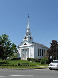
Historic places in Chelmsford
Transportation
Chelmsford is located at the intersection of the major US highways of I-495 and Route 3. Also found in Chelmsford are state routes 3A, 4, 27, 40, 110, and 129.
Chelmsford Center is a notorious junction of roadways. The heart of the town center is Central Square - the junction of routes 4, 110, the end of 129, and Westford Street. The Square is affectionately known as 'Chicken Corner' to locals. Until the 21st century, lights there were seen as non-'historic', crossing the 1 acre (0.40 ha) of pavement with no controls save a few stop signs was akin to a game of Chicken. Drivers would wait in long lines of cars to enter the square, where they often would invent their own lanes, waiting for a relatively safe chance to cross. In 2004, the town was forced to put in stoplights and lane markers. They were necessary to control the traffic-clogged center. In addition to the Square, Chelmsford Center is a series of merging and splitting roads, many one-way, including the beginning of route 27.
Chelmsford is home to the former Drum Hill Rotary. This rotary was the cause of many accidents that occurred due to its small overall size and ability for vehicles to gain speed. It formed the intersection of U.S. Route 3 (exit 32), Route 4, Drum Hill Road, and Westford Road. The rotary was demolished in 2003. It was replaced with a four intersection square with traffic lights, and is now called Drum Hill Square. This was part of a widening project for U.S. Route 3 between Interstate 95 (Route 128) and the New Hampshire state line.
Freight travels daily through Chelmsford over the tracks of the historic Stony Brook Railroad. The line currently serves as a major corridor of Pan Am Railway's District 3 which connects New Hampshire and Maine with western Massachusetts, Vermont, and New York.
The Bruce Freeman Rail Trail runs 6.8 miles (10.9 km) through Chelmsford, including the Central Square intersection.
The LRTA bus routes 15, 16 and 17 connect Chelmsford to the Lowell train station on the MBTA Commuter Rail Lowell Line.
North Chelmsford will get a Massachusetts Bay Transportation Authority commuter rail station if the proposed extension of the Lowell Line to Nashua, New Hampshire is completed.