
Country United States Elevation 406 ft (124 m) Local time Saturday 6:48 AM Settled 1635 | Incorporated September 23, 1729 Time zone Eastern (UTC-5) Zip code 01886 Population 21,951 (2010) | |
 | ||
Weather 1°C, Wind NE at 19 km/h, 96% Humidity | ||
Westford is a town in Middlesex County, Massachusetts, United States. The population was 21,951 at the 2010 census.
Contents
- Map of Westford MA USA
- Video of 24 main street westford massachusetts real estate homes
- History
- Geography
- Demographics
- Government
- Westford Public Schools
- Nashoba Valley Technical High School District
- Transportation
- Annual events
- Notable people
- References
Map of Westford, MA, USA
Video of 24 main street westford massachusetts real estate homes
History
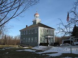
Originally a part of neighboring Chelmsford, West Chelmsford soon grew large enough to sustain its own governance, and was officially incorporated as Westford on September 23, 1729.
In the late 18th and early 19th centuries, Westford primarily produced granite, apples, and worsted yarn. The Abbot Worsted Company was said to be the first company in the nation to use camel hair for worsted yarns. Citizens from Westford also had some notable involvement in the Revolutionary War. Westford Minutemen were alerted by efforts of Samuel Prescott who alerted Acton, to the southeast towards Stow.
Paul Revere's son attended Westford Academy and a bell cast by Revere graces its lobby today. A weather vane made by Paul Revere sits atop the Abbot Elementary school.
By the end of the American Civil War, as roads and transportation improved, Westford began to serve as a residential suburb for the factories of Lowell, becoming one of the earliest notable examples of suburban sprawl. Throughout the 20th century (and with the invention of the automobile), Westford progressively grew, continuing to serve as residential housing for the industries of Lowell, and later, Boston.
In the 1960s, the town was home to one of the research sites supporting Project West Ford.
By the 1970s, with the advent of the 128 Technology Belt, Westford began to act as a suburb for high-tech firms in Burlington, Woburn, and other areas, and later became a center of technology itself.
By the 1990s, Westford was home to offices for Red Hat, Samsung, Sonus Networks, Seagate, Iris Associates, Visual Solutions, and many other technology firms, most located along Massachusetts Route 110, parallel to I-495. It is also the North American headquarters for Puma, which holds a road race in town. The leading manufacturer of EEG electrodes, HydroDot Inc., located here in 2007.
Today, Westford's agricultural past has given way to rapidly expanding high technology industries, suburban retail, and upper-middle class residential areas.
Westford's inter-town sports teams have the colors of maroon, white, and sometimes black.
Geography
According to the United States Census Bureau, the town has a total area of 31.3 square miles (81 km2), of which 30.6 square miles (79 km2) is land and 0.7 square miles (1.8 km2) (2.30%) is water.
The town is bordered by Chelmsford to the east, Tyngsborough to the north, Groton to the west, Littleton to the southwest, Acton to the south, and Carlisle to the southeast.
Regionally, it is on the edge of the Merrimack Valley, Northern Middlesex County, and the Metrowest regions of Massachusetts.
Colloquially, the town is divided into different regions based on location, including Forge Village, Nabnasset, Graniteville, Parker Village, and Center of Town. The town's Master Plan maintains a distinction between the Commercial and Residential zones of the town, divided by Route 495. This allows for growth in the town while maintaining the character of this lovely area, and a balance of open spaces, without encroachment of commercial development as you approach Westford's Historic Town Center.
The town was rated as #11 Best Places to live by CNN Money in 2013.
Demographics
As of the 2010 census there were 21,951 people, 7,498 households, and 6,165 families residing in the town. The racial makeup of the town was 85.1% White, 0.40% African American, 0.1% Native American, 12.6% Asian (5.7% Indian, 5.2% Chinese, 0.6% Korean, 0.3% Cambodian, 0.2% Vietnamese, 0.2% Japanese, 0.1% Filipino, 0.1% Pakistani, 0.1% Bangladeshi), 0.0% Pacific Islander, 0.30% from other races, and 1.5% from two or more races. Hispanic or Latino of any race were 1.5% of the population.
As of the 2010 census, there were 7,498 households out of which 45.3% had children under the age of 18 living with them, 72.5% were married couples living together, 7.3% had a female householder with no husband present, and 17.8% were non-families. The average household size was 2.93 and the average family size was 3.27.
In the town, the population was spread out with 31.8% under the age of 18, 4.2% from 18 to 24, 32.8% from 25 to 44, 23.9% from 45 to 64, and 7.2% who were 65 years of age or older. The median age was 37 years. For every 100 females there were 99.0 males. For every 100 females age 18 and over, there were 95.4 males.
The median income for a household in the town was $121,136, and the median income for a family was $137,230. The per capita income for the town was $48,951. About 1.3% of families and 1.7% of the population were below the poverty line, including 2.2% of those under age 18 and 1.0% of those age 65 or over.
Government
Westford is run by a board of five Selectmen who are the chief policy making officials for the Town and who are responsible for the enforcement of all town Bylaws and regulations. The Town is managed on a day-to day basis by a Town Manager who is a town employee and who acts as the agent for the Board of Selectmen.
Residents contribute to their local government by volunteering for Town Boards and Committees and by participating at Town Meeting, which occurs in the spring, and occasional Special Town Meetings, with one usually occurring in the fall.
In Westford, as in many New England towns, voters participate directly in the major decisions that affect how the town runs itself and how it spends its money.
Town meeting is the legislative branch of Westford’s government, and all registered voters may attend, speak and vote at the open town meeting. Town meeting has two primary responsibilities: establishing an annual budget by voting to appropriate money for all Town departments, and voting on the Town’s local statutes, called bylaws.
All residents, renters as well as property owners, if registered to vote, may attend and vote at town meeting. A voter must attend in person as no absentee voting is allowed. The non-voting public may attend open town meetings as observers.
Westford's award-winning government website is http://www.westfordma.gov
Westford Public Schools
The Superintendent of Westford's Public Schools is Everett "Bill" Olsen, who has held that role since 1986. [1] The Assistant Superintendent is Kerry Clery. [2]
Nashoba Valley Technical High School District
Nashoba Valley Technical High School enrolls students from Westford, Chelmsford, Ayer, Groton, Littleton, Townsend, Shirley, and Pepperell
Established in 1968, Nashoba Valley Technical High School is a public, four-year, vocational high school.
Transportation
Freight travels daily through Westford over the tracks of the historic Stony Brook Railroad. The line currently serves as a major corridor of Pan Am Railways' District 3 which connects New Hampshire and Maine with western Massachusetts, Vermont, and New York. Interstate 495 (Massachusetts) also passes through the town, linking it to other parts of the state as well as New Hampshire. US-3 passes through the town, although the nearest interchanges are located in neighboring Tyngsborough (exit 34) and Chelmsford (exit 33).
The LRTA 15 bus connects Westford along Route 110 with Chelmsford and the Lowell train station on the MBTA Commuter Rail Lowell Line.
Local routes passing through town are Massachusetts Routes 110, 40, 225, and 27.