
Existed: 1922 – present Length 103.7 km | Constructed 1922 | |
 | ||
County Worcester County, Massachusetts | ||
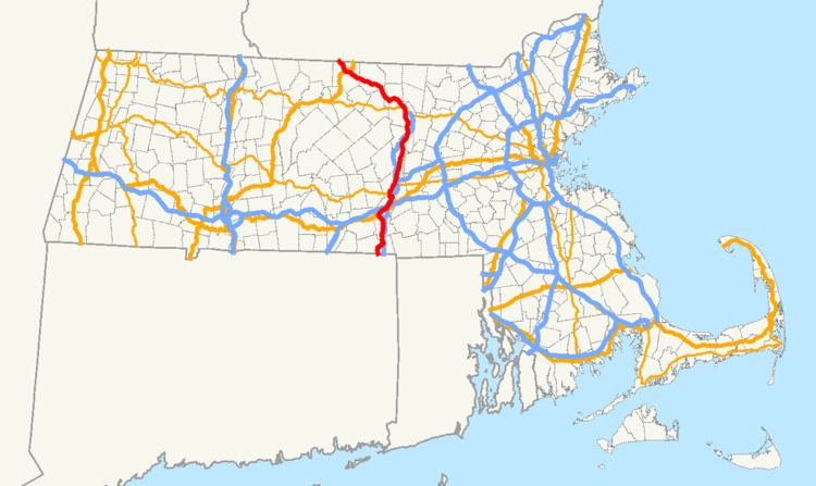
Massachusetts Route 12 is a north-south state highway that runs through central Massachusetts from the Connecticut state line at Dudley to the New Hampshire state line at Winchendon.
Contents
Map of MA-12, Massachusetts, USA
Route description
Route 12 begins at the Connecticut state line, runs north through the towns and cities of Dudley, Webster, Oxford, Auburn, Worcester, West Boylston, Sterling, Leominster, Fitchburg, Westminster, Ashburnham, and Winchendon before crossing into New Hampshire.
History
Route 12 has a junction with Interstate 90 (the Massachusetts Turnpike) at an interchange in Auburn that also includes Interstates 290 and 395 and US 20. Route 12 has an interchange with I-290 in Worcester, and three interchanges with I-190, in Worcester, West Boylston, and Sterling. Route 12 is a minor road in Massachusetts, having been replaced by I-395 from the Connecticut state line to Auburn, I-290 from Auburn to Worcester, and I-190 from Worcester to Leominster.
Major intersections
The entire route is in Worcester County.