
Counties: Bristol | Length 3.73 km | |
 | ||
County | ||
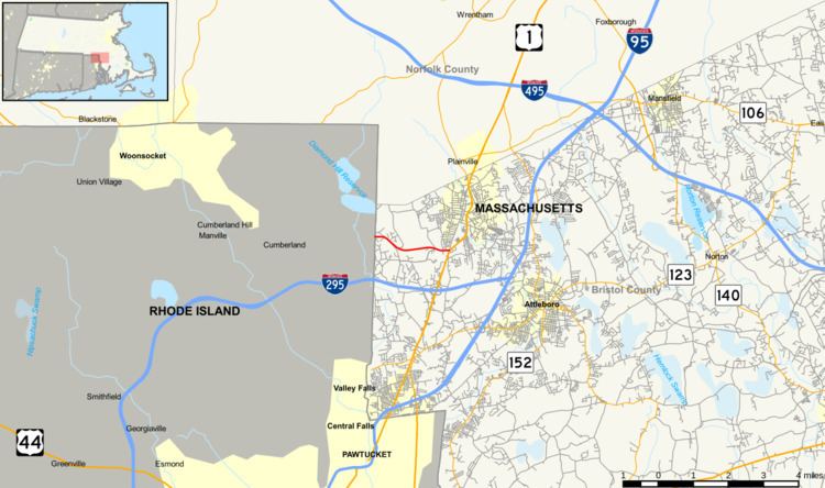
Route 120 is a state highway in the U.S. state of Massachusetts. The highway runs 2.320 miles (3.734 km) from the Rhode Island state line east to U.S. Route 1 (US 1) within North Attleborough in western Bristol County. Route 120 connects North Attleborough with Cumberland, Rhode Island.
Contents
Map of MA-120, North Attleborough, MA 02760, USA
Route description
Route 120 begins at the Rhode Island state line in the town of North Attleborough. The highway continues west as Rhode Island Route 120 into the town of Cumberland. The route heads east as two-lane Hickory Road, which crosses the Sevenmile River. Route 120's name changes to Hoppin Hill Road at the town road of that name, then it crosses the Hoppin Hill Reservoir. The highway reaches its eastern terminus at a four-way intersection with South Washington Street and East Washington Street south of downtown North Attleborough. US 1 heads south on South Washington Street and northeast on East Washington Street to bypass the town center, and South Washington Street north of the intersection is a town road through the town center.
Major intersections
The entire route is in North Attleborough, Bristol County.