
Existed: 1983 – present Constructed 1983 | Length 31 km | |
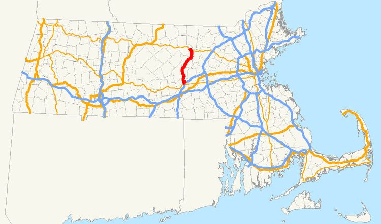 | ||
Interstate 190 (I-190) runs for 19.26 miles (31.00 km) north from I-290 in Worcester to Route 2 in Leominster in the US state of Massachusetts. A portion of the highway was built with extra-wide shoulders, which are painted green, to prevent runoff from contaminating the nearby Wachusett Reservoir. The green color is also intended to reduce the perceived width of the unusually wide road.
Contents
Map of I-190, Massachusetts, USA
Route description
I-190 begins at a southern terminus with I-290 in Worcester. Near the Greendale Mall, there is an interchange with Route 12 before the highway passes along the eastern shore of Indian Lake and goes through the city of Worcester. In West Boylston, I-190 has another interchange with Route 12 before turning to the northwest into Holden and then the north and crossing the Quinapoxet River. The freeway curves to the northeast reentering West Boylston and enters a more rural area, and I-190 intersects Route 140 and Route 12 another time in Sterling. In Lancaster, I-190 has an exit for Route 117. North of Johnny Appleseed State Park and Lancaster State Forest, I-190 merges and terminates at Route 2 and Mechanic Street in the city of Leominster.
Exit list
All interchanges were to be renumbered to mileage-based numbers under a project scheduled to start in 2016. However, this project has now been indefinitely postponed. The entire route is in Worcester County.