Neha Patil (Editor)

Japan National Route 42

Updated on
Edit
Like
Comment
Share on FacebookTweet on TwitterShare on LinkedInShare on Reddit
Existed:
  
1945 – present

West end:
  
Constructed
  
1945

East end:
  
Length
  
504.6 km

Japan National Route 42

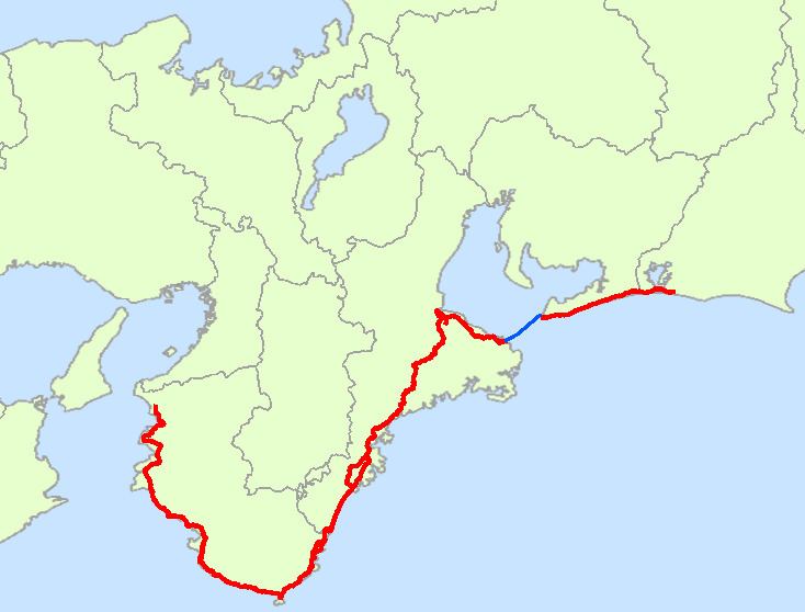
National Route 42, also called Kumano Kaido or Tropical Route is a national highway connecting Hamamatsu, Shizuoka and Wakayama, Wakayama in Japan. Part of the route requires crossing Ise Bay on the Ise-wan Ferry.

Contents

It is the 8th longest national highway in Japan.

Route Data

  • Length: 504.6 km (313.5 mi)
  • Origin: Hamamatsu (originates at junction with Route 1)
  • Terminus: Wakayama city
  • Major cities: Tahara, Toba, Ise, Matsusaka, Owase, Kumano, Shingū, Tanabe, and Gobō
  • Passes through

    Shizuoka Prefecture
  • Hamamatsu • Kosai
  • Aichi Prefecture
  • ToyohashiTahara
  • Mie Prefecture
  • TobaIseMeiwa • Matsusaka • Taki • Ōdai • TaikiKihoku • Owase • KumanoMihama • Kihō
  • Wakayama Prefecture
  • Shingū • Nachikatsuura • Taiji • Kushimoto • Susami • ShirahamaMinabeInami • Gobō • HidakaYura • Hirogawa • Yuasa • Aridagawa • Arida • Kainan • Wakayama
  • Intersects with

    Shizuoka Prefecture
  • Route 1
  • Route 257
  • Route 301
  • Aichi Prefecture
  • Route 259
  • Mie Prefecture
  • Route 167
  • Route 23
  • Route 166
  • Ise Expressway
  • Route 368
  • Kisei Expressway
  • Route 260
  • Route 425
  • Route 311
  • Route 309
  • Route 311
  • Wakayama Prefecture
  • Route 168
  • Route 371
  • Route 311
  • Hanwa Expressway
  • Route 424
  • Route 425
  • Yuasa-Gobō Bypass
  • Route 480
  • Route 24
  • Route 26
  • References

    Japan National Route 42 Wikipedia


    Similar Topics