
Population 9,543 (Sep 2012) | - Tree Maki Area 233.5 km² Local time Saturday 5:01 PM | |
 | ||
Weather 7°C, Wind E at 11 km/h, 68% Humidity Points of interest Takiharagu Shrine, Ouchiyama Zoo, Kōbenomiyayomō Shrine, Takihara Park, Kazaana | ||
Taiki (大紀町, Taiki-chō) is a town located in Watarai District, Mie Prefecture, Japan. As of September 2012, the town had an estimated population of 9,543 and a population density of 40.9 persons per km². The total area was 233.54 km².
Contents
- Map of Taiki Watarai District Mie Prefecture Japan
- Geography
- Adjacent municipalities
- History
- Economy
- Railway
- Highway
- References
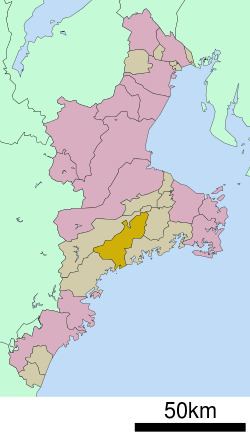
Map of Taiki, Watarai District, Mie Prefecture, Japan
Geography
Taiki is located in eastern Kii Peninsula, in south-central Mie Prefecture. The town is bordered by Ise Bay to the east.
Adjacent municipalities
History
Tamaki was the site of a Sengoku period Japanese castle, Tamaru Castle, initially built by the Kitabatake clan, which dominated the surrounding area, including access to the Ise Grand Shrines. The castle was destroyed in the early Meiji period.
Taiki Town was formed on February 14, 2005 from the merger of the towns of Kisei and Ōmiya and the village of Ōuchiyama.
Economy
The town serves as a commercial center for the surrounding region. Commercial fishing and the dairy industry play important roles in the local economy.