
Country Japan Phone number 0531-22-1111 Population 61,850 (Dec 2015) | Area 191.1 km² Local time Saturday 2:50 PM | |
 | ||
Weather 10°C, Wind SE at 11 km/h, 65% Humidity Points of interest Mt Zao, Tawarashi Historical Museum, Yashinomi Museum, Choonji, Mt Daisen | ||
Tahara (田原市, Tahara-shi) is a city located in Aichi Prefecture, Japan.
Contents
- Map of Tahara Aichi Prefecture Japan
- Geography
- Neighboring municipalities
- History
- Economy
- Energy
- Education
- Transportation
- Railway
- Highway
- Bus services
- Seaports
- Sister cities
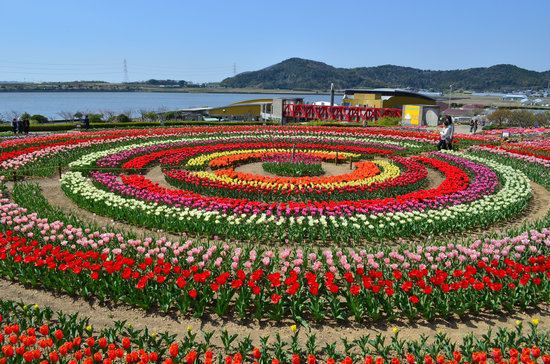
- Local attractions
- Noted people from Tahara
- References
Map of Tahara, Aichi Prefecture, Japan
As of December 2015, the city had an estimated population of 61,850 and a population density of 324 persons per km². The total area was 191.12 square kilometres (73.79 sq mi).
Geography
Tahara is situated in southern Aichi Prefecture, and occupies most of Atsumi Peninsula. The peninsula is bounded on the north by Mikawa Bay and to the south lies the Philippine Sea. Situated as it is between those two bodies of water, Tahara has a warm maritime climate.
Neighboring municipalities
History
The area of present-day Tahara has been continuously occupied since prehistoric times. Archaeologists have found numerous remains from the Jōmon period and burial mounds from the Kofun period. During the Nara period, the area was assigned to ancient Atsumi County, and was divided into several shōen during the Heian period. During the Kamakura period, the area was noted for production of a certain type of pottery. During the Sengoku period, the area was under the control of the Toda clan, who constructed Tahara Castle. The Toda, who were allied with Tokugawa Ieyasu were dispossessed by Toyotomi Hideyoshi, but returned as daimyō of Tahara Domain at the start of the Edo period. The Toda were later replaced by the Miyake clan, who ruled until the end of the Tokugawa shogunate. The noted scholar Watanabe Kazan was from Tahara.
At the start of the Meiji period, on October 1, 1889 Tahara was a collection of villages within Atsumi District, Aichi Prefecture. Tahara Village was elevated to town status on October 3, 1892 and Fukue village became Fukue Town on February 22, 1897. Fukue later changed its name to Atsumi Town on April 15, 1955. On November 11, 1958, the village of Akabane was raised to town status.
The modern city of Tahara was established on August 20, 2003, from the merger the former town of Tahara, absorbing the town of Akabane (both from Atsumi District) to elevate city status. On October 1, 2005, the town of Atsumi (also from Atsumi District) was merged into Tahara. Therefore, Atsumi District was dissolved as a result of this merger.
Economy
Tahara is a regional commercial center with a mixed economy of manufacturing and agriculture. Due to its long coastline, Tahara has many ports for commercial fishing. The main industrial employer is Toyota Motor Corporation, which has its award-winning Tahara plant in Tahara which makes many Lexus-brand cars and some Toyota models. The Toyota Celica was manufactured in Tahara from 1979 to 1999. Many Lexus models are manufactured within this plant, as are many Toyota models for domestic and international markets.
Energy
Tahara has a consortium of companies investing in renewable energy needs. As of November 2014, a new solar energy and wind energy power generation facility will provide 19,000 households with electricity on an infrequent basis that is dependent upon the weather.
Education
Tahara has 20 elementary schools, seven middle schools and three high schools.
Transportation
Tahara can be accessed by rail, motor vehicle, or ferry.
Railway
Highway
Bus services
Toyotetsu buses and city-operated environmentally friendly public transport facilitate access throughout Tahara, even to the westernmost point at Cape Irago.
Seaports
From the Port of Irago, the Ise-wan Ferry connects Tahara with the town of Toba, Mie prefecture. The ferry can accommodate motor vehicles. The ferry also docks at the Central Japan International Airport, built on an artificial island in Ise Bay, south of Nagoya.