
Chapman code INV | ||
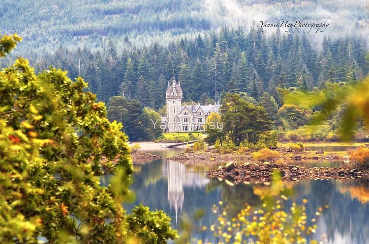 | ||
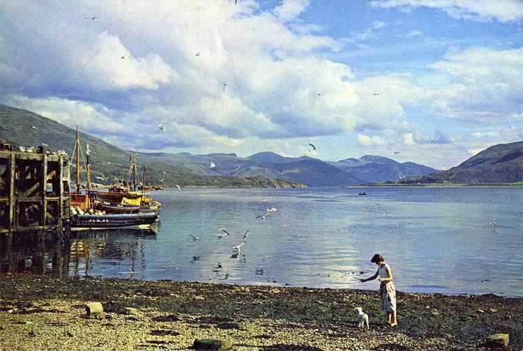
Highwinds self catering fort william scotland inverness shire highlands
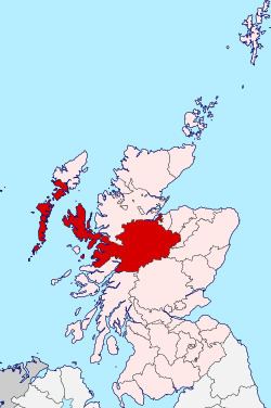
The Shire of Inverness (Scottish Gaelic: Siorrachd Inbhir Nis) is a historic county and lieutenancy area of Scotland. Covering much of the Highlands, it is Scotland's largest county, though one of the smallest in population, with 67,733 people or 1.34% of the national population.
Contents
- Highwinds self catering fort william scotland inverness shire highlands
- Deerstalking at balmacaan estate inverness shire
- Definition
- Geography
- Coat of arms
- 18901973
- 19741995
- 1996present
- Civil parishes
- Parliamentary constituencies
- Surnames
- References
Deerstalking at balmacaan estate inverness shire
Definition
The extent of the lieutenancy area was defined in 1975 as covering the districts of Inverness, Badenoch & Strathspey, and Lochaber. Thus it differs from the county in that it includes parts of what were once Moray and Banffshire, but does not include any of the Outer Hebrides which were given their own lieutenancy area — the Western Isles.
Geography
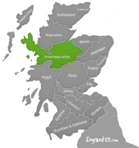
Inverness-shire is Scotland's largest county, and the second largest in the UK as a whole after Yorkshire. It borders Ross to the north, Nairnshire, Moray, Banffshire and Aberdeenshire to the east, and Perthshire and Argyll to the south.
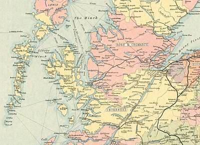
It covers a large mainland area and various island areas off the west coast. The mainland area has coastline in both the east and the west. The island areas include North Uist, South Uist and Harris in the Outer Hebrides and Skye and the Small Isles in the Inner Hebrides.
Principal settlements include Inverness, Fort William, Fort Augustus and Portree.
Coat of arms
Inverness-shire's coat of arms is blazoned:
The galley represents Clan Chattan, who aligned themselves under the banner of Somerled, Lord of the Isles. The stag's head comes from the crest of the Frasers of Lovat, while the bull's head comes from the crest of the MacLeods of that Ilk. The motto is in Gaelic and means "For the Good of the County".
1890–1973
Inverness-shire acquired a county council in 1890, under the Local Government (Scotland) Act 1889, and, under the same legislation, boundaries were altered to make the county a single contiguous area, transferring several exclaves of other counties to Inverness-shire.
Although the new boundaries were supposed to be valid for all purposes (unlike earlier boundaries, which were really default boundaries and not necessarily those used for any particular purpose), the burghs of Inverness, Fort William, Kingussie, which had their own town councils, retained autonomous status and were for some purposes beyond the writ of the new county council. The town of Inverness had been established as a royal burgh since the mid 12th century, Fort William, originally a Fort of that name built by the Government to keep the Highlanders in their place, around which grew up a village which became in turn Gordonsburgh, Maryburgh, Duncansburgh and laterly the town/burgh of Fort William which had been established as a burgh of barony since 1618 and Kingussie had been established as a burgh of barony since 1464. Also, use of the new boundaries for parliamentary elections was specifically excluded.
1974–1995
The old county councils were abolished by the Local Government (Scotland) Act 1973 and Scotland was instead governed by a two-tier system of regions and districts. Mainland Inverness-shire was split amongst four districts of the Highland region, whilst the county's territory in the Outer Hebrides was transferred to the Western Isles council area.
Within the Highland region, local government functions were divided between the regional council and the district councils. For example, education was a regional responsibility, and housing was a district responsibility.
1996–present
In 1996, under the Local Government etc (Scotland) Act 1994, the two-tier system was abolished and the Highland region became a unitary council area.
The new unitary Highland Council adopted the areas of the former districts as management areas. Each management area was represented, initially, by area committees consisting of councillors elected from areas (groups of local government wards) corresponding to the management areas, but changes to ward boundaries in 1999 created a mismatch between committee areas and management areas.
In 2007, at the time of further changes to ward boundaries, which created 22 multi-member wards instead of 80 single-member wards, the council created a new management structure, with three new corporate management areas and 16 new ward-level management areas. Also, four of the ward-level management areas, covering the seven wards, were grouped to form an Inverness city (or Inverness and Area) management area.
The total number of Highland councillors is 80, elected by the single transferable vote system of election, which is designed to produce a form of proportional representation. Wards in the Inverness city area elect 26 of the 34 council members elected from the Inverness, Nairn and Badenoch and Strathspey corporate management area.
The city area has the Nairn ward-level management area to the east, the Badenoch and Strathspey ward-level management area to the east and south, the Ross, Skye and Lochaber corporate management area to the south, west and north, and the Moray Firth to the north.
The city area is similar but not identical to the former district of Inverness.
Civil parishes
Civil parishes are still used for some statistical purposes, and separate census figures are published for them. As their areas have been largely unchanged since the 19th century this allows for comparison of population figures over an extended period of time.
In 1854 in Inverness-shire there were 29 civil parishes; 7 part civil parishes; and 5 parliamentary parishes.
Parliamentary constituencies
There was an Inverness-shire constituency of the Parliament of Great Britain (Westminster) from 1708 to 1801 and of the Parliament of the United Kingdom (also at Westminster) from 1801 to 1918. The constituency represented, nominally, the county of Inverness minus the parliamentary burgh of Inverness, which was represented as a component of the Inverness District of Burghs constituency.
In 1918 the county constituency was divided between two new constituencies, the Inverness constituency and the Western Isles constituency. The Inverness constituency included the burgh of Inverness, other components of the district of burghs being divided between the Moray and Nairn constituency and the Ross and Cromarty constituency.
In 1983, eight years after the local government county of Inverness had been divided between the Highland region and the Western Isles council area, three new constituencies were created to cover the Highland region. The region, until 1996, and the unitary Highland council area, 1996 to present, have been covered by three constituencies since then but there were changes to boundaries and names in 1997 and 2005.
In 1999 the areas of the Westminster constituencies became also constituencies of the Scottish Parliament (Holyrood). The boundaries of Scottish Parliament constituencies have not altered since then. The Holyrood constituencies are within the Highlands and Islands electoral region.
Since 1983, Inverness has appeared in the names of Westminster and Holyrood constituencies as tabled below.
Surnames
Most common surnames in Inverness-shire at the time of the United Kingdom Census of 1881, by order of incidence:
- McDonald
- Fraser
- McLeod
- McKenzie
- McLean
- Campbell
- McKinnon
- Cameron
- Grant
- McPherson