
OS grid reference NF835697 Highest elevation Eaval 1,138 ft (347 m) Area 303 km² | Area rank 10 Population 1,271 (2001) | |
 | ||
Gaelic name Uibhist a Tuath (help·info) Island groups British Isles, Outer Hebrides Points of interest | ||
North Uist (Scottish Gaelic: Uibhist a Tuath [ˈɯ.ɪʃtʲ ə t̪ʰuə]) is an island and community in the Outer Hebrides of Scotland.
Contents
- Map of North Uist United Kingdom
- GaelicEdit
- GeographyEdit
- SettlementsEdit
- Places of interestEdit
- EtymologyEdit
- PopulationEdit
- HistoryEdit
- North Uist and the ClearancesEdit
- Famous residentsEdit
- References
Map of North Uist, United Kingdom
GaelicEdit
According to the 2011 Census, there are 887 Gaelic speakers (61%) on North Uist.
GeographyEdit
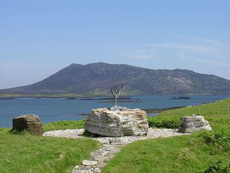
North Uist is the tenth largest Scottish island and the thirteenth largest island surrounding Great Britain. It has an area of 117 square miles (303 km2), slightly smaller than South Uist. North Uist is connected by causeways to Benbecula via Grimsay, to Berneray, and to Baleshare. With the exception of the south east, the island is very flat, and covered with a patchwork of peat bogs, low hills and lochans, with more than half the land being covered by water. Some of the lochs contain a mixture of fresh and tidal salt water, giving rise to some complex and unusual habitats. Loch Sgadabhagh, about which it has been said "there is probably no other loch in Britain which approaches Loch Scadavay in irregularity and complexity of outline", is the largest loch by area on North Uist although Loch Obisary has about twice the volume of water. The northern part of the island is part of the South Lewis, Harris and North Uist National Scenic Area, one of 40 in Scotland.
SettlementsEdit
The main settlement on the island is Lochmaddy, a fishing port and home to a museum, an arts centre and a camera obscura. Caledonian MacBrayne ferries sail from the village to Uig on Skye, as well as from the island of Berneray (which is connected to North Uist by road causeway), to Leverburgh in Harris. Lochmaddy also has Taigh Chearsabhagh - a museum and arts centre with a cafe, small shop and post office service. Nearby is the Uist Outdoor Centre.
The island's main villages are Sollas, Hosta, Tigharry, Hougharry, Paible, Grimsay and Cladach Kirkibost. Other settlements include Clachan Carinish, Knockquien, Port nan Long, Greinetobht and Scolpaig, home to the nineteenth century Scolpaig Tower folly. Loch Portain is a small hamlet on the east coast – some 9 miles (14 km) from Lochmaddy, with sub areas of Cheesebay and Hoebeg.
According to the 2001 census North Uist had a population of 1,271 (1,320 including Baleshare).
Places of interestEdit
North Uist has many prehistoric structures, including the Barpa Langass chambered cairn, the Pobull Fhinn stone circle, the Fir Bhreige standing stones, the islet of Eilean Dòmhnuill (which may be the earliest crannog site in Scotland), and the Baile Sear roundhouses, which were exposed by storms in January, 2005.
The Vikings arrived in the Hebrides in 800AD where they had large settlements.
The island is known for its birdlife, including corncrakes, Arctic terns, gannets, corn buntings and Manx shearwaters. The RSPB has a nature reserve at Balranald.
Despite limited facilities, the island's athletics club (North Uist Amateur Athletics Club) has performed well at local, regional and national athletics competitions.
EtymologyEdit
In Donald Munro's A Description of the Western Isles of Scotland Called Hybrides of 1549, North Uist, Benbecula and South Uist are described as one island of Ywst (Uist). Starting in the south of this 'island', he described the division between South Uist and Benbecula where "the end heirof the sea enters, and cuts the countrey be ebbing and flowing through it". Further north of Benbecula he described North Uist as "this countrey is called Kenehnache of Ywst, that is in Englishe, the north head of Ywst".
Some have given the etymology of Uist from Old Norse meaning "west", much like Westray in the Orkney Islands. Another speculated derivation from Uist in Old Norse is Ívist, derived from vist meaning "an abode, dwelling, domicile".
A Gaelic etymology is also possible, with I-fheirste meaning "Crossings-island" or "Fords-island", derived from I meaning "island" and fearsad meaning "estuary, sand-bank, passage across at ebb-tide". Place-names derived from fearsad include Fersit, and Belfast. Mac an Tàilleir (2003) suggests that a Gaelic derivation of Uist may be "corn island". However, whilst noting that the vist ending would have been familiar to speakers of Old Norse as meaning "dwelling" Gammeltoft (2007) states the word is "of non-Gaelic origin" and that it reveals itself as one of a number of "foreign place-names having undergone adaptation in Old Norse".
PopulationEdit
In the 18th century the total population of the combined Uists rose dramatically, before the population crash of the Highland Clearances. In 1755, the Uists' estimated combined population was 4,118; by 1794 it rose to 6,668; and in 1821 to 11,009.
The pre-clearance population of North Uist was about 5,000 and it has dwindled to about 1,300 in 2011.
From Haswell-Smith (2004) except as stated.
HistoryEdit
After the Norse occupation of the Western Isles the MacRuairidhs controlled the island. North Uist was granted to Macdonald of Sleat in 1495, and remained in possession of the Macdonalds of Sleat until 1855, when it was sold to Sir John Powlett Orde. Today the island is owned by the Granville family through the North Uist Trust.
North Uist and the ClearancesEdit
North Uist was hit hard during the Highland Clearances, and there was large scale emigration from the island to Cape Breton, Nova Scotia, Canada. The pre-clearance population of North Uist had been almost 5,000, though by 1841 it had fallen to 3,870, and has now further dwindled to about 1,300. The clearances occurred later on North Uist, which was predominately Presbyterian, than on South Uist which was mostly Roman Catholic.
The main reason for the massive emigration was the failure of the island's kelp industry. Since the French Revolutionary Wars the kelp industry had been North Uist's main source of income. With the collapse of this source of income the crofters of North Uist could not afford the high rents. Even as the landlords reduced the rents, e.g. in 1827 when the rents were reduced by 20%, many crofters were forced to emigrate.
The first real clearances on North Uist occurred in the 1820s. In 1826 the villages of Kyles Berneray, Baile Mhic Phail and Baile mhic Conon, at the north-east corner of North Uist, were cleared of their inhabitants. Although some moved further east to Loch Portain, most of those affected moved to Cape Breton, Nova Scotia. This is shown in the rental roll of 1827, which states that over fifty families had "Gone to America", meaning Cape Breton. As the economic conditions worsened and with reports of islanders succeeding overseas, the numbers of families emigrating from Scotland to North America greatly increased. In 1838 1,300 people from North Uist were recorded as being cleared. It is misconception that most families involved in the clearances were "cleared" from their holdings, though in 1849 there was rioting as 603 inhabitants from Sollas were forcefully cleared by Lord (the 4th Baron) Macdonald. In the incident the women of Sollas took large part in the rioting. As a detachment of Glasgow police officers advanced on the protesters, the Sollas men were said to have stood aside, but the women of Sollas stood up to the authorities, and pelted the police with rocks. The police then descended upon the Sollas folk and attacked them with their truncheons. In fact a Hebredian settlement in Cape Breton County, Nova Scotia was originally called Sollas (now Woodbine). North Uist surnames affected during the clearances were the MacAulays, Morrisons, MacCodrums, MacCuishs, and MacDonalds.