
 | ||
Similar Ardnamurchan Point, Loch Shiel, Mingarry Castle, Castle Tioram, Knoydart | ||
Ardnamurchan (/ˌɑːrdnəˈmɜːrxən/, Scottish Gaelic: Àird nam Murchan: headland of the great seas) is a 50-square-mile (130 km2) peninsula in the ward management area of Lochaber, Highland, Scotland, noted for being very unspoilt and undisturbed. Its remoteness is accentuated by the main access route being a single track road for much of its length.
Contents
- Map of Ardnamurchan Acharacle UK
- Geography
- Geology
- History
- Settlements
- Culture
- Fauna and scenery
- Famous people
- References
Map of Ardnamurchan, Acharacle, UK
From 1930 to 1975 Ardnamurchan also gave its name to a landward district of Argyll, which covered a much wider area, including the districts of Morvern, Sunart and Ardgour.
Geography
Strictly speaking Ardnamurchan covers only the peninsula beyond the villages of Salen (in the south) and Acharacle (in the north), but nowadays the term is also used more generally to include the neighbouring districts of Sunart, Ardgour, Morvern, and even Moidart (which was part of the former county of Inverness-shire, not Argyll).
Ardnamurchan Point, which has a 36-metre (118 ft) tall lighthouse built on it, is commonly described as the most westerly point of the British mainland although Corrachadh Mòr, a kilometre to the south, is a few metres further west.
Geology
The whole north western corner of Ardnamurchan contains a complex of underground volcanic structures, often described, perhaps inaccurately, as a caldera. It is in fact known that the structure of the north-western corner of the Ardnamurchan peninsula is due to a lopolith (previously interpreted as a ring dyke) which has been exposed at the surface. Evidence for such a structure can be indentified from the phenocrysts in the rock exposures around the area of interest which show plagioclase crystals aligned towards the centre of the complex, an alignment caused by magmatic flow within a lopolith. Relatively small areas of lava that were ejected onto the surface are found in some parts of the peninsula, close in proximity to the inner edges of the area of interest. At least seven other similar complexes of the same tectonic episode are dotted up the west coast of Britain, and these are popular sites for many university geological training courses. The sub-concentric rings of the geologic structure can easily be seen in satellite photographs and topographic maps, though they are less obvious on the ground.
History
Adomnan of Iona records St Columba visiting the peninsula in the 6th century, and gives the impression that it was settled by Irish Gaels at that time. He records three instances of signs performed by Columba on the peninsula.
Adomnan records in one instance that he prophesied to his companions the death of Kings Báetán mac Muirchertaig and Eochaid mac Domnaill before news arrived the same day at a place called 'paradise bay' to tell them the news. In the second instance, which is said to have occurred in an unnamed rocky spot in the interior, the parents of a boy brought their child to Columba to be baptized but no water could be found, and Columba prayed to God and water miraculously came out of a nearby rock and he prophesied that the child would live a sinful life and later be a saint.
In the third instance, which took place at a spot Adomnan called 'Sharp bay', there was a wicked man named Ioan mac Conaill maic Domnaill who was related to the Cenél nGabraín, and this man attacked Columba's friend and plundered his goods. Columba met this wicked man and called on him to repent, but he didn't listen and instead boarded his boat with the stolen goods. Columba then followed the boat, wading into the water up to his knees and prayed to God. He then prophesied to his companions that this man and his boat were going to meet with disaster on the sea, and according to Adomnan, the boat was sunk before reaching land with Ioan drowning at sea along with his stolen goods.
Donaldson identifies "Buarblaig" (now referred to as Bourblaige, about 5 miles (8.0 km) east of Kilchoan on the other side of Ben Hiant, grid reference NM546623) with Muribulg, where the Annals of Tigernach record a battle between the Picts and the Dalriads in 731. It may also be the 'Muirbole Paradisi' mentioned by Adomnán. Although its stone foundations still remain, the village of Bourblaige no longer exists, as it was destroyed in the Highland Clearances in the early 19th century.
Tradition has it that there have been at least two battles in the bays between Gortenfern and Sgeir a' Chaolais, in the northeast of the peninsula across Kentra Bay from Ardtoe. One involved the Vikings, the other may have been fought in 1297 in Cul na Croise between the forces of Edward I of England and islanders under Roderick of Bute and Lachlan MacRuari of Garmoran. Relics of a Viking ship burial in Cul na Croise have been given to the West Highland Museum at Fort William.
In 2011, a Viking ship burial, probably from the 10th century, was unearthed at Port an Eilean Mhòir on Ardnamurchan. Grave goods buried alongside a Viking warrior found in the boat suggest he was a high-ranking warrior. The Ardnamurchan Viking was found buried with an axe, a sword with a decorated hilt, a spear, a shield boss and a bronze ring pin. Other finds in the 5 metres (16 feet) long grave in Ardnamurchan included a knife, what could be the tip of a bronze drinking horn, a whetstone from Norway, a ring pin from Ireland and Viking Age pottery.
Settlements
The population of the whole peninsula is around 2000. Historically part of the former county of Argyll, it is now part of the Lochaber ward management area of the Highland local authority.
Villages in Ardnamurchan:
Culture
Ardnamurchan has one of the highest concentrations of Gaelic speakers on the mainland. The peninsula has its own shinty team, Ardnamurchan Camanachd.
Fauna and scenery
Rare species such as the wildcat, pine marten, golden eagle and white-tailed eagle can be seen in Ardnamurchan.
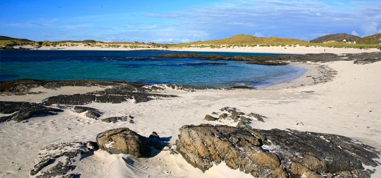
Ardnamurchan is wild and unspoilt. Ardnamurchan Point, adjacent to the most westerly point on the British mainland, has a lighthouse and a view from a sheer rock face of the open Atlantic Ocean.