
Chapman code PER | ||
 | ||
Status Local government county (until 1975)
Land registration county (1996 - ) Government County: Perthshire County Council (1890-1929)
Perth and Kinross County Council (1929-1975)
Modern: Perth and Kinross Council (1996 - )
Lieutenancy: Lord Lieutenant of Perth and Kinross HQ Perth (county town and administrative centre) | ||
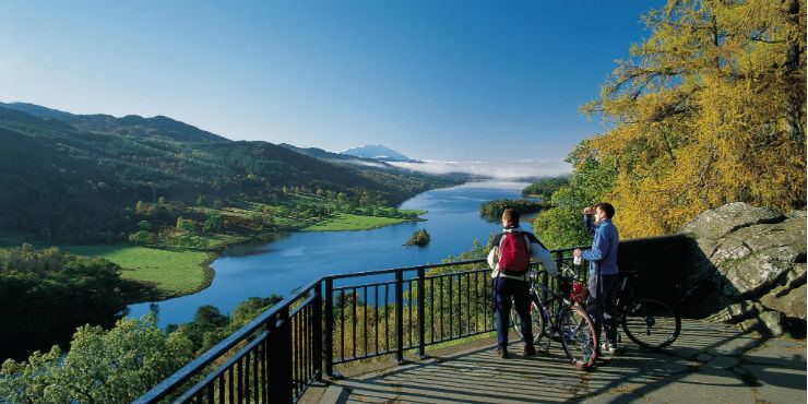
Perthshire majesty by samuel hazo
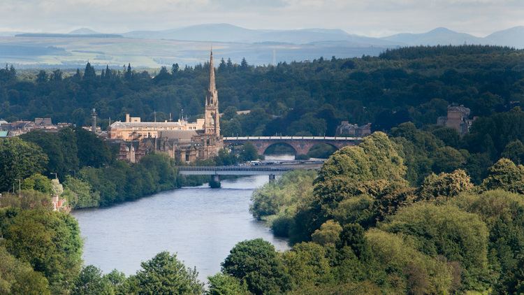
Perthshire (/pɛrθʃər/; Scottish Gaelic: Siorrachd Pheairt), officially the County of Perth, is a registration county in central Scotland. It extends from Strathmore in the east, to the Pass of Drumochter in the north, Rannoch Moor and Ben Lui in the west, and Aberfoyle in the south. It was a local government county from 1890 to 1930.
Contents
- Perthshire majesty by samuel hazo
- Perthshire tourist guide
- Administrative History
- Boundaries
- Coat of arms
- Burghs
- Civil parishes
- Towns and villages
- Districts
- Parliamentary constituencies
- 1707 1885
- 1885 1918
- 1918 1975
- Surnames
- References
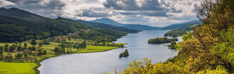
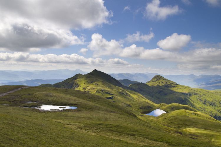
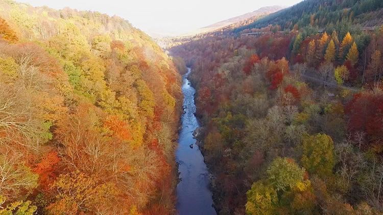
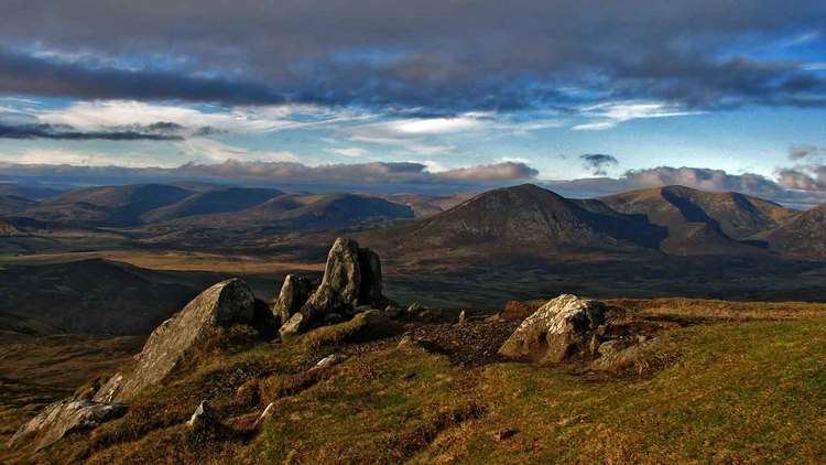
Perthshire is known as the "big county" and has a wide variety of landscapes, from the rich agricultural straths in the east, to the high mountains of the southern Highlands.
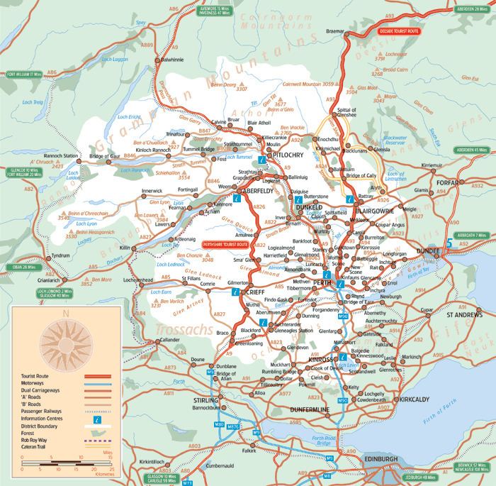
Perthshire tourist guide
Administrative History
Perthshire was an administrative county between 1890 and 1975, governed by a county council. This Local Government council was superseded in 1930, when a joint Local Government council was formed with the neighbouring small county of Kinross-shire, linking the two.
In 1975 this Local Government council was in turn superseded by the Local Government (Scotland) Act 1973 and split between the Local Government Central and Tayside Regions:
The two-tier system introduced in 1975 was superseded by a system of unitary authorities in 1996.
The area of the former council is now divided between the Local Government council areas of Clackmannanshire, Perth and Kinross and Stirling.
The area included in Dundee in 1975 was transferred to Perth and Kinross.
Boundaries
Prior to the 1890s Perthshire's boundaries were irregular: the parishes of Culross and Tulliallan formed an exclave some miles away from the rest of the county, on the boundaries of Clackmannanshire and Fife; while the northern part of the parish of Logie formed an enclave of Stirlingshire within the county.
Following the recommendations of the council boundary commission appointed under the Local Government (Scotland) Act 1889, Culross and Tulliallan were transferred to Fife, and the entire parish of Logie was included in Stirlingshire.
Coat of arms
The coat of arms of the County of Perth appears to have been granted for use on the colours and standards of the volunteer and militia units of the county raised at the end of the eighteenth century. The Earl of Kinnoull, a native of Perthshire, and commanding officer of the Perthshire Gentlemen and Yeomanry Cavalry, was also Lord Lyon King of Arms at the time, and he presented the arms to the county in 1800. The grant document was discovered in the Lyon Office in 1890, and forwarded to the newly formed Perth County Council.
The shield is very similar to the Scottish royal arms, reflecting that Perthshire was the home county of the House of Dunkeld and contains the former royal capital, Scone. Further royal references are made on the canton, which shows Scone Palace surmounted by the Crown of Scotland. The crest is a Highland soldier, reflecting that the famous Black Watch were formed in the county. The supporters are an eagle and a warhorse, the former from the arms of the city of Perth.
Burghs
By the 1890s the county contained the following burghs, which were largely outside the county council's jurisdiction:
The Local Government (Scotland) Act 1929 divided burghs into two classes from 1930: large burghs, which were to gain extra powers from the county council, and small burghs which lost many of their responsibilities.
Of the twelve burghs in Perthshire, only Perth was made a large burgh. There were ten small burghs: Blairgowrie and Rattray being united into a single burgh. In 1947 Pitlochry was created a small burgh.
Civil parishes
In 1894 parish councils were established for the civil parishes, replacing the previous parochial boards. The parish councils were in turn replaced by district councils in 1930.
Following the boundary changes caused by the Local Government (Scotland) Act 1889, the county contained the following civil parishes:
Towns and villages
Perthshire includes the City of Perth and the following other towns and villages (see also Civil Parish list):
Other towns and villages
Some others listed in alphabetical order in the Land Register Counties :
Districts
In 1930 the landward area of the Local Government councils (the part outside of burgh boundaries) was divided into five districts, replacing the parish councils established in 1894:
Parliamentary constituencies
Following the Act of Union, Perthshire returned members to the House of Commons of the Parliament of the United Kingdom from 1708.
1707 - 1885
1885 - 1918
In 1885 seats in the House of Commons were redistributed: Perthshire received three seats.
1918 - 1975
In 1918 there was a further redistribution. Perthshire was combined with Kinross-shire to form a parliamentary county, divided into two constituencies:
These boundaries continued in use until 1983, when new constituencies were formed based on the Local Government regions and districts created in 1975.
Surnames
Most common surnames in Perthshire at the time of the United Kingdom Census of 1881, by order of incidence:
- Robertson
- Stewart
- Campbell
- McGregor
- McDonald
- Cameron
- McLaren
- Anderson
- Smith
- Ferguson