
Country United States ZIP code 22122 Elevation 33 m Population 12,943 (2010) | Time zone Eastern (EST) (UTC-5) FIPS code 51-55752 Area 11.9 km² Area code Area codes 571 and 703 | |
 | ||
Newington is a census-designated place (CDP) in Fairfax County, Virginia, United States. The population was 12,943 at the 2010 census. The 2010 census showed a significant decrease after half the population was split off to the newly created Newington Forest CDP.
Contents
Map of Newington, VA, USA
While the ZIP code for Newington is 22122, this is only for delivery points within the post office itself. Homes and businesses in the CDP have Springfield or Lorton street addresses.
Geography
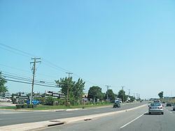
Newington is located in southern Fairfax County at 38°44′7″N 77°12′13″W (38.735414, -77.203558). It is bordered to the north by Springfield, to the northeast by Franconia and Kingstowne, to the east and southeast by Fort Belvoir, to the southwest by Lorton, to the west by Newington Forest, and to the northwest by West Springfield. Interstate 95 passes through the middle of the CDP, with access from Exit 166 (Virginia Route 286, the Fairfax County Parkway). Washington, D.C. is 16 miles (26 km) to the northeast via I-95 and I-395, and Fredericksburg is 37 miles (60 km) to the southwest. The Fairfax County Parkway leads northwest 16 miles (26 km) to Interstate 66 between Fairfax and Centreville.
According to the United States Census Bureau, the Newington CDP has a total area of 4.6 square miles (11.9 km2), of which 4.6 square miles (11.8 km2) is land and 0.04 square miles (0.1 km2), or 0.97%, is water.
Demographics
As of the census of 2000, there were 19,784 people, 6,710 households, and 5,321 families residing in the CDP. The population density was 2,977.8 people per square mile (1,150.4/km²). There were 6,793 housing units at an average density of 1,022.5/sq mi (395.0/km²). The racial makeup of the CDP was 67.80% White, 12.83% African American, 0.26% Native American, 11.66% Asian, 0.08% Pacific Islander, 2.66% from other races, and 4.71% from two or more races. Hispanic or Latino of any race were 7.98% of the population.
There were 6,710 households out of which 43.4% had children under the age of 18 living with them, 66.6% were married couples living together, 9.7% had a female householder with no husband present, and 20.7% were non-families. 15.7% of all households were made up of individuals and 5.0% had someone living alone who was 65 years of age or older. The average household size was 2.93 and the average family size was 3.28.
In the CDP, the population was spread out with 28.5% under the age of 18, 6.3% from 18 to 24, 32.3% from 25 to 44, 26.1% from 45 to 64, and 6.8% who were 65 years of age or older. The median age was 36 years. For every 100 females there were 96.1 males. For every 100 females age 18 and over, there were 91.9 males.
According to a 2007 estimate, the median income for a household in the CDP was $112,675, and the median income for a family was $119,001. Males had a median income of $58,203 versus $41,177 for females. The per capita income for the CDP was $32,901. About 1.3% of families and 2.1% of the population were below the poverty line, including 2.3% of those under age 18 and 2.2% of those age 65 or over.
Education
Fairfax County Public Schools operates public schools in the county.
Fairfax County Public Library operates the Kingstowne Library.
Climate
The climate in this area is characterized by hot, humid summers and generally cool to cold winters with moderate snowfall. Blizzards and major snowstorms are rare but not nonexistent, while summer thunderstorms are very common. According to the Köppen Climate Classification system, Newington has a "humid subtropical climate", abbreviated "Cfa" on climate maps.