
Existed: 1958 – present Constructed 1956 | Length 292.4 km | |
 | ||
Counties Similar Interstate 695 (District of Columbia), Interstate 66, Interstate 295 (Maryland–District of Columbia) | ||
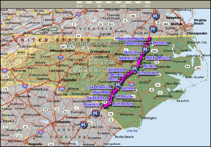
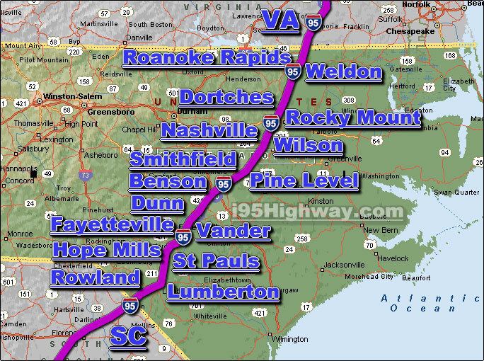
Interstate 95 (I-95) is a major Interstate Highway, running along the East Coast of the United States from Florida to Maine. In North Carolina, I-95 runs diagonally across the eastern third of the state, from Rowland at the South Carolina border to Pleasant Hill at the Virginia border. From south to north, the route passes through or near the cities of Lumberton, Fayetteville, Wilson, Rocky Mount and Roanoke Rapids. The entire route is rural, forming the informal border between the Piedmont and Coastal Plain regions of the state. There are three Auxiliary routes for I-95 in the state: Future I-295, a partially completed Bypass of Fayetteville, I-495, a partially completed Connector route between Rocky Mount and Raleigh that follows the current U.S. 64 freeway, and I-795, a spur route connecting I-95 to the city of Goldsboro.
Contents
Route description
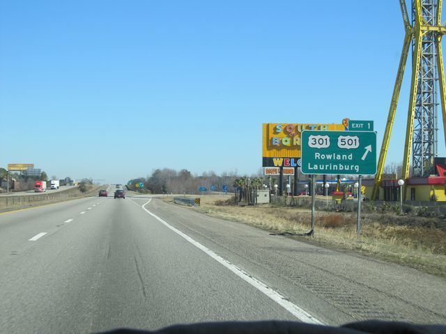
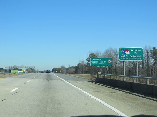
Interstate 95 enters North Carolina at the South Carolina line, just north of the South of the Border attraction and just to the south of the town of Rowland. Traveling mostly northeast from the border, the road enters Lumberton where it interchanges with I-74. Frontage roads through Lumberton have extensive travel services, including restaurants, shops, and hotels. Leaving Lumberton, the route turns due north through a rural area of the state, past the small farming community of St. Pauls. I-95 serves as the eastern bypass of Fayetteville where Interstate 95 Business, an older alignment, connects I-95 to downtown Fayetteville.
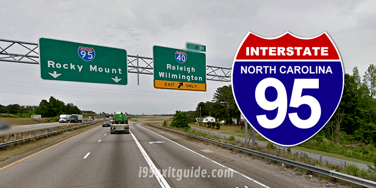
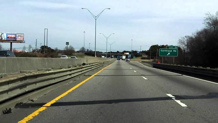
I-95 interchanges with I-40 in Benson, North Carolina, U.S. 264 in Wilson, and U.S. 64 in Rocky Mount, three of the Main east-west routes in the eastern part of the state. The last city it passes is Roanoke Rapids before leaving the state near the unincorporated community of Pleasant Hill at the Virginia border. For most of the route, I-95 is paralleled closely by U.S. 301.
Services
The North Carolina Department of Transportation (NCDOT) operate and maintain two welcome centers and six rest areas along I-95. Welcome centers, which have a travel information facility on site, are located at mile markers 5 (northbound) and 181 (southbound); rest areas are located at mile markers 47 (north and southbound), 99 (north and southbound) and 142 (north and southbound). Common at all locations are public restrooms, public telephones, vending machines, picnic area and barbecue grills.
The North Carolina Department of Public Safety (NCDPS) operate and maintain four truck inspection/weigh stations along I-95. The Robeson County stations are located on both north and southbound at mile marker 24, each has one fixed scale. The Halifax County stations are located on both north and southbound at mile marker 151, each has two fixed scales.
Dedicated and memorial names
Interstate 95 in North Carolina feature numerous dedicated or memorialized bridges, interchanges and stretches of freeway.
History
Established in 1956, as part of the Federal Aid Highway Act of 1956, I-95 was routed along or near existing US 301 throughout the state of North Carolina. By 1961, two stretches of the interstate opened: from mile marker 56, in Fayetteville, to mile marker 107, near Kenly; the other a small bypass near Saint Pauls. In 1964, the Saint Pauls section extended further south into Lumberton; while another small stretch opened from US 158, in Roanoke Rapids, to the Virginia state line. In 1969, I-95 was extended further south from Roanoke Rapids to exit 145, in Gold Rock (later used for NC 4). In 1973, Interstate 95 was completed from Saint Pauls to the South Carolina state line.
By the mid 1970s, I-95 had two gaps along its route: Fayetteville and Kenly-Gold Rock. In May 1978, two Interstate 95 Business loops were established, both overlapping US 301, to help connect through the gaps and make I-95 appear as one continuous route throughout the state. In November 1978, the first gap to be completed was the Kenly-Gold Rock section. The final section of Interstate 95 was completed in 1980, an easterly bypass of Fayetteville.
Tolls
The idea of tolling I-95 started in 2001 as a way to pay for improvements along the route. In 2003, state officials sought permission from the Federal Highway Administration for a plan that would cost $3 billion and put toll booths every thirty miles along the entire route. However, this was quickly killed by Governor Mike Easley, who did not support tolls.
In 2006, when the Virginia General Assembly passed the resolution calling for an interstate compact to build a toll highway, North Carolina was asked to join in on the compact of putting tolls along the entire length of Interstate 95 in both states. Again, this was stopped by Governor Mike Easley, who did not see the benefit in such a compact and reiterated his opposition of tolls along Interstate 95.
In 2010, North Carolina leaders revived talks on tolling Interstate 95, submitting a request to the Federal Highway Administration to toll the entire route. Approval would be considered after an environmental assessment and other conditions. Support has grown in a number of factors including the fact that the interstate is mostly rural and used predominantly by out-of-state drivers.
On January 20, 2012, NCDOT received final approval of the Environmental Assessment for improvements along I-95 in North Carolina. The following recommendations were made:
It is estimated to cost $4.4 billion with recommendation that it should be paid through tolls. Construction would begin in two phases: Phase 1 (exit 31-exit 81) would begin in 2016 with tolls starting after completion; phase 2 would begin in 2019, which covers the remainder of the interstate. With a possible 2019 start date for the tolls, NCDOT plans to install nine overhead toll collection sensors every twenty miles with additional toll collection sensors at exits before tolls (to reduce drivers from jumping off and on at each toll); main toll stations will charge twenty miles each while exit tolls will charge ten miles each. Gaps along the route, where no toll collectors are located, will allow local traffic to utilize the interstate toll free. Though the toll rates have not been established, a NCDOT report suggest charging 19.2 cents per mile (11.9 ¢/km) for cars in the phase 1 section, with a much lower rate of 6.4 ¢/mi (4.0 ¢/km) on phase 2 sections; which would work out to be $19.20 from border to border (trucks with three axles or more will be charged more). Drivers that do not carry a toll transponder (i.e. North Carolina Quick Pass) will have their license numbers recorded by cameras and will be billed by mail, at a higher toll rate.
Future
NCDOT plans to widen I-95 from four to six lanes between mile markers 14 and 21, in Robeson County. However, it is currently flagged "Scheduled for Reprioritization," with no estimated cost or date established.
An improvement project along I-95 is in the development stage, between mile markers 56 and 81, in Cumberland and Johnston counties. Improvements include upgraded interchanges, raise and rebuild bridges, and widening of the interstate. The total estimated cost is $526 million, with date of construction starting on the first phase on October, 2017. However, it is currently flagged "Subject to Reprioritization."