
Country Norway Region Austlandet Demonym(s) Gudbrandsdøl | Area 15,340 km² | |
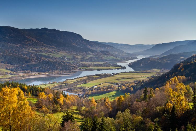
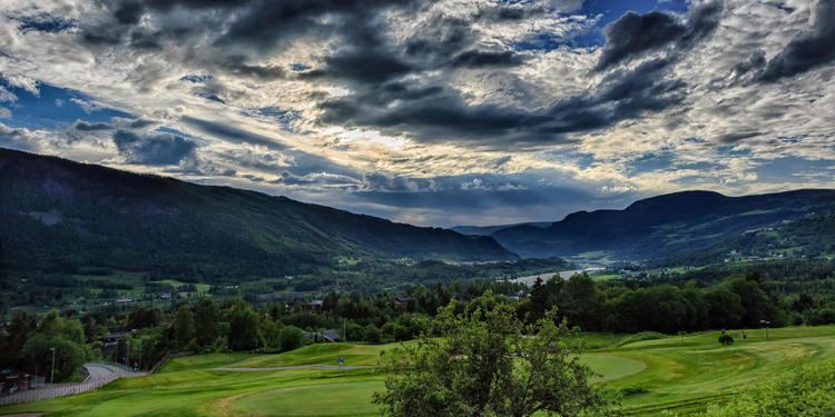
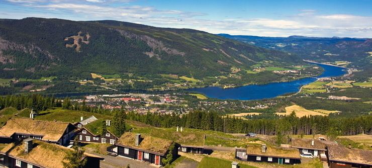
Gudbrandsdalen (English: Gudbrand Valley) is a valley and traditional district in the Norwegian county of Oppland. The valley is oriented in a north-westerly direction from Lillehammer and the lake of Mjøsa, extending 230 kilometers (140 mi) toward Romsdalen. The river of Gudbrandsdalslågen (Lågen) flows through the valley, starting from Lesjaskogsvatnet and ending at Mjøsa. The Otta river flowing through Otta valley is a major tributary to Lågen. The valleys of the tributary rivers such as Otta and Gausa (Gausdal) are usuall regarded as part of the Gudbrand Valley. The total area of the valley is calculated from the areas of the related municipalities.
Contents
- Han ola i gudbrandsdalen norske barnesanger
- Etymology
- Geography
- History
- Legendary history
- Older history
- Modern history
- Towns
- Mountain areas close to the valley
- References
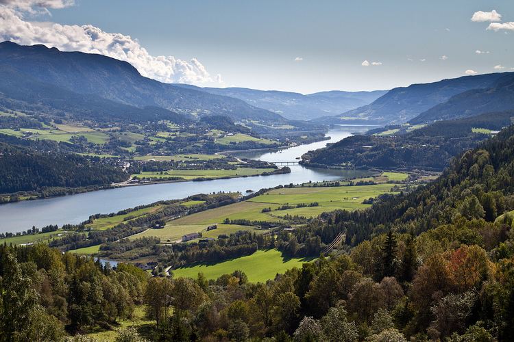
Together with Glomma river and Østerdalen, Lågen and the Gudbrand Valley forms Norway's largest drainage system covering major parts of East Norway. The Gudbrand Valley is home to Dovre Line and the E6 road, and is the main land transport corridor through South Norway, from Oslo and central eastern lowlands to Trondheim and Møre og Romsdal.
The valley is divided into three parts: Norddalen (the municipalities of Lesja, Dovre, Skjåk, Lom, Vågå and Sel), Midtdalen (the municipalities of Nord-Fron, Sør-Fron and Ringebu), and Sørdalen (the municipalities of Øyer, Gausdal and Lillehammer). The valley has two district courts, north and south. Until 2016 the valley was also a police district.
The main character in Henrik Ibsen's play Peer Gynt was inspired by a real or legendary person living in the valley in the 18th or 17th century. Ibsen travelled through the valley in 1862 and collected local stories, legends and poems.
Han ola i gudbrandsdalen norske barnesanger
Etymology
The name Gudbrandsdalen means 'the valley/dale of Gudbrand'. Gudbrand (Old Norse Guðbrandr) is an old male name compounded of guð, 'god' and brandr, 'sword'. Dale-Gudbrand was the name of the first ruler of the valley, who settled in Hundorp, Sør-Fron.
Geography
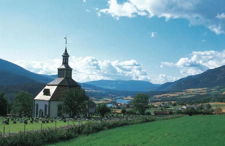
Gudbrand Valley includes the most arid area in Norway. At Skjåk the average annual precipitation is only 278 mm. Gudbrand Valley sits in the rain shadow of the mountains West (including Jotunheimen), North and East of the valley.
In July 1789 the Storofsen flood disaster occurred and Gudbrandsdalslågen overflooded. This is the largest flood recorded in Norway and the valley was particularly affected. 61 people perished. About 3000 houses were totally damaged and some thousand livestock drowned. All bridges disappeared. Lågen rose up to 7 meters above its normal level and covered most of the valley floor. A number of farmers abandoned their damaged farms and settled in Målselv, Troms county. The second largest flood occurred in the summer of 1995 and again the valley floor was largely covered by water. After Storofsen the valley floor upstream from Sel church changed into bogs and shallow lakes because stone and gravel changed the flow of Lågen. From around 1910 drainage efforts left some 500 hectar dry farmland on what is still known as the Sel bogs. The toxic cicuta virosa thrived on those bogs before they were drained and are known in Norwegian as selsnepe (literally Sel turnip). The valley floor in Lesja (between Dombås and Lora) were originally covered by a shallow lake. Drainage efforts from 1860 abolished the lake and left some 1000 hectar farmland. The central part of the valley is covered by the Losna lake, some 50–60 meters deep.
History
The Gudbrand Valley was shaped by the recent ice age and rivers from the present glacial areas in Jotunheimen and Dovre. Bones and teeth from mammoths and musk oxen, living in the area at that time, are found in the valley. Several traces of hunters from the Stone Age are found in the valley (and in the mountain areas around). There is a rock carving of elks in the northern part of Lillehammer.
Legendary history
Raum the Old was the father of Dale-Gudbrand, and he settled in Hundorp. The Gudbrand Valley is mentioned extensively in the Heimskringla (Chronicle of the Kings of Norway) by Snorri Sturluson. The account of King Olaf's (A.D. 1015-1021) conversion of Dale-Gudbrand to Christianity is popularly recognized. In 1206, the heir to the Norwegian throne, Håkon Håkonsson, was saved by birkebeiners with a ski-run from Lillehammer to Rena.
The Black Plague halved the population in Gudbrandsdal from 1349 to 1350. This resulted in a temporary improvement for the lower classes as crofters became scarce and the poor were able to rent the better farms in the bottom lands.
Older history
During the Reformation in 1537, the Church of Norway was subordinated to the lendmenn or sheriffs. Church property was appropriated by the Crown and the King became the biggest landowner in the Gudbrand Valley. The Battle of Kringen took place in 1612, near Otta, Norway, and the local "Gudbrandsdøls" defeated a Scottish mercenary army. The legends of this battle live on to this day, including the story of how the peasant girl Prillar-Guri lured the Scots into an ambush by playing the traditional ram's horn.
In 1670 to 1725, most of the royal property was sold off to pay for war debts, first to established property holders, but increasingly to peasant proprietors. A freeholders' era began and a new "upper class" of land holders was formed. Storofsa happened in 1789, and is the greatest flood recorded in the Gudbrand Valley; several farms were devastated, and many people died.
Modern history
In 1827, the city of Lillehammer is established. The paddle steamer Skibladner on Mjøsa and Hovedbanen (the first railroad in Norway) connected the Gudbrand Valley to Christiania in 1856. The Hamar-Selbanen railway was completed to Tretten in 1894. Hamar-Selbanen changed its name to the Dovre Line 1921, and the new main railway between Oslo and Trondheim, was completed through the Gudbrand Valley. The outdoor museum of Maihaugen, exhibiting old houses from all parts of the Gudbrand Valley, opened at Lillehammer in 1904.
There was severe fighting in the valley at Tretten and Kvam, as well as in Dombås, during World War II. The Battle of Dombås was an attempt to stop the German advance. British troops engaged German troops in land battles for the first time in World War 2 after many months of Phoney War.
The 1994 Winter Olympics were celebrated at Lillehammer.