
 | ||
Six sigma green belt training video six sigma tutorial videos part 1
A green belt or greenbelt is a policy and land use designation used in land use planning to retain areas of largely undeveloped, wild, or agricultural land surrounding or neighbouring urban areas. Similar concepts are greenways or green wedges which have a linear character and may run through an urban area instead of around it. In essence, a green belt is an invisible line designating a border around a certain area, preventing development of the area and allowing wildlife to return and be established.
Contents
How to play it s raining recorder karate green belt
Purposes
In those countries which have them, the stated objectives of green belt policy are to:
The green belt has many benefits for people:
The effectiveness of green belts differs depending on location and country. They can often be eroded by urban rural fringe uses and sometimes, development 'jumps' over the green belt area, resulting in the creation of "satellite towns" which, although separated from the city by green belt, function more like suburbs than independent communities.
History
The Old Testament outlines a proposal for a green belt around the Levite towns in the Land of Israel. Moses Maimonides expounded that the greenbelt plan from the Old Testament referred to all towns in ancient Israel. In the 7th century, Muhammad established a green belt around Medina. He did this by prohibiting any further removal of trees in a 12-mile long strip around the city. In 1580 Elizabeth I of England banned new building in a 3-mile wide belt around the City of London in an attempt to stop the spread of plague. However, this was not widely enforced and it was possible to buy dispensations which reduced the effectiveness of the proclamation.
In modern times, the term emerged from continental Europe where broad boulevards were increasingly used to separate new development from the centre of historic towns; most notably the Ringstraße in Vienna. Green belt policy was then pioneered in the United Kingdom. Various proposals were put forward from 1890 onwards but the first to garner widespread support was put forward by the London Society in its "Development Plan of Greater London" 1919. Alongside the CPRE they lobbied for a continuous belt (of up to two miles wide) to prevent urban sprawl, beyond which new development could occur.
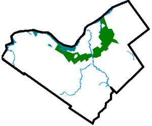
There are fourteen green belt areas, in the UK covering 16,716 km², or 13% of England, and 164 km² of Scotland; for a detailed discussion of these, see Green belt (UK). Other notable examples are the Ottawa Greenbelt and Golden Horseshoe Greenbelt in Ontario, Canada. Ottawa's 20,350 hectare greenbelt is managed by the National Capital Commission (NCC). The more general term in the United States is green space or greenspace, which may be a very small area such as a park.
The dynamic Adelaide Park Lands, measuring approximately 7.6 km², completely surround the city centre of Adelaide. On the fringe of the eastern suburbs, an expansive natural greenbelt in the Adelaide Hills acts as a growth boundary for Adelaide, cooling the region in the hottest months.
The concept of "green belt" has evolved in recent years to encompass not only "Greenspace" but also "Greenstructure", taking into account all urban greenspaces, an important aspect of sustainable development in the 21st century. The European Commission's COST Action C11 (COST – European Cooperation in Science and Technology) is undertaking "Case studies in Greenstructure Planning" involving 15 European countries.
An act of the Swedish parliament from 1994 has declared a series of parks in Stockholm and the adjacent municipality of Solna to its north a "national city park" called Royal National City Park.
House prices
The difference/contrarian interpretation of the green belt's effects/motivation (for example, suggested by economist Tim Harford) is that a green belt is created by residents to preserve the bourgeois status quo of those already living within the zone, and especially the advantage of landlords who profit from a scarcity of housing (see above, "preserving the character of rural communities"). The stated motivation and benefits of the green belt might be well-intentioned (public health, environment), but these benefits do not accrue as intentioned or claimed (for example, critics such as Mark Pennington claim that only a small fraction of the population ever sets foot on the green belt for leisure purposes, and they claim that a green belt is not strongly causally linked to clean air and water). Rather, the ultimate result of the decision to green-belt a city is to prevent housing demand within the zone to be met with supply, thus exacerbating high housing prices and stifling competitive forces in general.
Increasing urban sprawl
Another area of criticism comes from the fact that, since a greenbelt does not extend indefinitely outside a city, it spurs the growth of areas much further away from the city core than if it had not existed, thereby actually increasing urban sprawl. Examples commonly cited are the Ottawa suburbs of Kanata and Orleans, both of which are outside the city's greenbelt, and are currently undergoing explosive growth (see Greenbelt (Ottawa)). This leads to other problems, as residents of these areas have a longer commute to work places in the city and worse access to public transport. It also means people have to commute through the green belt, an area not designed to cope with high levels of transportation. Not only is the merit of a green belt subverted, but the green belt may heighten the problem and make the city unsustainable.
There are many examples whereby the actual effect of green belts is to act as a land reserve for future freeways and other highways. Examples include sections of the 407 highway north of Toronto and the Hunt Club Rd./Richmond Rd. south of Ottawa. Whether they are originally planned as such, or the result of a newer administration taking advantage of land that was left available by its predecessors is debatable.
United Kingdom
In the UK, greenbelt barriers to urban expansion have been criticized as one of several protectionist political-economic barriers to housebuilding with negative effects on the supply, cost/prices, and quality of new homes. Critics argue that the greenbelts defeat their own stated objective of saving the countryside and open spaces. By preventing existing towns and cities from extending normally and organically, they result in more land-extensive housing developments further out – i.e., the establishment beyond the greenbelts of new communities with lower building densities, their own built infrastructure and other facilities, and greater dependence on cars and commuting, etc. Meanwhile, valuable urban green space and brownfield sites best suited to industry and commerce are lost in existing conurbations as more and more new housing is crammed into them.
Notable examples
Australia
Brazil
Canada
Dominican Republic
Mainland Europe
New Zealand
Pakistan
Philippines
Thailand
South Korea
United Kingdom
United States