
Highest elevation 2,814 m (9,232 ft) Area 1,800 km² | Lowest elevation -212 m (−696 ft) | |
 | ||
Points of interest Nachal Sa'ar, Duga Beach, Nachal Si'on, Mount Hermonit, Golan Beach | ||
The Golan Heights (Arabic: هضبة الجولان Haḍbatu 'l-Jawlān or مرتفعات الجولان Murtafaʻātu l-Jawlān, Hebrew: רמת הגולן, Ramat HaGolan ), or simply the Golan or the Syrian Golan, is a region in the Levant. The western two-thirds of the Golan Heights are currently occupied and administrated by Israel, whereas the eastern third is controlled by Syria, with the UNDOF maintaining a buffer zone in between, to implement the ceasefire of the Purple Line.
Contents
- Map of Golan
- Update israel golan heights
- Etymology and toponymy
- Geography
- Antiquity
- Middle Ages
- Ottoman era
- Early Jewish settlement
- French and British mandates
- Border incidents after 1948
- Six Day War and Israeli occupation
- Yom Kippur War
- Israeli annexation and civil rule
- Peace negotiations
- Territorial claims
- Borders armistice line and ceasefire line
- Shebaa Farms
- Al Ghajar
- US position
- UNDOF supervision
- Syrian villages
- Israeli settlements
- Landmarks
- Kursi
- Katzrin
- Gamla Nature Reserve
- Rujm el Hiri
- Um el Kanatir
- Nimrod Fortress
- Mount Hermon and Lake Ram
- Hamat Gader
- HipposSusita
- Viticulture
- Hydrocarbon exploration
- References
Map of Golan
The exact region defined as the Golan Heights is different in different disciplines:
The earliest evidence of human habitation dates to the Upper Paleolithic period. According to the Bible, an Amorite Kingdom in Bashan was conquered by Israelites during the reign of King Og. Throughout the Old Testament period, the Golan was "the focus of a power struggle between the Kings of Israel and the Aramaeans who were based near modern-day Damascus." The Itureans, an Arab or Aramaic people, settled there in the 2nd century BCE and remained until the end of the Byzantine period. Organized Jewish settlement in the region came to an end in 636 CE when it was conquered by Arabs under Umar ibn al-Khattāb. In the 16th century, the Golan was conquered by the Ottoman Empire and was part of the Vilayet of Damascus until it was transferred to French control in 1918. When the mandate terminated in 1946, it became part of the newly independent Syrian Arab Republic.
Internationally recognized as Syrian territory, the Golan Heights has been occupied and administered by Israel since 1967. It was captured during the 1967 Six-Day War, establishing the Purple Line.
On 19 June 1967, the Israeli cabinet voted to return the Golan to Syria in exchange for a peace agreement, although this was rejected after the Khartoum Resolution of 1 September 1967. In the aftermath of the 1973 Yom Kippur War, in which Syria tried but failed to recapture the Golan, Israel agreed to return about 5% of the territory to Syrian civilian control. This part was incorporated into a demilitarised zone that runs along the ceasefire line and extends eastward. This strip is under the military control of UNDOF.
Construction of Israeli settlements began in the remainder of the territory held by Israel, which was under military administration until Israel passed the Golan Heights Law extending Israeli law and administration throughout the territory in 1981. This move was condemned by the United Nations Security Council in UN Resolution 497, which said that "the Israeli decision to impose its laws, jurisdiction and administration in the occupied Syrian Golan Heights is null and void and without international legal effect." Israel states it has a right to retain the Golan, citing the text of UN Resolution 242, which calls for "safe and recognised boundaries free from threats or acts of force". However, the international community reject Israeli claims to title to the territory and regards it as sovereign Syrian territory. That said, the atrocities of the Syrian Civil War and the rise of the so-called Islamic State group, which at times has controlled what was the Syrian-administered Golan have added a new twist to the issue. In 2015, it was reported that Israeli Prime Minister Benjamin Netanyahu asked US President Barack Obama to recognize Israeli claims to the territory because of these recent ISIS actions and the fact that modern Syria has likely "disintegrated" beyond the point of reunification. The White House dismissed Netenyahu's suggestion, stating that the president continues to support UN resolutions 242 and 497, and any alterations of this policy could strain American alliances with western-backed Syrian rebel groups.
Historically, Israeli Prime Ministers Yitzhak Rabin, Ehud Barak, and Ehud Olmert each stated that they were willing to exchange the Golan for peace with Syria. Later, in 2010, Israeli foreign minister Avigdor Lieberman told Syria to abandon its dreams of recovering the Golan Heights. Approximately 10% of Syrian Golan Druze have accepted Israeli citizenship. According to the CIA World Factbook, as of 2010, "there are 41 Israeli settlements and civilian land use sites in the Israeli-occupied Golan Heights."
Update israel golan heights
Etymology and toponymy
Arabic names are Jawlān and Djolan (Arabic: جولان). In the Bible, Golan is mentioned as a city of refuge located in Bashan: Deuteronomy 4:43, Joshua 20:8, 1 Chronicles 6:71. Nineteenth-century authors interpreted the word "Golan" (Hebrew: גולן) as meaning "something surrounded, hence a district". The Greek name for the region is Gaulanitis (Greek: Γαυλανῖτις). In the Mishna the name is Gablān similar to Aramaic language names for the region: Gawlāna, Guwlana and Gublānā.
Arab cartographers of the Byzantine period referred to the area as jabal (mountain), though the region is a plateau. The Muslims took over in 7th century CE. The 1906 Jewish Encyclopedia refers to the region as Gaulonitis. The name Golan Heights was not used before the 19th century.
Geography
The Golan Heights borders Israel, Lebanon, and Jordan. According to Israel, it has captured 1,150 square kilometres (440 sq mi). According to Syria the Golan Heights measures 1,860 square kilometres (718 sq mi), of which 1,500 km2 (580 sq mi) are occupied by Israel. According to the CIA, Israel holds 1,300 square kilometres (500 sq mi).
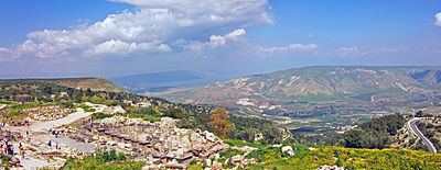
The area is hilly and elevated, overlooking the Jordan Rift Valley which contains the Sea of Galilee and the Jordan River, and is itself dominated by the 2,743.2 metres (9,000 ft) tall Mount Hermon. The plateau has an average altitude of 1,000 metres (3,300 ft) and an area totaling 1,800 square kilometres (690 sq mi), and straddles the boundary between Syria and Israeli-held territory. Elevations range from 2,814 metres (9,232 ft) in the north (if one considers Mount Hermon as part of the Heights), to below sea level along the Sea of Galilee and the Yarmuk River in the south.
The plateau that Israel controls is part of a larger area of volcanic basalt fields stretching north and east that were created in the series of volcanic eruptions that began recently in geological terms, almost 4 million years ago, and continue to this day. It has distinct geographic boundaries. On the north, the Sa'ar valley (Banias) generally divides the lighter-colored limestone bedrock of the mountains from the dark-colored volcanic rocks of the Golan plateau. The western border of the plateau is truncated structurally by the Jordan Rift Valley, which falls down steeply into the lake. The southern border is lined by the Yarmuk River, which separates the plateau from the Hashemite Kingdom of Jordan. Finally, the east end of Golan Heights is carved out by the Raqqad river (Wadi Ruqqad) and areas still controlled by Syria.
The plateau's north-south length is approximately 65 kilometres (40 mi) and its east-west width varies from 12 kilometres (7.5 mi) to 25 kilometres (16 mi). Topographically, the Golan Heights ranges in elevation from 2,814 metres (9,232 ft) on Mount Hermon in the north, to about 400 metres (1,300 ft) elevation along the Yarmuk River in the south. The Sea of Galilee, also known as Lake Kinneret or Lake Tiberias, at the southwest corner of the plateau is 200 metres (660 ft) below sea level. The steeper, more rugged topography is generally limited to the northern half, including the foothills of Mount Hermon; on the south the plateau is more level.
The broader Golan plateau exhibits a more subdued topography, generally ranging between 120 metres (390 ft) and 520 metres (1,710 ft) in elevation. In Israel, the Golan plateau is divided into three regions: northern (between the Sa'ar and Jilabun valleys), central (between the Jilabun and Daliyot valleys), and southern (between the Daliyot and Yarmouk valleys). The Golan Heights is bordered on the west by a rock escarpment that drops 500 metres (1,600 ft) to the Jordan River valley and the Sea of Galilee. In the south, the incised Yarmouk River valley marks the limits of the plateau and, east of the abandoned railroad bridge upstream of Hamat Gader and Al Hammah, it marks the recognised international border between Syria and Jordan.
Geologically, the Golan plateau and the Hauran plain to the east constitute a Holocene volcanic field that also extends northeast almost to Damascus. Much of the area is scattered with dormant volcanos, as well as cinder cones, such as Majdal Shams. The plateau also contains a crater lake, called Birkat Ram ("Ram Pool"), which is fed by both surface runoff and underground springs. These volcanic areas are characterised by basalt bedrock and dark soils derived from its weathering. The basalt flows overlie older, distinctly lighter-colored limestones and marls, exposed along the Yarmouk River in the south.
The rock forming the mountainous area in the northern Golan Heights, descending from Mount Hermon, differs geologically from the volcanic rocks of the plateau and has a different physiography. The mountains are characterised by lighter-colored, Jurassic-age limestone of sedimentary origin. Locally, the limestone is broken by faults and solution channels to form a karst-like topography in which springs are common.
In addition to its strategic military importance, the Golan Heights is an important water resource, especially at the higher elevations, which are snow-covered in the winter and help sustain baseflow for rivers and springs during the dry season. The heights receive significantly more precipitation than the surrounding, lower-elevation areas. The occupied sector of the Golan Heights provides or controls a substantial portion of the water in the Jordan River watershed, which in turn provides a portion of Israel's water supply. The Golan Heights supply 15% of Israel's water.
Antiquity
The Venus of Berekhat Ram, a stone figure from the Lower Paleolithic era, found in the Golan Heights, may have been created by Homo erectus between 700,000 and 230,000 BCE.
In the 3rd millennium BC the Amorites inhabited the Golan until it was conquered in the 2nd millennium by the Arameans. The Aramaean city state Aram Damascus reached over most of Golan to the Sea of Galilee.
According to the Bible, the Children of Israel conquered the Golan from the Amorites. The Bible also says that the area, known as Bashan, was inhabited by two Israelite tribes during the time of Joshua, the tribe of Dan and Manasseh. The city of Golan was a city of refuge. King Solomon appointed ministers in the region. After the split of the United Monarchy, the area was contested between the northern Kingdom of Israel and the Aramean kingdom from the 9th century BC. King Ahab of Israel (reigned 874–852 BC) defeated Ben-Hadad I in Afek of the southern Golan.
In the 8th century BC the Assyrians gained control of the area, followed by the Babylonian and the Persian Empire. In the 5th century BC, the Persian Empire allowed the region to be resettled by returning Jewish exiles from Babylonian Captivity.
The Golan Heights, along with the rest of the region, came under the control of Alexander the Great in 332 BC, following the Battle of Issus. Following Alexander's death, the Golan came under the domination of the Macedonian noble Seleucus and remained part of the Seleucid Empire for most of the next two centuries. It is during this period that the name Golan, previously that of a city mentioned in the book of Deuteronomy, came to be applied to the entire region (Greek: Gaulanitis).
After the Assyrian period, about four centuries provide limited archaeological finds in the Golan. In the middle of the 2nd century BCE, Itureans started living in the Golan. They lived in over 100 locations in the Mount Hermon and Golan region.
The Maccabean revolt saw much action in the regions around the Golan and it is possible that the Jewish communities of the Golan were among those rescued by Judas Maccabeus during his campaign in the Galilee and Gilead (Transjordan) mentioned in Chapter 5 of 1 Maccabees. The Golan, however, remained in Seleucid hands until the campaign of Alexander Jannaeus from 83–80 BC. Jannaeus established the city of Gamla in 81 BC as the Hasmonean capital for the region.
During the Roman and Byzantine periods the area was administered as part of Phoenicia Prima and Syria Palaestina, and finally Golan/Gaulanitis was included together with Peraea in Palaestina Secunda, after 218 AD. Ancient kingdom Bashan was incorporated into the province of Batanea.
Following the death of Herod the Great in 4 BC, Augustus Caesar adjudicated that the Golan fell within the Tetrarchy of Herod's son, Herod Philip I. After Philip's death in 34 AD, the Romans absorbed the Golan into the province of Syria, but Caligula restored the territory to Herod's grandson Agrippa in 37. Following Agrippa's death in 44, the Romans again annexed the Golan to Syria, promptly to return it again when Claudius traded the Golan to Agrippa II, the son of Agrippa I, in 51 as part of a land swap. Although nominally under Agrippa's control and not part of the province of Judea, the Jewish communities of the Golan joined their coreligionists in the First Jewish-Roman War, only to fall to the Roman armies in its early stages. Gamla was captured in 67; according to Josephus, its inhabitants committed mass suicide, preferring it to crucifixion and slavery. Agrippa II contributed soldiers to the Roman war effort and attempted to negotiate an end to the revolt. In return for his loyalty, Rome allowed him to retain his kingdom, but finally absorbed the Golan for good after his death in 100.
In about 250, the Ghassanids, Arab Christians from Yemen, established a kingdom which encompassed southern Syria and the Transjordan, building their capital at Jabiyah on the Golan. Like the later Herodians, the Ghassanids ruled as clients of Byzantine Rome; unlike the Herodians, the Ghassanids were able to hold on to the Golan until the Sassanid invasion of 614. Following a brief restoration under the Emperor Heraclius, the Golan again fell, this time to the invading Arabs after the Battle of Yarmouk in 636.
Middle Ages
After Yarmouk, Muawiyah I, a member of Muhammad's tribe, the Quraish, was appointed governor of Syria, including the Golan. Following the assassination of his cousin, the Caliph Uthman, Muawiya claimed the Caliphate for himself, initiating the Umayyad dynasty. Over the next few centuries, while remaining in Muslim hands, the Golan passed through many dynastic changes, falling first to the Abbasids, then to the Shi'ite Fatimids, then to the Seljuk Turks, then to the Kurdish Ayyubids. During the Crusades, the Heights represented a formidable obstacle the Crusader armies were not able to conquer, and the area was a part of the Emirate of Damascus during this time. The Mongols swept through in 1259, but were driven off by the Mamluk sultan Qutuz at the Battle of Ain Jalut in 1260. Ain Jalut ensured Mamluk dominance of the region for the next 250 years. For many centuries nomadic tribes lived together with the sedentary population in the region. At times, the central government attempted to settle the nomads which would result in the establishment of permanent communities. When the power of the governing regime declined, as happened during the early Muslim period, nomadic trends increased and many of the rural and agricultural villages were abandoned due to harassment from the Bedouins. They were not resettled until the second half of the 19th century.
Ottoman era
In the 16th century, the Ottoman Turks conquered Syria. During this time, the Golan formed part of the southern district of their empire. Some Druze communities were established in the Golan during the 17th and 18th centuries. In 1868, the region was described as "almost entirely desolate." According to a travel handbook of the time, only 11 of 127 ancient towns and villages in the Golan were inhabited. As a result of the Russo-Turkish War of 1877–78, there was a huge influx of refugees from the Caucasus into the empire. The Ottomans encouraged them to settle in southern Syria, particularly the Golan Heights, by granting them land with a 12-year tax exemption.
Early Jewish settlement
In 1884 there were still open stretches of uncultivated land between villages in the lower Golan, but by the mid-1890s most was owned and cultivated. Some land had been purchased in the Golan and Hawran by Zionist associations based in Romania, Bulgaria, the USA and England, in the late 19th century and early 20th century. In 1880, Laurence Oliphant published Eretz ha-Gilad (The Land of Gilead), which described a plan for large-scale Jewish settlement in the Golan. In the winter of 1885, members of the Old Yishuv in Safed formed the Beit Yehuda Society and purchased 15,000 dunams of land from the village of Ramthaniye in the central Golan. Due to financial hardships and the long wait for a kushan (Ottoman land deed) the village, Golan be-Bashan, was abandoned after a year. Soon afterwards, the society regrouped and purchased 2,000 dunams of land from the village of Bir e-Shagum on the western slopes of the Golan. The village they established, Bnei Yehuda, existed until 1920. The last families left in the wake of the Passover riots of 1920. In 1944 the JNF bought the Bnei Yehuda lands from their Jewish owners, but a later attempt to establish Jewish ownership of the property in Bir e-Shagum through the courts was not successful.
Between 1891 and 1894, Baron Edmond James de Rothschild purchased around 150,000 dunams of land in the Golan and the Hawran for Jewish settlement. Legal and political permits were secured and ownership of the land was registered in late 1894.
The Agudat Ahim society, whose headquarters were in Yekatrinoslav, Russia, acquired 100,000 dunams of land in several locations in the districts of Fiq and Daraa. A plant nursery was established and work began on farm buildings in Djillin. The Jews also built a road stretching from Lake Hula to Muzayrib. A village called Tiferet Binyamin was established on lands purchased from Saham al-Jawlan by the Shavei Zion Association based in New York, but the project was abandoned after a year when the Turks issued an edict in 1896 evicting the 17 non-Turkish families. A later attempt to resettle the site with Syrian Jews who were Ottoman citizens also failed. Between 1904 and 1908, a group of Crimean Jews settled in the Bethsaida Valley, initially as tenants of a Kurdish proprietor with the prospects of purchasing the land, but the arrangement faltered. Jewish settlement in the region dwindled over time, due to Arab hostility, Turkish bureaucracy, disease and economic difficulties. In 1921–1930, during the French Mandate, the Palestine Jewish Colonization Association (PICA) obtained the deeds to the Rothschild estate and continued to manage it, collecting rents from the Arab peasants living there.
French and British mandates
Great Britain accepted a Mandate for Palestine at the meeting of the Allied Supreme Council at San Remo, but the borders of the territory were not defined at that stage. The boundary between the forthcoming British and French mandates was defined in broad terms by the Franco-British Boundary Agreement of December 1920. That agreement placed the bulk of the Golan Heights in the French sphere. The treaty also established a joint commission to settle the precise details of the border and mark it on the ground. The commission submitted its final report on 3 February 1922, and it was approved with some caveats by the British and French governments on 7 March 1923, several months before Britain and France assumed their Mandatory responsibilities on 29 September 1923. In accordance with the same process, a nearby parcel of land that included the ancient site of Tel Dan and the Dan spring were transferred from Syria to Palestine early in 1924. The Golan Heights, including the spring at Wazzani and the one at Banias, thus became part of the French Mandate of Syria, while the Sea of Galilee was placed entirely within the British Mandate of Palestine. When the French Mandate of Syria ended in 1944, the Golan Heights became part of the newly independent state of Syria and was later incorporated into Quneitra Governorate.
Border incidents after 1948
After the 1948–49 Arab-Israeli War, the Golan Heights were partly demilitarised by the Israel-Syria Armistice Agreement. During the following years, the area along the border witnessed thousands of violent incidents; the armistice agreement was being violated by both sides. The underlying causes of the conflict were a disagreement over the legal status of the demilitarised zone (DMZ), cultivation of land within it and competition over water resources. Syria claimed that neither party had sovereignty over the DMZ. Israel contended that the Armistice Agreement dealt solely with military concerns and that she had political and legal rights over the DMZ. Israel wanted to assert control up till the 1923 boundary in order to reclaim the Hula swamp, gain exclusive rights to Lake Galilee and divert water from the Jordan for its National Water Carrier. During the 1950s, Syria registered two principal territorial accomplishments: it took over Al-Hammah enclosure south of Lake Tiberias and established a de facto presence on and control of eastern shore of the lake.
The Jordan Valley Unified Water Plan was sponsored by the United States and agreed by the technical experts of the Arab League and Israel. The U.S.A funded the Israeli and Jordanian water diversion projects, when they pledged to abide by the plan's allocations. President Nasser too, assured the U.S.A, that the Arabs would not exceed the plan's water quotas. However, in the early 1960s the Arab League funded a Syrian water diversion project that would have denied Israel use of a major portion of its water allocation. The resulting armed clashes are called the War over Water.
in July 1966, Fatah began raids into Israeli territory in early 1965, with active support from Syria. At first the militants entered via Lebanon or Jordan, but those countries made concerted attempts to stop them and raids directly from Syria increased. Israel's response was a series of retaliatory raids, of which the largest were an attack on the Jordanian village of Samu in November 1966. In April 1967, after Syria heavily shelled Israeli villages from the Golan Heights, Israel shot down six Syrian MiG fighter planes and warned Syria against future attacks.
In the period between the first Arab-Israeli War and the Six-Day War, the Syrians constantly harassed Israeli border communities by firing artillery shells from their dominant positions on the Golan Heights. In October 1966 Israel brought the matter up before the United Nations. Five nations sponsored a resolution criticizing Syria for its actions but it failed to pass due to a Soviet veto.
Former Israeli General Mattityahu Peled said that more than half of the border clashes before the 1967 war "were a result of our security policy of maximum settlement in the demilitarised area." Israeli incursions into the zone were responded to with Syrians shooting. Israel in turn would retaliate with military force. Sir Alec Douglas-Home, former Prime Minister of the UK, stated that when he was visiting the Galilee a few months before the 1967 war "at regular intervals the Russian-built forts on the Golan Heights used to lob shells into the villages, often claiming civilian casualties." He said after the 1973 war that any agreement between the two sides "must clearly put a stop the that kind of offensive action."
In 1976, Israeli defense minister Moshe Dayan said that Israel provoked more than 80% of the clashes with Syria, although historians say the remark was part of an informal conversation. The provocation was sending a tractor to plow in the demilitarized areas. The Syrians responded by firing at the tractors and shelling Israeli settlements. Jan Mühren, a former UN observer in the area at the time, told a Dutch current affairs programme that Israel "provoked most border incidents as part of its strategy to annex more land". UN officials blamed both Israel and Syria for destabilizing the borders.
Six-Day War and Israeli occupation
After the Six-Day War broke out in June 1967, Syria's shelling greatly intensified and the Israeli army captured the Golan Heights on 9–10 June. The area which came under Israeli control as a result of the war consists of two geologically distinct areas: the Golan Heights proper, with a surface of 1,070 square kilometres (410 sq mi) and the slopes of the Mt. Hermon range, with a surface of 100 square kilometres (39 sq mi). The new ceasefire line was named the Purple Line. In the battle, Israel lost 115 men, with another 306 wounded. An estimated 2,500 Syrians were killed, with another 5,000 wounded.
During the war, between 80,000 and 131,000 Syrians fled or were driven from the heights and around 7,000 remained in the Israeli-occupied territory. Israeli sources and the U.S. Committee for Refugees and Immigrants reported that much of the local population of 100,000 fled as a result of the war, whereas the Syrian government stated that a large proportion of it was expelled. Israel has not allowed former residents to return, citing security reasons. The remaining villages were Majdal Shams, Shayta (later destroyed), Ein Qiniyye, Mas'ade, Buq'ata and, outside the Golan proper, Ghajar.
Israeli settlement in the Golan began soon after the war. Merom Golan was founded in July 1967 and by 1970 there were 12 settlements.
In the 1970s, Israeli politician Yigal Allon proposed as part of the Allon Plan that a Druze state be established in Syria's Quneitra Governorate, including the Israeli-held Golan Heights. Allon died in 1980 and his plan never materialised.
Yom Kippur War
During the Yom Kippur War in 1973, Syrian forces overran much of the southern Golan, before being pushed back by an Israeli counterattack. Israel and Syria signed a ceasefire agreement in 1974 that left almost all the Heights in Israeli hands. East of the 1974 ceasefire line lies the Syrian controlled part of the Heights, an area that was not captured by Israel (500 square kilometres or 190 sq mi) or withdrawn from (100 square kilometres or 39 sq mi). This area forms 30% of the Golan Heights. Today it contains more than 40 Syrian towns and villages. In 1975, following the 1974 ceasefire agreement, Israel returned a narrow demilitarised zone to Syrian control. Some of the displaced residents began returning to their homes located in this strip and the Syrian government began helping people rebuild their villages, except for Quneitra. In the mid-1980s the Syrian government launched a plan called "The Project for the Reconstruction of the Liberated Villages". By the end of 2007, the population of the Quneitra Governorate was estimated at 79,000. Mines deployed by the Syrian army remain active. As of 2003, there had been at least 216 landmine casualties in the Syrian-controlled Golan since 1973, of which 108 were fatalities.
Israeli annexation and civil rule
The Golan Heights was under Israeli military administration from 1967 to 1981. In 1981, Israel passed the Golan Heights Law, which applied Israeli "laws, jurisdiction and administration" to the Golan Heights. Although the law in effect annexed the territory to Israel, it did not explicitly spell out the formal annexation. The area is administered as part of Israel's Northern District. Israel's action was not recognised internationally and United Nations Security Council Resolution 242 which declared the Golan Heights Israeli-occupied territory continues to apply. Israel maintains that it may retain the area as the text of Resolution 242 calls for "safe and recognised boundaries free from threats or acts of force".
During the negotiations regarding the text of United Nations Security Council resolution 242, U.S. Secretary of State Rusk explained that U.S. support for secure permanent frontiers did not mean the US supported territorial changes. The U.N. representative for the United Kingdom who was responsible for negotiating and drafting the Security Council resolution said that the actions of the Israeli Government in establishing settlements and colonizing the Golan are in clear defiance of Resolution 242.
Syria continued to demand a full Israeli withdrawal to the 1967 borders, including a strip of land on the east shore of the Sea of Galilee that Syria captured during the 1948–49 Arab-Israeli War and occupied from 1949–67. Successive Israeli governments have considered an Israeli withdrawal from the Golan in return for normalization of relations with Syria, provided certain security concerns are met. Prior to 2000, Syrian president Hafez al-Assad rejected normalization with Israel.
Peace negotiations
During United States–brokered negotiations in 1999–2000, Israel and Syria discussed a peace deal that would include Israeli withdrawal in return for a comprehensive peace structure, recognition and full normalization of relations. The disagreement in the final stages of the talks was on access to the Sea of Galilee. Israel offered to withdraw to the pre-1948 border (the 1923 Paulet-Newcombe line), while Syria insisted on the 1967 frontier. The former line has never been recognised by Syria, claiming it was imposed by the colonial powers, while the latter was rejected by Israel as the result of Syrian aggression. The difference between the lines is less than 100 m for the most part, but the 1967 line would give Syria access to the Sea of Galilee, and Israel wished to retain control of the Sea of Galilee, its only freshwater lake and a major water resource. Dennis Ross, Clinton's chief Middle East negotiator, blamed "cold feet" on the part of Barak for the breakdown. Clinton also laid blame on Israel.
In June 2007, it was reported that Prime Minister Ehud Olmert had sent a secret message to Syrian President, Bashar Assad saying that Israel would concede the land in exchange for a comprehensive peace agreement and the severing of Syria's ties with Iran and militant groups in the region. On the same day, former Prime Minister Benjamin Netanyahu announced that the former Syrian President, Hafez Assad, had promised to let Israel retain Mount Hermon in any future agreement.
In April 2008, Syrian media reported Turkey's Prime Minister Recep Tayyip Erdoğan told President Bashar al-Assad that Israel would withdraw from the Golan Heights in return for peace. Israeli leaders of communities in the Golan Heights held a special meeting and stated: "all construction and development projects in the Golan are going ahead as planned, propelled by the certainty that any attempt to harm Israeli sovereignty in the Golan will cause severe damage to state security and thus is doomed to fail". A survey found that 70% of Israelis oppose relinquishing the Golan for peace with Syria. That year, a plenary session of the United Nations General Assembly passed a resolution 161–1 in favour of a motion on the Golan Heights that reaffirmed Security Council resolution 497 and called on Israel to desist from "changing the physical character, demographic composition, institutional structure and legal status of the occupied Syrian Golan and, in particular, to desist from the establishment of settlements [and] from imposing Israeli citizenship and Israeli identity cards on the Syrian citizens in the occupied Syrian Golan and from its repressive measures against the population of the occupied Syrian Golan." Israel was the only nation to vote against the resolution. Indirect talks broke down after the Gaza War began. Syria broke off the talks to protest Israeli military operations. Israel subsequently appealed to Turkey to resume mediation.
In May 2009, Prime Minister Netanyahu said that returning the Golan Heights would turn it into "Iran's front lines which will threaten the whole state of Israel." He said: "I remember the Golan Heights without Katzrin, and suddenly we see a thriving city in the Land of Israel, which having been a gem of the Second Temple era has been revived anew." American diplomat Martin Indyk said that the 1999–2000 round of negotiations began during Netanyahu's first term (1996–1999), and he was not as hardline as he made out.
In March 2009, Syrian President Bashar al-Assad claimed that indirect talks had failed after Israel did not commit to full withdrawal from the Golan Heights. In August 2009, he said that the return of the entire Golan Heights was "non-negotiable," it would remain "fully Arab," and would be returned to Syria.
In June 2009, Israeli President Shimon Peres said that Syrian President Assad would have to negotiate without preconditions, and that Syria would not win territorial concessions from Israel on a "silver platter" while it maintained ties with Iran and Hezbollah. In response, Syrian Foreign Minister Walid Muallem demanded that Israel unconditionally cede the Golan Heights "on a silver platter" without any preconditions, adding that "it is our land," and blamed Israel for failing to commit to peace. Syrian President Assad claimed that there was "no real partner in Israel."
In 2010, Israeli foreign minister Avigdor Lieberman said: "We must make Syria recognise that just as it relinquished its dream of a greater Syria that controls Lebanon ... it will have to relinquish its ultimate demand regarding the Golan Heights"
Territorial claims
Claims on the territory include the fact that an area in northwestern of the Golan region, delineated by a rough triangle formed by the towns of Banias, Quneitra and the northern tip of the Sea of Galilee, was part of the British Palestine Mandate in which the establishment of a Jewish national home had been promised. In 1923, this triangle in northwestern Golan was ceded to the French Mandate in Syria, but in exchange for this, land areas in Syria and Lebanon was ceded to Palestine, and the whole of the Sea of Galilee which previously had its eastern boundary connected to Syria was placed inside Palestine. Syrians counter that the region was placed in the Vilayet of Damascus as part of Syria under the Ottoman boundaries and that the 1920 British-Franco agreement which had placed part of the Golan under the control of Britain was only temporary and that the final border line drawn up in 1923, which excluded the Golan triangle, had superseded it, although Syria has never recognised the 1923 border as legally binding.
Borders, armistice line and ceasefire line
One of the aspects of the dispute involves the existence prior to 1967 of three different lines separating Syria from the area that between 1948 and 1967 was referred to as Mandatory Palestine.
The 1923 boundary between British Mandatory Palestine and the French Mandate of Syria was drawn with water in mind. Accordingly, it was demarcated so that all of the Sea of Galilee, including a 10-meter wide strip of beach along its northeastern shore, would stay inside Mandatory Palestine. From the Sea of Galilee north to Lake Hula the boundary was drawn between 50 and 400 meters east of the upper Jordan River, keeping that stream entirely within Mandatory Palestine. The British also received a sliver of land along the Yarmouk River, out to the present-day Hamat Gader.
During the Arab-Israeli War, Syria captured various areas of the formerly British controlled Mandatory Palestine, including the 10-meter strip of beach, the east bank of the upper Jordan, as well as areas along the Yarmouk.
While negotiating the 1949 Armistice Agreements, Israel called for the removal of all Syrian forces from the former Palestine territory. Syria refused, insisting on an armistice line based not on the 1923 international border but on the military status quo. The result was a compromise. Under the terms of an armistice signed on 20 July 1949, Syrian forces were to withdraw east of the old Palestine-Syria boundary. Israeli forces were to refrain from entering the evacuated areas, which would become a demilitarised zone, "from which the armed forces of both Parties shall be totally excluded, and in which no activities by military or paramilitary forces shall be permitted." Accordingly, major parts of the armistice lines departed from the 1923 boundary and protruded into Israel. There were three distinct, non-contiguous enclaves—in the extreme northeast to the west of Banias, on the west bank of the Jordan River near Lake Hula, and the eastern-southeastern shores of the Sea of Galilee extending out to Hamat Gader, consisting of 66.5 square kilometres (25.7 sq mi) of land lying between the 1949 armistice line and the 1923 boundary, forming the demilitarised zone.
Following the armistice, both Israel and Syria sought to take advantage of the territorial ambiguities left in place by the 1949 agreement. This resulted in an evolving tactical situation, one "snapshot" of which was the disposition of forces immediately prior to the Six-Day War, the “line of June 4, 1967”.
Shebaa Farms
On 7 June 2000, the demarcation Blue Line was established by the UN in order to ensure full Israeli withdrawal from Lebanon, according to UN Security Council Resolution 425. After Israeli troops left Lebanese soil, the UN announced the resolution had been respected. However, Lebanon continues to claim a small portion of the area occupied by Israel and administered as part of the Golan Heights. The territory, known as the Shebaa Farms, measures 22 square kilometres (8.5 sq mi) and lies on the border between Lebanon and the Golan Heights. Maps used by the UN in demarcating the Blue Line were not able to conclusively show the border between Lebanon and Syria in the area. Syria agrees that the Shebaa Farms are within Lebanese territory; however, Israel considers the area to be inside of Syria's borders and continues to occupy the territory.
Al-Ghajar
Al Ghajar village is another complex border issue west of Shebaa farms. Before the 1967 war this Alawite village was in Syria. It is divided by an international boundary, with the northern part of the village on the Lebanese side since 2000. Residents of both parts hold Israeli citizenship, and in the northern part often a Lebanese passport as well. Today the entire village is surrounded by a fence, with no division between the Israeli-occupied and Lebanese sides. There is an Israeli army checkpoint at the entrance to the village from the rest of the Golan Heights.
U.S. position
In 1975, U.S. President Gerald Ford wrote a letter to Israeli Prime Minister Yitzhak Rabin stating that the U.S. had not developed a final position on the borders but once it had, it would give great weight to Israel's position that a peace agreement with Syria must be predicated on Israel remaining on the Golan Heights.
In 1991, U.S. Secretary of State James Baker told Israeli Prime Minister Yitzhak Shamir that the United States would honor the position expressed in Ford's letter. William B. Quandt speculates that Baker told Syrian President Hafez al-Assad that the United States did not recognize Israel's annexation of the Golan and thought that UN Resolution 242 should apply there.
The United States considers the Golan Heights to be Syrian territory held under Israeli occupation subject to negotiation and Israeli withdrawal. The United States considers the application of Israeli law to the Golan Heights to be a violation of international law, both the Fourth Geneva Convention's prohibition on the acquisition of territory by force and United Nations Security Council Resolution 242.
UNDOF supervision
UNDOF (the United Nations Disengagement Observer Force) was established in 1974 to supervise the implementation of the Agreement on Disengagement and maintain the ceasefire with an area of separation known as the UNDOF Zone. Currently there are more than 1,000 UN peacekeepers there trying to sustain a lasting peace. Details of the UNDOF mission, mandate, map and military positions can be accessed via the following United Nations link. Syria and Israel still contest the ownership of the Heights but have not used overt military force since 1974. The great strategic value of the Heights both militarily and as a source of water means that a deal is uncertain. Members of the UN Disengagement force are usually the only individuals who cross the Israeli-Syrian de facto border (cease fire "Alpha Line"), but since 1988 Israel has allowed Druze pilgrims to cross into Syria to visit the shrine of Abel on Mount Qasioun. Since 1967, Druze brides have been allowed to cross into Syria, although they do so in the knowledge that they may not be able to return.
Though the cease fire in the UNDOF zone has been largely uninterrupted since the seventies, in 2012 there have been repeated violations from the Syrian side, including tanks and live fire, though these incidents are attributed to the ongoing Syrian civil war rather than intentionally directed towards Israel.
Syrian villages
The population of the Golan Heights prior to the 1967 Six-Day War has been estimated between 130,000 and 145,000, including 17,000 Palestinian refugees registered with UNRWA. Between 80,000 and 130,000 Syrians fled or were driven from the heights during the Six-Day War and around 7,000 remained in the Israeli-held territory in six villages: Majdal Shams, Mas'ade, Buq'ata, Ein Qiniyye, Ghajar and Shayta.
Israel demolished over one hundred Syrian villages and farms in the Golan Heights. After the demolitions, the lands were given to Israeli settlers.
Quneitra was the largest town in the Golan Heights until 1967, with a population of 27,000. It was occupied by Israel on the last day of the Six-Day War and handed back to Syrian civil control per the 1974 Disengagement Agreement. But the Israelis had destroyed Quneitra with dynamite and bulldozers before they withdrew from the city. East of the 1973 ceasefire line, in the Syrian controlled part of the Golan Heights, an area of 600 square kilometres (232 sq mi), are more than 40 Syrian towns and villages, including Quneitra, Khan Arnabah, al-Hamidiyah, al-Rafid, al-Samdaniyah, al-Mudariyah, Beer Ajam, Bariqa, Ghadir al-Bustan, Hadar Juba, Kodana, Ufaniyah, Ruwayhinah, Nabe’ al-Sakhar, Trinjah, Umm al-A’zam, and Umm Batna. The population of the Quneitra Governorate numbers 79,000.
Once annexing the Golan Heights in 1981, the Israeli government offered all non-Israelis living in the Golan citizenship, but until the early 21st century fewer than 10% of the Druze were Israeli citizens; the remainder held Syrian citizenship. The Golan Alawites in the village of Ghajar accepted Israeli citizenship in 1981. In 2012, due to the situation in Syria, young Druze have applied to Israeli citizenship in much larger numbers than in previous years.
In 2012, there were 20,000 Druze with Syrian citizenship living in the Israeli-occupied portion Golan Heights.
The Druze living in the Golan Heights are permanent residents of Israel. They hold laissez-passers issued by the Israeli government, and enjoy the country's social welfare benefits. The pro-Israeli Druze were historically ostracized by the pro-Syrian Druze. Reluctance to accept citizenship also reflects fear of ill treatment or displacement by Syrian authorities should the Golan Heights eventually be returned to Syria. According to The Independent, most Druze in the Golan Heights live relatively comfortable lives in a freer society than they would have in Syria under Assad's government. According to Egypt's Daily Star, their standard of living vastly surpasses that of their counterparts on the Syrian side of the border. Hence their fear of a return to Syria, though most of them identify themselves as Syrian, but feel alienated from the "autocratic" government in Damascus. According to the Associated Press, "many young Druse have been quietly relieved at the failure of previous Syrian-Israeli peace talks to go forward." On the other hand, expressing pro-Syrian rhetoric, The Economist found, represents the Golan Druzes' view that by doing so they may be potentially rewarded by Syria, while simultaneously risking nothing in Israel's freewheeling society. The Economist likewise reported that "Some optimists see the future Golan as a sort of Hong Kong, continuing to enjoy the perks of Israel’s dynamic economy and open society, while coming back under the sovereignty of a stricter, less developed Syria." The Druze are also reportedly well-educated and relatively prosperous, and have made use of Israel's universities.
Since 1988, Druze clerics have been permitted to make annual religious pilgrimages to Syria. Since 2005, Israel has allowed Druze farmers to export some 11,000 tons of apples to the rest of Syria each year, constituting the first commercial relations between Syria and Israel.
Since the breakout of the Syrian Civil War in 2012, the number of applications for Israeli citizenship is growing, although Syrian loyalty remains strong and those who apply for citizenship are often ostracized by members of the older generation.
Israeli settlements
Israeli settlement activity began in the 1970s. The area was governed by military administration until 1981 when Israel passed the Golan Heights Law, which extended Israeli law and administration throughout the territory. This move was condemned by the United Nations Security Council in UN Resolution 497, although Israel states it has a right to retain the area, citing the text of UN Resolution 242, adopted after the Six-Day War, which calls for "safe and recognised boundaries free from threats or acts of force". The continued Israeli control of the Golan Heights remains highly contested and is still regarded as belligerent occupation by most countries. The international community rejects the validity of the Golan Heights Law as an attempted annexation by force, illegal under the UN Charter and the Geneva Conventions. Israeli settlements and human rights policy in the occupied territory have also drawn criticism from the UN.
The Israeli-occupied territory is administered by the Golan Regional Council, based in Katzrin, which has a population of 6,400. There are another 19 moshavim and 10 kibbutzim. In 1989, the settler population was 10,000. By 2010 the Jewish settler population had expanded to 20,000 living in 32 settlements.
Landmarks
The Golan Heights features numerous archeological sites, mountains, streams and waterfalls. Throughout the region 62 ancient synagogues have been found dating back to the Roman and Byzantine periods.
Kursi
Kursi is the ruins of a Byzantine Christian monastery.
Katzrin
Katzrin is the administrative and commercial center of the Israeli-occupied Golan Heights. Katzrin Ancient Village is an archaeological site on the outskirts of Katzrin where the remains of a Talmud-era village and synagogue have been reconstructed. Golan Archaeological Museum hosts archaeological finds uncovered in the Golan Heights from prehistoric times. A special focus concerns Gamla and excavations of synagogues and Byzantine churches.
Golan Heights Winery, a major Israeli winery, and the mineral water plant of Mey Eden, which derives its water from the spring of Salukiya in the Golan. One can tour these factories as well as factories of oil products and fruit products.
Two open air strip malls, one which holds the Kesem ha-Golan (Golan Magic), a three-dimensional movie and model of the geography and history of the Golan Heights.
Gamla Nature Reserve
Gamla Nature Reserve is an open park with the archaeological remains of the ancient Jewish city of Gamla — including a tower, wall and synagogue. It is also the site of a large waterfall, an ancient Byzantine church, and a panoramic spot to observe the nearly 100 vultures that dwell in the cliffs. Israeli scientists study the vultures and tourists can watch them fly and nest.
Rujm el-Hiri
Rujm el-Hiri is a large circular stone monument similar to Stonehenge. Excavations since 1968 have not uncovered material remains common to archaeological sites in the region. Archaeologists believe the site may have been a ritual center linked to a cult of the dead. A 3D model of the site exists in the Museum of Golan Antiquities in Katzrin.
Um el Kanatir
Um el Kanatir is another impressive set of standing ruins of a Jewish village of the Byzantine era. The site includes a very large synagogue and two arches next to a natural spring.
Nimrod Fortress
The Nimrod Fortress was built against the Crusaders, served the Ayyubids and Mamluks, and was captured only once, in 1260, by the Mongols. It is now located inside a nature reserve.
Mount Hermon and Lake Ram
A ski resort on the slopes of Mount Hermon features a wide range of ski trails and activities. Several restaurants are located in the area. The Lake Ram crater lake is nearby.
Hamat Gader
Hamat Gader is site of natural hot mineral springs with temperatures reaching 50 °C (122 °F). Hamat Gader was already used for recreation and healing purposes during Roman times. The site includes a Roman theatre, which was built in the 3rd century CE and contained 2,000 seats. A large synagogue was built in the 5th century CE.
Hippos/Susita
Hippos is an ancient Greco-Roman city, known in Jewish Aramaic as Susita. The archaeological site includes excavations of the city's forum, the small imperial cult temple, a large Hellenistic temple compound, the Roman city gates, and two Byzantine churches.
Viticulture
On a visit to Israel and the Golan Heights in 1972, Cornelius Ough, a professor of viticulture and oenology at the University of California, Davis, pronounced conditions in the Golan very suitable for the cultivation of wine grapes. A consortium of four kibbutzim and four moshavim took up the challenge, clearing 250 burnt-out tanks in the Golan's Valley of Tears to plant vineyards for what would eventually become the Golan Heights Winery. The first vines were planted in 1976, and the first wine was released by the winery in 1983. The heights are now home to about a dozen wineries.
Hydrocarbon exploration
In the early 1990s, the Israel National Oil Company (INOC) was granted shaft-sinking permits in the Golan Heights. It estimated a recovery potential of two million barrels of oil, equivalent at the time to $24 million. During the Yitzhak Rabin administration (1992–1995), the permits were suspended as efforts were undertaken to restart peace negotiations between Israel and Syria. In 1996, Benjamin Netanyahu granted preliminary approval to INOC to proceed with oil exploration drilling in the Golan. INOC began undergoing a process of privatization in 1997, overseen by then-Director of the Government Companies Authority (GCA), Tzipi Livni. During that time, it was decided that INOC's drilling permits would be returned to the state. In 2012, National Infrastructure Minister Uzi Landau approved exploratory drilling for oil and natural gas in the Golan. The following year, the Petroleum Council of Israel's Ministry of Energy and Water Resources secretly awarded a drilling license covering half the area of the Golan Heights to a local subsidiary of New Jersey-based Genie Energy Ltd. headed by Effi Eitam.
Human rights groups have said the drilling violates international law as Golan Heights is an occupied territory.